1970s Maps of Sherman County, Oregon
Explore 23 historic maps of Sherman County from the 1970s. These maps offer a rare glimpse into what life looked like during the 1970s — showing old roads, neighborhoods, homes, and landmarks that have changed or disappeared over time.
Whether you're researching your family's past, planning a metal detecting trip, or studying how Sherman County's landscape evolved across the 1970s, these high-resolution maps are a powerful tool for exploring the history of this region.
- Focus on a specific era: All maps on this page are from the 1970s, giving you a focused view of this time period.
- See what’s changed: Compare century-old streets, trails, and buildings to today's modern landscape using overlays and satellite layers.
- Research with precision: Use these maps for genealogy, historical research, land use analysis, or educational projects.
- View, download, or print: Maps are fully viewable online in high resolution, and can be downloaded or printed for your own records.
Start exploring Sherman County's history through authentic maps from the 1970s. This is your window into the past.
Sherman County, OR maps
(23)- 1970 Map of Devils Backbone, 1973 Print
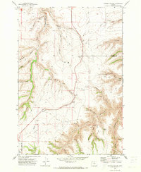
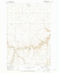
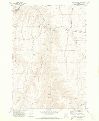 1970 Devils Backbone1973 Print · USGSThe high canyon country of Gilliam County is captured here in the early 1970s, where the John Day River carves the county line. Genealogists and historians can trace old routes like Mikkalo Road to remote landmarks such as Potters Cem and the former site of Lewis.
 - 1970 Map of Chimney Springs, 1973 Print
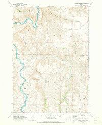 1970 Chimney Springs1973 Print · USGSThe high plateaus and canyons of the John Day country are captured here during the early seventies, when ranching life centered on remote outposts and spring-fed canyons. Researchers can trace land use at Buckhorn Ranch, locate the passage at Bills Pass, or find water sources like Duncan Spring.
 - 1970 Map of Indian Cove, 1973 Print
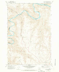
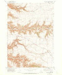
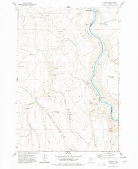
 1970 Indian Cove1973 Print · USGSThe John Day River canyonlands along the Sherman and Gilliam county line are captured here in the early seventies. Researchers can trace the sinuous river curves through Indian Cove or locate remote water sources like Penny Spring and Hawkins Spring.
 - 1970 Map of Kent, 1973 Print
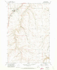
 1970 Kent1973 Print · USGSSherman County agriculture and transportation are captured here in the early 1970s, as the community centered around wheat storage and ranching. Genealogists and historians can trace the Old Railroad Grade past Kent and locate the IOOF Cem or the Decker Airstrip.
 - 1970 Map of Macken Canyon, 1973 Print
 1970 Macken Canyon1973 Print · USGSThe high desert plateaus along the Wasco and Sherman County line appear here in the early seventies, defined by deep canyons and seasonal springs. Researchers can trace the path of an Old Railroad Grade and locate agricultural landmarks like the lone Grain Elevator and Macken Springs.
 - 1970 Map of Shoestring Ridge, 1973 Print
 1970 Shoestring Ridge1973 Print · USGSThe high canyons and river breaks of north-central Oregon are documented here just as the 1970s began. Genealogists and local historians can trace the remote ranching landscape across Shoestring Ridge, identifying isolated landmarks like Schilling Spring and the Richmond Road.
 - 1970 Map of Rosebush, 1973 Print
 1970 Rosebush1973 Print · USGSSherman County wheat country is captured here during the early seventies, showing the small settlements and transport links of the plateau. Researchers can trace the Old Railroad Grade and locate local landmarks like the Bourbon Grain Elevator and Rutledge.
 - 1970 Map of Esau Canyon, 1973 Print
 1970 Esau Canyon1973 Print · USGSThe high desert canyons along the Sherman and Gilliam county lines were characterized by remote ranching and river access in the 1970s. Researchers can trace historic transport routes like Ruggles (Pack) Grade and locate local landmarks such as Rietmann Ranch or the Ajax Landing Strip.
 - 1971 Map of Moro, 1973 Print
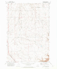
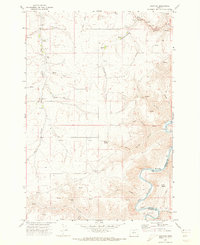
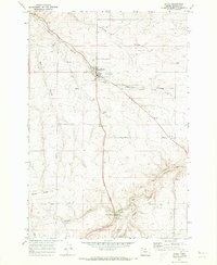
 1971 Moro1973 Print · USGSThe high plateau of Sherman County is captured here in the early 1970s, centered on the community of Moro. Genealogists and historians can trace the Old Railroad Grade and locate local landmarks like Rose Hill Cem and the Sherman Experiment Station.
 - 1971 Map of Quinton, 1973 Print
 1971 Quinton1973 Print · USGSThe Oregon-Washington borderlands are defined here in the early 1970s by the meeting of the Columbia and John Day rivers. Follow the industrial infrastructure of the Union Pacific railroad past the settlement of Quinton or locate family landmarks like Albert Philippi Park.2 unique versions available
 - 1971 Map of Bath Canyon, 1973 Print
 1971 Bath Canyon1973 Print · USGSThe high plateau of Wasco and Sherman counties in the early seventies reveals a landscape of deep canyons and vital springs. Researchers can trace historic access routes across North Pole Ridge and locate family-named landmarks like McGilvery Canyon and Joes Camp Canyon.
 - 1971 Map of Horseshoe Bend, 1973 Print
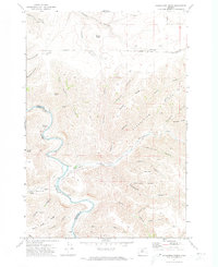
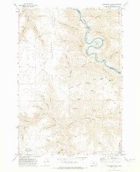 1971 Horseshoe Bend1973 Print · USGSThe high desert of North-Central Oregon is captured in the early seventies, centered on the winding John Day River. Trace family landmarks and rural infrastructure from the Wilson Airstrip to the namesake loop at Horseshoe Bend.
 - 1971 Map of Sundale NW, 1973 Print
 1971 Sundale NW1973 Print · USGSThe Columbia River corridor in the early seventies shows a landscape defined by the water and the rails. Genealogists and local historians can trace the riverside settlements of Blalock and Bates or explore the rugged drainages of Swanson Canyon and The Nook.2 unique versions available
 - 1971 Map of Klondike, 1973 Print
 1971 Klondike1973 Print · USGSSherman County wheat country is captured here in the early seventies, showcasing a high-desert landscape defined by deep canyons. Trace the path of the Old Railroad Grade and find family-named landmarks like Klondike, Webfoot, and Beavertail Butte.
 - 1971 Map of Harmony, 1973 Print
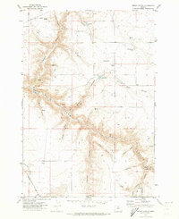
 1971 Harmony1973 Print · USGSThe high plateau of Sherman County meets the deep bends of the John Day River in the early 1970s. Local researchers can trace old ranching routes like Ruggles Grade and locate community landmarks like the Grange Hall in Harmony.
 - 1971 Map of Dead Dog Canyon, 1973 Print
 1971 Dead Dog Canyon1973 Print · USGSThe high desert border of Wasco and Sherman Counties is shown here in the early 1970s, defined by deep drainage networks. Genealogists can locate Buzan Cemetery and the Flanagan (Site) near Dead Dog Canyon.
 - 1971 Map of Rufus, 1973 Print
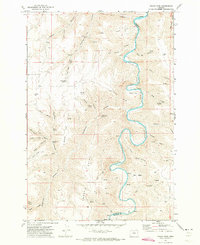
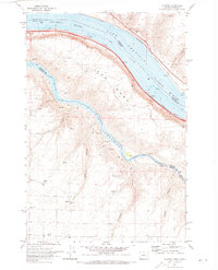
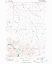
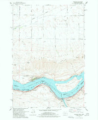
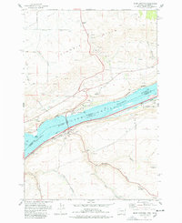
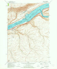 1971 Rufus1973 Print · USGSThe Columbia River corridor is captured here in the early seventies, just as the John Day Dam transformed the region's geography. Trace the industrial landscape from Rufus to Cliffs, along with rail lines like the Union Pacific and deep canyons like China Hollow.
 - 1971 Map of Wasco, 1973 Print
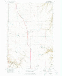
 1971 Wasco1973 Print · USGSWasco and the surrounding plateau appear here in the early 1970s as a thriving center for the regional grain economy. Genealogists and historians can trace the Old Railroad Grade, locate the Sunrise Cemetery, and find the rail-side Grain Elevator and Storage Bins.3 unique versions available
 - 1971 Map of Bronx Canyon, 1973 Print
 1971 Bronx Canyon1973 Print · USGSThe borderlands of Sherman and Wasco Counties are captured in the early 1970s, showing a landscape defined by deep canyons and high plateaus. Researchers can locate the Liberty (Site) and trace remote routes along Bakeoven Road and the Bronx Trail.
 - 1974 Map of Locust Grove, 1977 Print
 1974 Locust Grove1977 Print · USGSIn the mid-1970s, the rural uplands of Sherman County remained a landscape of wheat farming and deep drainage canyons. Researchers can trace the agricultural economy through the Grain Elevator and Landing Strip at Locust Grove or locate the solitary Grave near Frank Fulton Canyon.
 - 1977 Map of Wishram
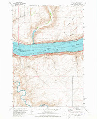
 1977 Wishram1977 Print · USGSThe Columbia River Gorge in the late seventies is captured here at the busy rail crossing of Wishram. Genealogists and local historians can trace the old roads of the Klickitat Valley, locate the Centerville Cem, and study the riverfront at Celilo Village.
 - 1977 Map of Emerson
 1977 Emerson1977 Print · USGSNorth-central Oregon's high wheat country and the deep Deschutes canyon are captured here in the late 1970s. Genealogists and historians can trace rural life through the Douglas Hollow School, the Free Bridge Historical Site, and the rail stops at Kloan and Pollywog.
 - 1977 Map of Biggs Junction, 1978 Print
 1977 Biggs Junction1978 Print · USGSThe Columbia River gorge in the late 1970s reveals a landscape shaped by rail, water, and unique monuments. Researchers can trace the legacy of the Maryhill area through the Stonehenge Memorial, the tracks of the Union Pacific, and the small settlement at Thornberry.
End of results
Showing maps 1-23 of 23
Top cities of Sherman County
Frequently asked questions
- What are the different types of historical maps available for Sherman County?
- What is the oldest map of Sherman County?
- Where can I purchase historical maps of Sherman County for my home or office?
- Where can I download high-res historical maps of Sherman County?
- Are there historical topographic maps available for Sherman County?
- Is there historical aerial imagery available for Sherman County?
- Where are historical maps of Sherman County sourced from?