Old Maps of Netarts, Oregon for Academic Research
Study the evolution of Netarts with 13 high-resolution historic maps. Whether you're teaching, researching, or modeling changes in land use, these maps provide essential visual documentation of urban, environmental, and geographic change.
- Analyze long-term change: Track patterns in development, transportation, and natural features.
- Ideal for environmental or urban studies: Support academic projects with primary historical map data.
- Use in the classroom or lab: Educators and researchers rely on these maps to bring historical context to life.
These maps are a powerful tool for teaching, research, and visualizing how Netarts has changed over the decades.
Netarts, OR maps
(13)- 1942 Map of Tillamook
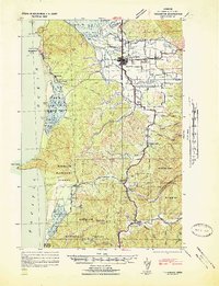 1942 Tillamook1942 Print · USGSCoastal Tillamook County is captured here in the early war years as a landscape of timbered hills and river deltas. You can trace the historic Southern Pacific rail line into Tillamook or locate vanished rural landmarks like Long Prairie Sch and Hemlock.2 unique versions available
 - 1948 Map of Vancouver, 1957 Print
 1948 Vancouver1957 Print · USGSPost-war growth transforms the river valleys of the Pacific Northwest as the timber and rail economy thrives. Trace family roots in Tillamook or Oregon City, and locate vanished landmarks like the spit at Bayocean or the Skamania Mine.
 - 1950 Map of Vancouver
 1950 Vancouver1950 Print · USGSCoastal Oregon and the lower Columbia River valley are captured in detail just after the war. Researchers can trace historic rail routes like the Southern Pacific or locate early settlements such as Vernonia, Gaston, and the Grand Ronde Indian Reservation.
 - 1950 Map of Vancouver, 1951 Print
 1950 Vancouver1951 Print · USGSThe Pacific Northwest urban corridor meets the rugged coast in the years following the war, showing the expansion of Portland and Vancouver. Genealogists and historians can trace the reach of the Southern Pacific RR and locate coastal communities like Tillamook, Seaside, and Tolovana Park.
 - 1955 Map of Tillamook, 1957 Print
 1955 Tillamook1957 Print · USGSThe Oregon coast in the mid-fifties comes alive here, showing the dairy and maritime hub of Tillamook at a peak of industrial activity. Trace the region's development through the Cheese Factory, the Naval Air Station, and family-named landmarks like Hathaway Mead.3 unique versions available
 - 1958 Map of Vancouver, 1968 Print
 1958 Vancouver1968 Print · USGSThe Lower Columbia and Willamette valleys thrive in the late sixties as major rail and river hubs. Genealogists and historians can trace the development of Portland, identify the grounds of Camp Withycombe, and locate coastal landmarks from Tillamook Head to Garibaldi.3 unique versions available
 - 1964 Map of Vancouver
 1964 Vancouver1964 Print · USGSThe Pacific Northwest interior and coast are shown here in the 1960s, from the Portland metropolitan hub to the rugged Pacific shoreline. Researchers can trace the legacy of the Grand Ronde Indian Reservation, the early layout of McMinnville, and the maritime approaches near Tillamook Head.
 - 1980 Map of Yamhill River
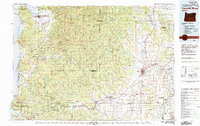 1980 Yamhill River1980 Print · USGSThe Oregon Coast Range and the western Willamette Valley meet in this 1980 survey, showing the landscape from the Pacific shore to the valley floor. Genealogists and historians can trace old routes like the Salmon River Highway to find the Grand Ronde Agency, Cloverdale, and Perrydale.3 unique versions available
 - 1986 Map of Netarts
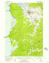
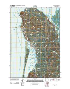
 1986 Netarts1986 Print · USGSThe Oregon coast at the mid-eighties shows a landscape of established beach communities and protected wilderness areas. You can trace the shorelines of Netarts Bay and Tillamook Bay, or locate local landmarks like the Lighthouse and the Netarts Spit.
 - 2011 Map of Netarts, 2011 Print
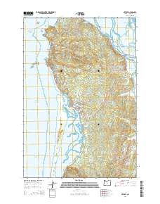
 2011 Netarts2011 Print · USGSCovers Netarts, including Cape Meares, Oceanside, and other nearby areas
 - 2014 Map of Netarts, 2014 Print
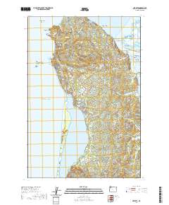
 2014 Netarts2014 Print · USGSCovers Netarts, including Cape Meares, Oceanside, and other nearby areas
 - 2020 Map of Netarts, 2020 Print
 2020 Netarts2020 Print · USGSCovers Netarts, including Cape Meares, Oceanside, and other nearby areas
 - 2024 Map of Netarts, 2024 Print
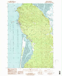
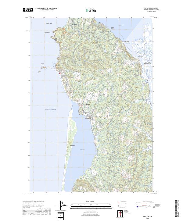 2024 Netarts2024 Print · USGSThe Tillamook coast comes into focus in this recent study of Netarts Bay and its surrounding communities. Genealogists and historians can trace the shoreline from Cape Meares south to Oceanside and Netarts, identifying landmarks like Three Arch Rocks and Netarts Spit.
End of results
Showing maps 1-13 of 13
Top cities near Netarts
- Tillamook historical maps
- Rockaway Beach historical maps
- Bay City historical maps
- Garibaldi historical maps
Frequently asked questions
- What are the different types of historical maps available for Netarts?
- What is the oldest map of Netarts?
- Where can I purchase historical maps of Netarts for my home or office?
- Where can I download high-res historical maps of Netarts?
- Are there historical topographic maps available for Netarts?
- Is there historical aerial imagery available for Netarts?
- Where are historical maps of Netarts sourced from?