Old Maps of Rockaway Beach, Oregon for Academic Research
Study the evolution of Rockaway Beach with 19 high-resolution historic maps. Whether you're teaching, researching, or modeling changes in land use, these maps provide essential visual documentation of urban, environmental, and geographic change.
- Analyze long-term change: Track patterns in development, transportation, and natural features.
- Ideal for environmental or urban studies: Support academic projects with primary historical map data.
- Use in the classroom or lab: Educators and researchers rely on these maps to bring historical context to life.
These maps are a powerful tool for teaching, research, and visualizing how Rockaway Beach has changed over the decades.
Rockaway Beach, OR maps
(19)- 1937 Map of Nehalem, 1954 Print
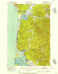 1937 Nehalem1954 Print · USGSThe Tillamook coast in the late thirties shows a landscape of thriving seaside resorts and industrial rail lines. Genealogists and historians can trace the foundations of Bayocean and Garibaldi or locate the long-standing Nehalem Fish Hatchery and local mills.
 - 1943 Map of Nehalem
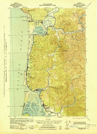 1943 Nehalem1943 Print · USGSCoastal Tillamook County is captured here in the early 1940s, showing the early resort towns and timber-driven rail lines of the north Oregon shore. Genealogists and historians can trace the now-changed footprint of Bayocean or locate the Sawmill and Pine Grove Sch.
 - 1948 Map of Vancouver, 1957 Print
 1948 Vancouver1957 Print · USGSPost-war growth transforms the river valleys of the Pacific Northwest as the timber and rail economy thrives. Trace family roots in Tillamook or Oregon City, and locate vanished landmarks like the spit at Bayocean or the Skamania Mine.
 - 1950 Map of Vancouver
 1950 Vancouver1950 Print · USGSCoastal Oregon and the lower Columbia River valley are captured in detail just after the war. Researchers can trace historic rail routes like the Southern Pacific or locate early settlements such as Vernonia, Gaston, and the Grand Ronde Indian Reservation.
 - 1950 Map of Vancouver, 1951 Print
 1950 Vancouver1951 Print · USGSThe Pacific Northwest urban corridor meets the rugged coast in the years following the war, showing the expansion of Portland and Vancouver. Genealogists and historians can trace the reach of the Southern Pacific RR and locate coastal communities like Tillamook, Seaside, and Tolovana Park.
 - 1955 Map of Nehalem, 1957 Print
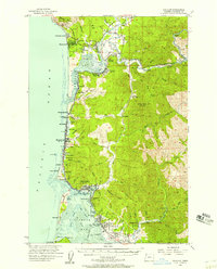 1955 Nehalem1957 Print · USGSThe Tillamook County coastline and Nehalem River valley are captured here in the mid-fifties, showing the vital link between coastal ports and inland timber country. Researchers can trace the Southern Pacific rail line as it serves towns like Wheeler, Garibaldi, and Bayocean.3 unique versions available
 - 1958 Map of Vancouver, 1968 Print
 1958 Vancouver1968 Print · USGSThe Lower Columbia and Willamette valleys thrive in the late sixties as major rail and river hubs. Genealogists and historians can trace the development of Portland, identify the grounds of Camp Withycombe, and locate coastal landmarks from Tillamook Head to Garibaldi.3 unique versions available
 - 1964 Map of Vancouver
 1964 Vancouver1964 Print · USGSThe Pacific Northwest interior and coast are shown here in the 1960s, from the Portland metropolitan hub to the rugged Pacific shoreline. Researchers can trace the legacy of the Grand Ronde Indian Reservation, the early layout of McMinnville, and the maritime approaches near Tillamook Head.
 - 1979 Map of Nehalem River, 1980 Print
 1979 Nehalem River1980 Print · USGSThe northern Oregon coast and its timber-rich interior are captured here in the late seventies, showing the vital connection between sea and forest. Researchers can trace the rail lines of the Southern Pacific and Burlington Northern through historic logging hubs like Vernonia, Timber, and Nehalem.3 unique versions available
 - 1985 Map of Nehalem
 1985 Nehalem1985 Print · USGSCoastal Tillamook County is captured here in the mid-1980s, showcasing the intricate tidal environment where the river meets the sea. Researchers can trace local development in Nehalem, Wheeler, and Manzanita, or locate family sites near the Cem and Bayside Gardens.2 unique versions available
 - 1985 Map of Garibaldi
 1985 Garibaldi1985 Print · USGSThe Tillamook coast in the mid-1980s reveals the striking geography of the Bayocean Peninsula and its lost resort site. Researchers can trace the maritime infrastructure of Garibaldi and explore coastal settlements like Watseco, Twin Rocks, and Hobsonville.2 unique versions available
 - 2011 Map of Garibaldi, 2011 Print
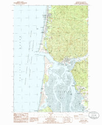
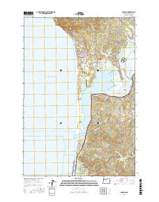
 2011 Garibaldi2011 Print · USGSCovers Rockaway Beach, including Bay City, Garibaldi, and other nearby areas
 - 2011 Map of Nehalem, 2011 Print
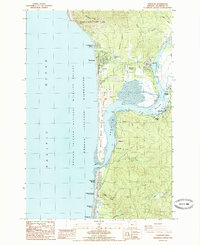
 2011 Nehalem2011 Print · USGSCovers Rockaway Beach, including Manzanita, Wheeler, and other nearby areas
 - 2014 Map of Garibaldi, 2014 Print
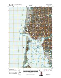
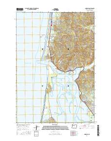
 2014 Garibaldi2014 Print · USGSCovers Rockaway Beach, including Bay City, Garibaldi, and other nearby areas
 - 2017 Map of Nehalem, 2017 Print
 2017 Nehalem2017 Print · USGSCovers Rockaway Beach, including Manzanita, Wheeler, and other nearby areas
 - 2017 Map of Garibaldi, 2017 Print
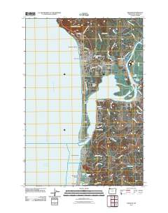
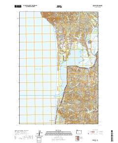
 2017 Garibaldi2017 Print · USGSCovers Rockaway Beach, including Bay City, Garibaldi, and other nearby areas
 - 2020 Map of Nehalem, 2020 Print
 2020 Nehalem2020 Print · USGSCovers Rockaway Beach, including Manzanita, Wheeler, and other nearby areas
 - 2024 Map of Garibaldi, 2024 Print
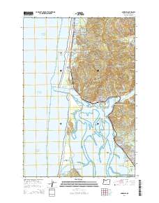
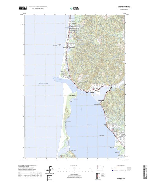 2024 Garibaldi2024 Print · USGSCoastal Tillamook County is shown in detail here during the 2020s, where the busy port at Garibaldi meets the quiet waters of Tillamook Bay. Researchers can trace the modern shoreline of the Bayocean Peninsula and locate coastal landmarks like Cape Meares and Kilchis Point.
 - 2024 Map of Nehalem, 2024 Print
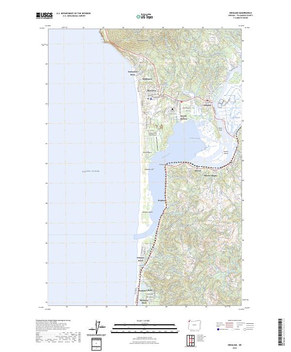 2024 Nehalem2024 Print · USGSThe Oregon coast at the Nehalem River estuary comes alive in this detailed recent survey of the region's shoreline and river towns. Genealogy and history researchers can trace the streets of Manzanita, find the Nehalem American Legion Cem, and explore the marshes around Dean Point.
End of results
Showing maps 1-19 of 19
Top cities near Rockaway Beach
- Tillamook historical maps
- Bay City historical maps
- Garibaldi historical maps
- Manzanita historical maps
- Wheeler historical maps
- Nehalem historical maps
Top neighborhoods of Rockaway Beach
Frequently asked questions
- What are the different types of historical maps available for Rockaway Beach?
- What is the oldest map of Rockaway Beach?
- Where can I purchase historical maps of Rockaway Beach for my home or office?
- Where can I download high-res historical maps of Rockaway Beach?
- Are there historical topographic maps available for Rockaway Beach?
- Is there historical aerial imagery available for Rockaway Beach?
- Where are historical maps of Rockaway Beach sourced from?