Old Maps of Wapinitia, Oregon for Metal Detecting
Plan your next treasure hunt with 13 historic maps of Wapinitia. Find old homesites, ghost towns, trails, and gathering spots that may be lost to time — perfect for identifying promising metal detecting locations.
- Locate forgotten sites: Uncover places like long-lost settlements, abandoned rail lines, or gathering spots.
- Plan better hunts: Use map overlays combined with LiDAR or satellite views to narrow in on historically rich areas.
- Made for detectorists: Thousands of hobbyists use these maps to discover relics, coins, and hidden history.
Use these historic maps to boost your research and find new opportunities beneath the surface of Wapinitia.
Wapinitia, OR maps
(13)- 1930 Map of Dufur, 1945 Print
 1930 Dufur1945 Print · USGSWasco County at the start of the 1930s shows a transition from pioneer wagon routes to a rail-and-ranch economy. Genealogists can locate dozens of country schools like Ireland Sch and early infrastructure including the Barlow Road and the Great Southern Railroad.2 unique versions available
 - 1934 Map of Dufur
 1934 Dufur1934 Print · USGSWasco County during the mid-1930s reveals a landscape of high plateaus and river canyons shaped by pioneering roads and rail. Genealogists can trace family roots through a dense network of rural schoolhouses like Kelly Sch and Wolf Run Sch, or follow the path of the historic Barlow Road.2 unique versions available
 - 1953 Map of The Dalles, 1965 Print
 1953 The Dalles1965 Print · USGSThe Columbia River Gorge at mid-century shows a region being transformed by massive hydroelectric dams and a growing highway network. Researchers can trace the development of The Dalles Dam, locate the Maryhill Museum, and find old rail stops in Rufus, Wishram, and Arlington.3 unique versions available
 - 1956 Map of The Dalles
 1956 The Dalles1956 Print · USGSThe Columbia River Gorge and the high Cascades are captured in the mid-1950s, showing a vital corridor of rail and road. Researchers can trace the original path of The Old Oregon Trail or locate historical landmarks like the Maryhill Museum and Mount Hood.
 - 1957 Map of The Dalles
 1957 The Dalles1957 Print · USGSThe Columbia River Gorge and the high plateaus of the mid-1950s come alive on this detailed survey of northern Oregon and southern Washington. Researchers can trace the path of the Oregon Trail and The Old Barlow Road alongside river towns like The Dalles and Wishram.
 - 1962 Map of Wapinitia, 1964 Print
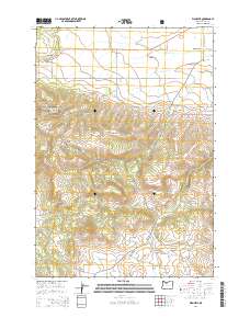
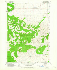 1962 Wapinitia1964 Print · USGSIn the early sixties, this portion of Wasco County shows the interplay between high plateaus and reservation lands. Researchers can trace historic boundary markers like the Mc Quinn Line-1884 or locate local landmarks including Oak Grove Sch and the Rainbow Quarry.2 unique versions available
 - 1983 Map of Mount Hood
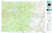 1983 Mount Hood1983 Print · USGSMount Hood and its surrounding national forest are captured here in the early eighties, spanning from alpine glaciers to the high desert plains. Genealogists and historians can trace old routes like the Barlow Road and locate remote landmarks like Bear Springs Ranger Sta or the settlement of Tygh Valley.
 - 1996 Map of Wapinitia, 1998 Print
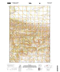
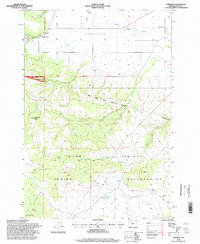 1996 Wapinitia1998 Print · USGSHigh plateau agriculture meets the reservation boundary in Wasco County during the late nineties. Genealogists and local historians can locate the Oak Grove Sch, the settlement of Wapinitia, and the historic McQuinn Line 1884 survey marker.
 - 2011 Map of Wapinitia, 2011 Print
 2011 Wapinitia2011 Print · USGSCovers Wapinitia, including Pine Grove, Wasco County, and other nearby areas
 - 2014 Map of Wapinitia, 2014 Print
 2014 Wapinitia2014 Print · USGSCovers Wapinitia, including Pine Grove, Wasco County, and other nearby areas
 - 2017 Map of Wapinitia, 2017 Print
 2017 Wapinitia2017 Print · USGSCovers Wapinitia, including Pine Grove, Wasco County, and other nearby areas
 - 2020 Map of Wapinitia, 2020 Print
 2020 Wapinitia2020 Print · USGSCovers Wapinitia, including Pine Grove, Wasco County, and other nearby areas
 - 2024 Map of Wapinitia, 2024 Print
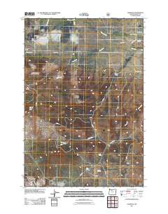
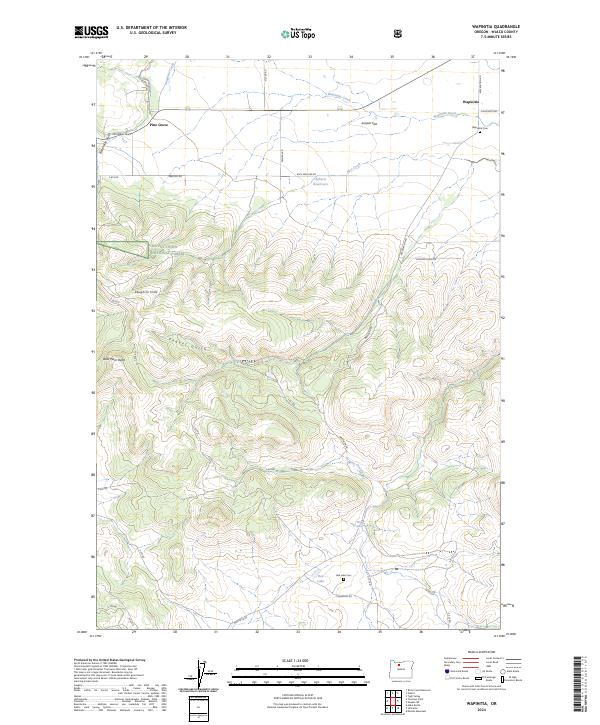 2024 Wapinitia2024 Print · USGSSettled high on the plateau south of the Columbia River, this area maintains its rural character in the early twenty-first century. Researchers can trace land use and lineage through markers like Wapinitia Cem, Pine Grove, and Red Lake.
End of results
Showing maps 1-13 of 13
Top cities near Wapinitia
Frequently asked questions
- What are the different types of historical maps available for Wapinitia?
- What is the oldest map of Wapinitia?
- Where can I purchase historical maps of Wapinitia for my home or office?
- Where can I download high-res historical maps of Wapinitia?
- Are there historical topographic maps available for Wapinitia?
- Is there historical aerial imagery available for Wapinitia?
- Where are historical maps of Wapinitia sourced from?