1980s Maps of Tigard Triangle, Tigard
Explore 2 historic maps of Tigard Triangle from the 1980s. These maps offer a rare glimpse into what life looked like during the 1980s — showing old roads, neighborhoods, homes, and landmarks that have changed or disappeared over time.
Whether you're researching your family's past, planning a metal detecting trip, or studying how Tigard Triangle's landscape evolved across the 1980s, these high-resolution maps are a powerful tool for exploring the history of this region.
- Focus on a specific era: All maps on this page are from the 1980s, giving you a focused view of this time period.
- See what’s changed: Compare century-old streets, trails, and buildings to today's modern landscape using overlays and satellite layers.
- Research with precision: Use these maps for genealogy, historical research, land use analysis, or educational projects.
- View, download, or print: Maps are fully viewable online in high resolution, and can be downloaded or printed for your own records.
Start exploring Tigard Triangle's history through authentic maps from the 1980s. This is your window into the past.
Tigard Triangle, Tigard maps
(2)- 1982 Map of Oregon City, 1983 Print
 1982 Oregon City1983 Print · USGSGreater Portland and the Willamette Valley are shown in the early eighties as the region's urban and rural landscapes converged. Genealogists and historians can trace family-named sites across French Prairie, visit St Paul Ch, or locate the grounds of Dammasch State Hospital.
 - 1984 Map of Beaverton, 1985 Print
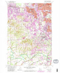 1984 Beaverton1985 Print · USGSThe Tualatin Valley was undergoing a significant suburban transformation during the mid-eighties as growth pushed south from Beaverton. Researchers can trace old property lines and community hubs like St Marys Boys Home, Crescent Grove Cem, and the Oregon Electric rail line.
End of results
Showing maps 1-2 of 2
Frequently asked questions
- What are the different types of historical maps available for Tigard Triangle?
- What is the oldest map of Tigard Triangle?
- Where can I purchase historical maps of Tigard Triangle for my home or office?
- Where can I download high-res historical maps of Tigard Triangle?
- Are there historical topographic maps available for Tigard Triangle?
- Is there historical aerial imagery available for Tigard Triangle?
- Where are historical maps of Tigard Triangle sourced from?