Old Maps of Franklin Township, Pennsylvania for Academic Research
Study the evolution of Franklin Township with 38 high-resolution historic maps. Whether you're teaching, researching, or modeling changes in land use, these maps provide essential visual documentation of urban, environmental, and geographic change.
- Analyze long-term change: Track patterns in development, transportation, and natural features.
- Ideal for environmental or urban studies: Support academic projects with primary historical map data.
- Use in the classroom or lab: Educators and researchers rely on these maps to bring historical context to life.
These maps are a powerful tool for teaching, research, and visualizing how Franklin Township has changed over the decades.
Franklin Township, PA maps
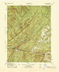
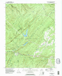
(38)- 1909 Map of Fairfield
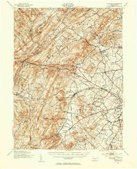
 1909 Fairfield1909 Print · USGSAdams County at the turn of the century shows a landscape of mountain sanitaria, early iron works, and a dense network of country schoolhouses. Genealogists and researchers can trace the old Western Maryland Railroad route and locate landmarks like Maria Furnace, Cashtown, and the South Mountain Sanatorium.6 unique versions available
 - 1942 Map of Gettysburg, 1944 Print
 1942 Gettysburg1944 Print · USGSGettysburg and its surrounding borderlands are shown in great detail during the early 1940s, capturing the region's dense network of rural schools and mills. Genealogists can trace family-named landmarks such as Galt Kump PO, Hafers Mill, and Philips Delight Sch.
 - 1944 Map of Flat Ridge
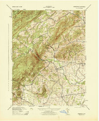
 1944 Flat Ridge1944 Print · USGSThe South Mountain high country in the mid-1940s is defined by vast state forests and conservation lands. Hikers and historians can trace the Appalachian Trail past Caledonia Park, Strasbaugh School, and the Chambersburg Reservoir.6 unique versions available
 - 1944 Map of Arendtsville
 1944 Arendtsville1944 Print · USGSAdams County orchard country and the eastern slopes of South Mountain are captured here during the mid-1940s. Genealogists and local historians can locate several rural schoolhouses, including Shellys School, and old mill sites like Genoltz Mill near Arendtsville.7 unique versions available
 - 1944 Map of Fairfield
 1944 Fairfield1944 Print · USGSAdams County at the height of the 1940s shows the rural landscape west of the famous battlegrounds. Researchers can trace the Western Maryland railroad and locate numerous country schoolhouses like Oak Grove School and Belmont School.
 - 1944 Map of Iron Springs
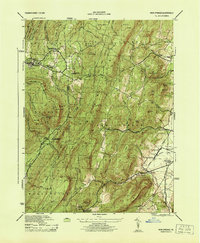 1944 Iron Springs1944 Print · USGSThe South Mountain highlands of Adams and Franklin Counties are captured during the mid-forties, highlighting the Appalachian Trail and early medical facilities. Trace the rail-and-valley economy through Fairfield Sta, Maria Furnace, and the Roofing Plant.2 unique versions available
 - 1948 Map of Baltimore
 1948 Baltimore1948 Print · USGSMaryland and Pennsylvania crossroads are captured in the late 1940s, showing a landscape defined by historic rail lines and major military installations. Genealogists can trace family connections in Gettysburg, Westminster, and near the U.S. Naval Academy in Annapolis.2 unique versions available
 - 1951 Map of Fairfield, 1953 Print
 1951 Fairfield1953 Print · USGSAdams County in the early fifties maintains its nineteenth-century agricultural character as the western gate to the Gettysburg battlefield. Genealogists can trace family landmarks and rural institutions including the Black Horse Tavern, Flohrs Cem, and the McKnightstown Sta.7 unique versions available
 - 1951 Map of Fairfield, 1954 Print
 1951 Fairfield1954 Print · USGSSouth Mountain and the Adams County fruit belt are captured here in the early fifties. Genealogists can trace family footprints through numerous rural schools like Pitzer Sch and settlements such as Arendtsville and Maria Furnace.3 unique versions available
 - 1953 Map of Iron Springs, 1954 Print
 1953 Iron Springs1954 Print · USGSAdams County in the early fifties shows a landscape of mountain ridges and valley farms. Genealogists can locate old family landmarks like Chamberlains Hill, trace the Appalachian Trail, or find the historic Maria Furnace site.5 unique versions available
 - 1954 Map of Baltimore
 1954 Baltimore1954 Print · USGSThe Mid-Atlantic region in the early fifties shows a landscape of growing suburban centers and heavy rail corridors. Trace mid-century transit networks and military landmarks from the Aberdeen Proving Ground to the Gettysburg National Military Park.
 - 1956 Map of Arendtsville
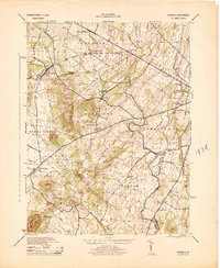
 1956 Arendtsville1956 Print · USGSMid-century Adams County is captured in this 1956 survey as an established agricultural landscape of boroughs and orchard lands. Researchers can trace historic local sites like Eicholtz Mill, Sheelys School, and the community of Arendtsville.
 - 1956 Map of Baltimore
 1956 Baltimore1956 Print · USGSMid-century Maryland and Pennsylvania are captured here during a period of massive suburban and military growth across the Chesapeake region. Genealogists and historians can trace the rail corridors of the Baltimore & Ohio RR and locate landmarks like Fort McHenry or the Aberdeen Proving Ground.
 - 1957 Map of Baltimore, 1964 Print
 1957 Baltimore1964 Print · USGSMaryland and Southern Pennsylvania are shown during the mid-century expansion of the Baltimore-Washington corridor. Researchers can trace the extensive rail lines of the Baltimore & Ohio RR and locate sites like Fort Detrick and Gettysburg National Military Park.5 unique versions available
 - 1961 Map of Baltimore
 1961 Baltimore1961 Print · USGSMaryland and Pennsylvania are captured at a mid-century peak of industrial and military expansion. Genealogists and historians can trace rail corridors like the Western Maryland Ry or locate regional landmarks such as Camp Detrick and Kent Island.
 - 1983 Map of Hagerstown, 1984 Print
 1983 Hagerstown1984 Print · USGSThe tri-state borderlands of Maryland, Pennsylvania, and West Virginia are shown in the early eighties as a hub of military installations and valley towns. Genealogists and historians can trace the landscape from Gettysburg National Military Park to the banks of the Potomac River.2 unique versions available
 - 1989 Map of Baltimore
 1989 Baltimore1989 Print · USGSThe Mid-Atlantic corridor in the late eighties is captured here, from the Baltimore harbor to the Blue Ridge foothills. Researchers can trace the sprawling footprints of Aberdeen Proving Ground, the historic grounds of Gettysburg National Military Park, and the winding Susquehanna River.
 - 1990 Map of Caledonia Park, 1995 Print
 1990 Caledonia Park1995 Print · USGSSouth Mountain and the thick timberlands of Adams and Franklin counties are shown here in the early nineties. Genealogists and hikers can trace the Appalachian Trail past Caledonia State Park and the historic St Ignatius-Loyola Ch.
 - 1990 Map of Fairfield, 1995 Print
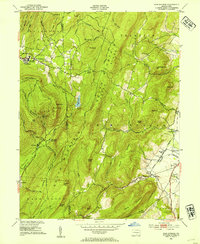
 1990 Fairfield1995 Print · USGSAdams County’s storied landscape is captured here in the 1990s, showcasing the intersection of Civil War preservation and rural Pennsylvania life. Researchers can trace family history through local landmarks like Black Horse Tavern, the Lower Marsh Creek Ch, and Flohrs Cem.
 - 1990 Map of Iron Springs, 1995 Print
 1990 Iron Springs1995 Print · USGSSouth Mountain and the wooded reaches of Michaux State Forest are captured here in the early nineties. Researchers can trace rural landmarks like Mt Carmel Ch, the South Mountain Restoration Center, and the historic Iron Springs area.2 unique versions available
 - 1990 Map of Arendtsville, 1995 Print
 1990 Arendtsville1995 Print · USGSAdams County orchard country is captured here during the 1990s, centered on the historic crossroads of Arendtsville and Mummasburg. Researchers can trace rural church history at St James Ch or locate family sites near Greenmount Cem and Franklin Sch.
 - 1994 Map of Fairfield, 1998 Print
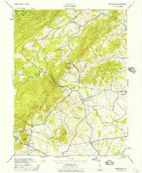
 1994 Fairfield1998 Print · USGSFairfield and the western fringes of Gettysburg are documented here in the mid-1990s as the landscape balances preservation and modern growth. Genealogists and historians can locate family sites at Flohrs Cem or trace the grounds of the Eisenhower National Historic Site and Black Horse Tavern.
 - 2010 Map of Fairfield, 2010 Print
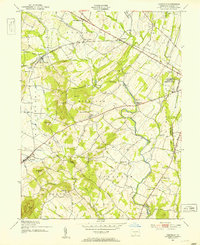
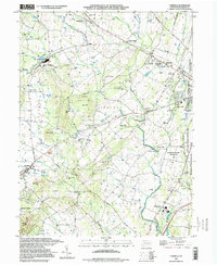
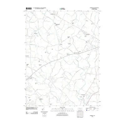 2010 Fairfield2010 Print · USGSCovers Franklin Township, including Fairfield, Hamiltonban Township, and other nearby areas
 - 2010 Map of Iron Springs, 2010 Print
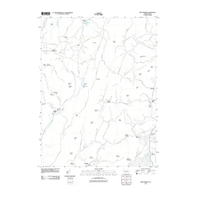 2010 Iron Springs2010 Print · USGSCovers Franklin Township, including Quincy Township, Guilford Township, and other nearby areas
 - 2010 Map of Caledonia Park, 2010 Print
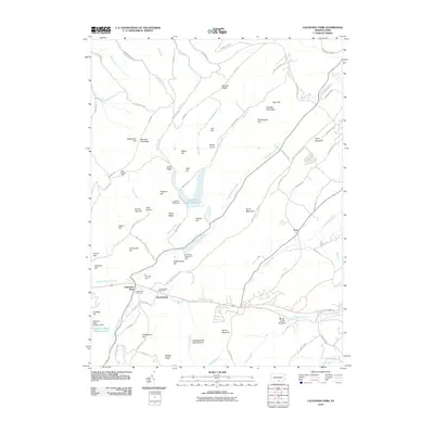 2010 Caledonia Park2010 Print · USGSCovers Franklin Township, including Guilford Township, Southampton Township, and other nearby areas
Showing maps 1-25 of 38
Top cities near Franklin Township
- Waynesboro historical maps
- Gettysburg historical maps
- Quincy Township historical maps
- Shippensburg historical maps
- Dickinson historical maps
- Carroll Valley historical maps
See more
Top neighborhoods of Franklin Township
- Cashtown-McKnightstown historical maps
- Bridgeport historical maps
- Graefenburg historical maps
- Seven Stars historical maps
- Hilltown historical maps
- Mummasburg historical maps
See more
Frequently asked questions
- What are the different types of historical maps available for Franklin Township?
- What is the oldest map of Franklin Township?
- Where can I purchase historical maps of Franklin Township for my home or office?
- Where can I download high-res historical maps of Franklin Township?
- Are there historical topographic maps available for Franklin Township?
- Is there historical aerial imagery available for Franklin Township?
- Where are historical maps of Franklin Township sourced from?