Old Maps of Latimore Township, Pennsylvania for Hiking & Exploration
Hike through history with 37 historic maps of Latimore Township. Explore old trails, ghost towns, and forgotten backroads — perfect for outdoor adventurers and local explorers.
- Rediscover forgotten places: Map out old mining camps, roads, and footpaths that no longer exist on modern maps.
- Layer with modern tools: Combine with LiDAR or satellite views to plan hikes through historical terrain.
- Made for exploration: Popular among hikers, overlanders, and local history lovers.
Use these maps to find adventure and explore the hidden past of Latimore Township.
Latimore Township, PA maps
(37)- 1904 Map of Carlisle
 1904 Carlisle1904 Print · USGSCumberland County at the opening of the century is a network of thriving rail hubs and rural gaps. Genealogists and historians can trace the foundations of Carlisle, find the grounds of the Carlisle Indian School, and locate rural landmarks like Salem Church and Boiling Springs.7 unique versions available
 - 1908 Map of Gettysburg
 1908 Gettysburg1908 Print · USGSGettysburg and rural Adams County appear in the early twentieth century as a landscape of memorialized battlefields and thriving rail-side villages. Genealogists can trace family roots through numerous country schools and landmark mills like Bream Mill or the Bermudian Churches.6 unique versions available
 - 1942 Map of Gettysburg, 1944 Print
 1942 Gettysburg1944 Print · USGSGettysburg and its surrounding borderlands are shown in great detail during the early 1940s, capturing the region's dense network of rural schools and mills. Genealogists can trace family-named landmarks such as Galt Kump PO, Hafers Mill, and Philips Delight Sch.
 - 1943 Map of Carlisle, 1944 Print
 1943 Carlisle1944 Print · USGSCumberland County during the mid-forties reveals a landscape transitioning between its deep industrial roots and new high-speed transit. Genealogists and historians can trace family locations through numerous rural landmarks like Farmers Academy, Reading Banks, and the Carlisle Barracks.3 unique versions available
 - 1944 Map of Hampton
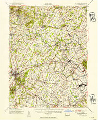
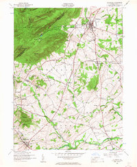
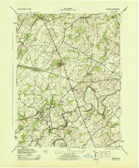 1944 Hampton1944 Print · USGSAdams County townships like Huntington and Straban appear here during the mid-1940s, showing a landscape of small farms and family-named schools. You can trace old property lines and local landmarks from Round Hill School to the banks of Conewago Creek.5 unique versions available
 - 1948 Map of Baltimore
 1948 Baltimore1948 Print · USGSMaryland and Pennsylvania crossroads are captured in the late 1940s, showing a landscape defined by historic rail lines and major military installations. Genealogists can trace family connections in Gettysburg, Westminster, and near the U.S. Naval Academy in Annapolis.2 unique versions available
 - 1950 Map of Harrisburg, 1952 Print
 1950 Harrisburg1952 Print · USGSMid-century Central Pennsylvania comes alive through its dense rail networks and river valley settlements during the post-war industrial era. Genealogists and historians can trace family roots through hubs like Harrisburg, locate Carlisle Barracks, or follow the Pennsylvania RR through the Lebanon Valley.
 - 1951 Map of Gettysburg, 1954 Print
 1951 Gettysburg1954 Print · USGSGettysburg and its surrounding Adams County townships appear here during the early fifties, blending solemn Civil War landmarks with a bustling mid-century rural economy. Genealogists can locate family-named sites like Ziegler Mill, trace students at Locust Grove Sch, or find ancestors at Conewago Chapel.3 unique versions available
 - 1952 Map of Mount Holly Springs, 1958 Print
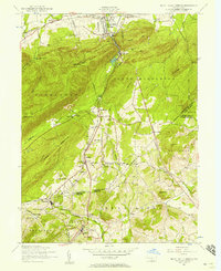 1952 Mount Holly Springs1958 Print · USGSCumberland and Adams counties meet at the mountain gaps of south-central Pennsylvania in the early 1950s. Trace the path of the Appalachian Trail and identify rural landmarks like the Telegraph relay station, Peach Glen, and Mt Zion Church.6 unique versions available
 - 1952 Map of Dillsburg, 1958 Print
 1952 Dillsburg1958 Print · USGSDillsburg and the surrounding rural townships of York and Adams Counties are shown in the early fifties as the region balanced agriculture with growing community centers. Researchers can trace old family sites and rural landmarks like Deardorffs Mill, Sunny Side Cemetery, and the Appalachian Trail.5 unique versions available
 - 1952 Map of Carlisle, 1959 Print
 1952 Carlisle1959 Print · USGSCumberland County at the midpoint of the century shows a landscape defined by its historic military presence and the emerging Turnpike. Genealogists and hikers can trace the Appalachian Trail over Long Mountain or locate family sites at Churchtown and Deardorffs Mill.2 unique versions available
 - 1954 Map of Baltimore
 1954 Baltimore1954 Print · USGSThe Mid-Atlantic region in the early fifties shows a landscape of growing suburban centers and heavy rail corridors. Trace mid-century transit networks and military landmarks from the Aberdeen Proving Ground to the Gettysburg National Military Park.
 - 1956 Map of Baltimore
 1956 Baltimore1956 Print · USGSMid-century Maryland and Pennsylvania are captured here during a period of massive suburban and military growth across the Chesapeake region. Genealogists and historians can trace the rail corridors of the Baltimore & Ohio RR and locate landmarks like Fort McHenry or the Aberdeen Proving Ground.
 - 1957 Map of Harrisburg
 1957 Harrisburg1957 Print · USGSMid-century Central Pennsylvania comes into focus as a bustling network of rail, river, and mountain ridges. Genealogists and historians can trace the development of the State Capitol and surrounding hubs like Middletown, Columbia, and Pottsville.7 unique versions available
 - 1957 Map of Baltimore, 1964 Print
 1957 Baltimore1964 Print · USGSMaryland and Southern Pennsylvania are shown during the mid-century expansion of the Baltimore-Washington corridor. Researchers can trace the extensive rail lines of the Baltimore & Ohio RR and locate sites like Fort Detrick and Gettysburg National Military Park.5 unique versions available
 - 1961 Map of Harrisburg
 1961 Harrisburg1961 Print · USGSCentral Pennsylvania is shown at a mid-century peak of industrial and military activity, from the Susquehanna water gaps to the fertile Dutch Country. Genealogists and historians can trace the rail corridors of the Pennsylvania RR and find landmarks like Carlisle Barracks or the Anthracite Coal Fields.2 unique versions available
 - 1961 Map of Baltimore
 1961 Baltimore1961 Print · USGSMaryland and Pennsylvania are captured at a mid-century peak of industrial and military expansion. Genealogists and historians can trace rail corridors like the Western Maryland Ry or locate regional landmarks such as Camp Detrick and Kent Island.
 - 1964 Map of Harrisburg
 1964 Harrisburg1964 Print · USGSCentral Pennsylvania in the mid-fifties reveals a landscape shaped by ridge-and-valley geology and critical Cold War infrastructure. Researchers can trace the massive Indiantown Gap Military Reservation or the rail corridors of the Pennsylvania RR and Reading RR.
 - 1983 Map of Hagerstown, 1984 Print
 1983 Hagerstown1984 Print · USGSThe tri-state borderlands of Maryland, Pennsylvania, and West Virginia are shown in the early eighties as a hub of military installations and valley towns. Genealogists and historians can trace the landscape from Gettysburg National Military Park to the banks of the Potomac River.2 unique versions available
 - 1984 Map of Carlisle, 1985 Print
 1984 Carlisle1985 Print · USGSSouth-central Pennsylvania is shown during the mid-eighties as a hub of military activity and mountain transit. Genealogists and historians can trace the development of Carlisle Barracks and Letterkenny Army Depot, alongside rail routes like Conrail.2 unique versions available
 - 1989 Map of Baltimore
 1989 Baltimore1989 Print · USGSThe Mid-Atlantic corridor in the late eighties is captured here, from the Baltimore harbor to the Blue Ridge foothills. Researchers can trace the sprawling footprints of Aberdeen Proving Ground, the historic grounds of Gettysburg National Military Park, and the winding Susquehanna River.
 - 1990 Map of Hampton, 1995 Print
 1990 Hampton1995 Print · USGSAdams County’s rural landscape is captured here in the early nineties, showcasing the area's transition between agricultural tradition and modern development. Genealogists can locate family sites near New Chester, St Johns Ch, and the many cemeteries dotting the banks of Conewago Creek.
 - 2010 Map of Hampton, 2010 Print
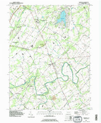
 2010 Hampton2010 Print · USGSCovers Latimore Township, including Reading Township, Tyrone Township, and other nearby areas
 - 2010 Map of Dillsburg, 2010 Print
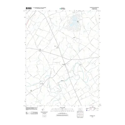
 2010 Dillsburg2010 Print · USGSCovers Latimore Township, including Dillsburg, York Springs, and other nearby areas
 - 2010 Map of Mount Holly Springs, 2010 Print
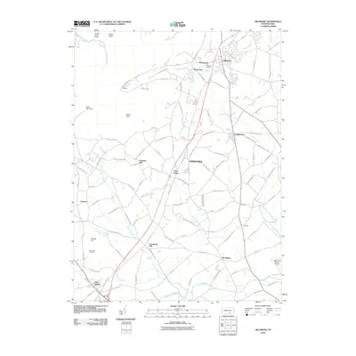
 2010 Mount Holly Springs2010 Print · USGSCovers Latimore Township, including Mount Holly Springs, Gardners, and other nearby areas
Showing maps 1-25 of 37
Top cities near Latimore Township
- Harrisburg historical maps
- Carlisle historical maps
- Hanover historical maps
- Parkville historical maps
- Gettysburg historical maps
- New Cumberland historical maps
See more
Top neighborhoods of Latimore Township
Frequently asked questions
- What are the different types of historical maps available for Latimore Township?
- What is the oldest map of Latimore Township?
- Where can I purchase historical maps of Latimore Township for my home or office?
- Where can I download high-res historical maps of Latimore Township?
- Are there historical topographic maps available for Latimore Township?
- Is there historical aerial imagery available for Latimore Township?
- Where are historical maps of Latimore Township sourced from?