Old Maps of Allegheny County, Pennsylvania for Metal Detecting
Plan your next treasure hunt with 198 historic maps of Allegheny County. Find old homesites, ghost towns, trails, and gathering spots that may be lost to time — perfect for identifying promising metal detecting locations.
- Locate forgotten sites: Uncover places like long-lost settlements, abandoned rail lines, or gathering spots.
- Plan better hunts: Use map overlays combined with LiDAR or satellite views to narrow in on historically rich areas.
- Made for detectorists: Thousands of hobbyists use these maps to discover relics, coins, and hidden history.
Use these historic maps to boost your research and find new opportunities beneath the surface of Allegheny County.
Allegheny County, PA maps
(198)- 1901 Map of Beaver, 1958 Print
 1901 Beaver1958 Print · USGSThe industrial river valleys of Beaver County at the dawn of the twentieth century are captured here in meticulous detail. Researchers can trace the development of Beaver Falls and Rochester or locate riverside landmarks like Baker's Landing and Dam No. 6.
 - 1902 Map of Brownsville
 1902 Brownsville1902 Print · USGSThe Monongahela Valley was a powerhouse of Pennsylvania industry at the start of the twentieth century, defined by its coal mines and river-front rail lines. Researchers can trace the heritage of the National Pike and locate vanished works at Vesta Mine or Coal Bluff.
 - 1904 Map of Mc Keesport
 1904 Mc Keesport1904 Print · USGSAllegheny County at the height of its industrial era reveals a landscape of massive rail yards and riverfront steel towns. Genealogists can trace family roots through dense neighborhoods in Homestead, Wilkinsburg, and Braddock or locate ancestral plots in Homewood Cem.2 unique versions available
 - 1904 Map of Beaver
 1904 Beaver1904 Print · USGSBeaver County at the opening of the twentieth century shows a landscape defined by the bustling industrial corridors of the Ohio River. Genealogists can trace family roots through riverfront settlements like Monaca, Shippingport, and Freedom, or locate early transport hubs such as Cooks Ferry.6 unique versions available
 - 1904 Map of Carnegie, 1954 Print
 1904 Carnegie1954 Print · USGSAllegheny County's industrial heartland is captured here at the start of the twentieth century as rail lines and mines reshaped the landscape. Researchers can trace early settlements and social hubs like Cliff Mine, the County Home, and the Union Church.
 - 1904 Map of Burgettstown, 1958 Print
 1904 Burgettstown1958 Print · USGSWashington County and its neighbors are documented at the turn of the century as the coal and rail industries began reshaping the landscape. Researchers can trace early family sites and infrastructure from Pattersons Mill to the Francis Mine and the North Star Tyre P O.
 - 1904 Map of Greensburg, 1963 Print
 1904 Greensburg1963 Print · USGSWestmoreland County at the dawn of the twentieth century was a landscape of industrial power and small-town growth. Genealogists can trace family footprints through Greensburg, find the Bulltown Schoolhouse, or follow the Pennsylvania Railroad through Jeannette and Manor.
 - 1906 Map of Brownsville
 1906 Brownsville1906 Print · USGSSouthwestern Pennsylvania’s river valleys were centers of industrial expansion when this survey was conducted. Genealogists can locate family homes and landmarks in riverfront towns like Monessen and Charleroi, or trace rural roots near Salem Church and Ginger Hill.4 unique versions available
 - 1906 Map of Burgettstown
 1906 Burgettstown1906 Print · USGSWestern Pennsylvania’s coal and rail landscape comes into focus at the dawn of the twentieth century. Researchers can trace historic family landmarks and industrial sites like Francis Mine, Pattersons Mill, and the North Star Tyre P O.5 unique versions available
 - 1906 Map of Carnegie
 1906 Carnegie1906 Print · USGSThe industrial valleys of Western Pennsylvania come alive in the early 1900s, showing the early infrastructure of the Ohio River and its tributaries. Local historians can trace family roots at Union Church or explore the early coal economy at Cliff Mine and Walkers Mills.7 unique versions available
 - 1906 Map of Greensburg
 1906 Greensburg1906 Print · USGSWestmoreland County at the height of its industrial growth is detailed here, showing a landscape defined by coal, glass, and rail. Researchers can trace ancestral roots at the Bulltown Schoolhouse or follow the early trolley and rail lines through Jeannette and Export.6 unique versions available
 - 1906 Map of Sewickley, 1960 Print
 1906 Sewickley1960 Print · USGSWestern Pennsylvania’s river-and-rail corridor is captured here at the start of the century, showing the industrial development along the Ohio River. Researchers can trace early infrastructure like Dam No 4 or locate landmarks such as the Camp Meeting Grounds and Parks Quarries.
 - 1907 Map of Pittsburg
 1907 Pittsburg1907 Print · USGSSteel-industry heartlands and river-valley rail corridors define the Pittsburgh region in the early nineteen-hundreds. Trace the complex rail networks of the Union RR and Pennsylvania RR through industrial hubs like Homestead and Wilmerding.10 unique versions available
 - 1907 Map of Freeport, 1956 Print
 1907 Freeport1956 Print · USGSThe industrial river valleys of Armstrong, Westmoreland, and Butler counties come alive in this early 1900s survey. Genealogists and researchers can trace the rail-and-river network through Freeport and Schenley, locating old post offices at Garvers Ferry and Dime.
 - 1908 Map of Sewickley
 1908 Sewickley1908 Print · USGSThe industrial corridor of the Ohio River valley is captured here in the early twentieth century, showing a landscape defined by steam-era transport and valley settlements. Researchers can trace the riverfront rail networks of the Pennsylvania System and locate historic landmarks like Aliquippa Park and the Campmeeting Grounds.7 unique versions available
 - 1908 Map of Carnegie, 1910 Print
 1908 Carnegie1910 Print · USGSSouthwest of the Pittsburgh river forks in the early 1900s, a complex web of railroads and industrial hollows began to link the rural coal and mill towns. Trace the paths of the Wabash and Side Belt lines past landmarks like Cliff Mine, Guy Mills, and Treveskyn Cuddy PO.
 - 1908 Map of New Kensington, 1956 Print
 1908 New Kensington1956 Print · USGSThe Allegheny River valley and its surrounding townships are captured here at the start of the twentieth century. Researchers can trace early railroad stops at Allison Park Sta, find rural landmarks like Sandy Hill School, and locate the Fulton Ferry crossing.
 - 1909 Map of Freeport
 1909 Freeport1909 Print · USGSThe industrial river valleys of the Allegheny and Kiskiminitas are captured here during the peak of Pennsylvania's rail-and-river era. Researchers can trace the early layouts of Freeport and Leechburg or locate vanished sites like the Lucesco PO.5 unique versions available
 - 1910 Map of New Kensington
 1910 New Kensington1910 Print · USGSThe industrial Allegheny River corridor and its rugged hinterlands come alive in this 1910 survey of the Westmoreland and Butler County borders. Genealogists and historians can trace family roots through labels for Sandy Hill School, Clinton Church, and the settlement at Saxonburg.7 unique versions available
 - 1931 Map of Brownsville, 1954 Print
 1931 Brownsville1954 Print · USGSThe industrial Monongahela and Youghiogheny river valleys are captured here in the early thirties, showcasing a landscape of coal mines and river locks. Genealogists can trace family homes near Vesta Mine, Sutersville, and rural landmarks like Salem Church.
 - 1933 Map of Brownsville
 1933 Brownsville1933 Print · USGSWestern Pennsylvania’s industrial heartland thrives along the river bends in the early thirties, where coal and rail define the landscape. Trace the expansion of river towns like Charleroi and Monessen, locate the Vesta Mine, or find rural landmarks like Mt Union Sch.2 unique versions available
 - 1940 Map of Brownsville
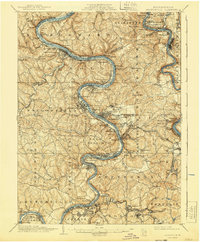 1940 Brownsville1940 Print · USGSThe Monongahela and Youghiogheny river valleys were the industrial heart of Pennsylvania during this era of coal and steel. Genealogists and historians can trace the exact locations of Vesta Mine, Salem Church, and historic rural schools like Central Sch.
 - 1948 Map of Pittsburgh West, 1954 Print
 1948 Pittsburgh West1954 Print · USGSPittsburgh’s western riverfronts and boroughs are captured in the mid-forties during a peak era of rail and industrial activity. Genealogists can locate family landmarks like Highwood Cemetery or the Western State Penitentiary and trace the Chartiers Creek rail lines.
 - 1950 Map of Valencia, 1952 Print
 1950 Valencia1952 Print · USGSThe borderlands of Butler and Allegheny Counties are captured at mid-century as rural life met growing institutions and industry. Researchers can trace the rail-side growth of Valencia and Bakerstown, locate family landmarks like Galbreath School No 2, and find the Mine Dump near Bairdford.5 unique versions available
 - 1951 Map of Pittsburgh West
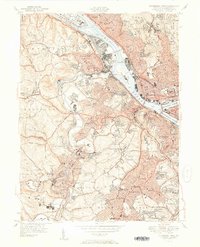 1951 Pittsburgh West1951 Print · USGSThe industrial heart of Allegheny County is captured at mid-century as neighborhoods expanded across the hills west of the rivers. Researchers can trace the rail lines through McKees Rocks, find ancestors at Highwood Cemetery, or locate old landmarks like the Allegheny Observatory.3 unique versions available
Showing maps 1-25 of 198
Top cities of Allegheny County
- Pittsburgh historical maps
- Penn Hills historical maps
- Bethel Park historical maps
- Ross Township historical maps
- Mount Lebanon historical maps
- McCandless historical maps
See more
Frequently asked questions
- What are the different types of historical maps available for Allegheny County?
- What is the oldest map of Allegheny County?
- Where can I purchase historical maps of Allegheny County for my home or office?
- Where can I download high-res historical maps of Allegheny County?
- Are there historical topographic maps available for Allegheny County?
- Is there historical aerial imagery available for Allegheny County?
- Where are historical maps of Allegheny County sourced from?