1990s Maps of Beaver County, Pennsylvania
Explore 5 historic maps of Beaver County from the 1990s. These maps offer a rare glimpse into what life looked like during the 1990s — showing old roads, neighborhoods, homes, and landmarks that have changed or disappeared over time.
Whether you're researching your family's past, planning a metal detecting trip, or studying how Beaver County's landscape evolved across the 1990s, these high-resolution maps are a powerful tool for exploring the history of this region.
- Focus on a specific era: All maps on this page are from the 1990s, giving you a focused view of this time period.
- See what’s changed: Compare century-old streets, trails, and buildings to today's modern landscape using overlays and satellite layers.
- Research with precision: Use these maps for genealogy, historical research, land use analysis, or educational projects.
- View, download, or print: Maps are fully viewable online in high resolution, and can be downloaded or printed for your own records.
Start exploring Beaver County's history through authentic maps from the 1990s. This is your window into the past.
Beaver County, PA maps
(5)- 1994 Map of East Palestine, 1997 Print
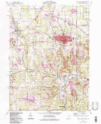 1994 East Palestine1997 Print · USGSThe Ohio-Pennsylvania borderlands near the end of the century reveal a landscape of heavy industry and quiet rural settlements. Researchers can trace the legacy of resource extraction through extensive Strip Mines while locating family roots at St Marys Cem and Mason Rich Cem.
 - 1994 Map of East Liverpool North, 1998 Print
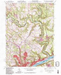 1994 East Liverpool North1998 Print · USGSThe tri-state border region of Ohio, Pennsylvania, and West Virginia is captured here in the late twentieth century as the industrial legacy of the Ohio River meets the protected valley of Little Beaver Creek. Researchers can locate family sites at Riverview Cemetery or trace old routes through Calcutta and Sprucevale.
 - 1994 Map of Weirton, 1998 Print
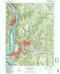 1994 Weirton1998 Print · USGSThe Ohio River valley at the close of the 20th century shows a landscape defined by heavy industry and established riverfront towns. Genealogists and researchers can trace local roots through landmarks like Hollidays Cove, Union Cem, and Roosevelt Sch.
 - 1996 Map of East Liverpool South, 1999 Print
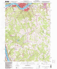 1996 East Liverpool South1999 Print · USGSThe industrial Ohio River valley and West Virginia panhandle are captured in the late 1990s as legacy towns like Newell and Chester face the river. Researchers can trace the region's civic roots through landmarks like the County Childrens Home, Locust Hill Cem, and Tomlinson Run State Park.
 - 1998 Map of Clinton, 2000 Print
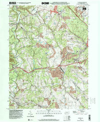 1998 Clinton2000 Print · USGSWestern Pennsylvania at the end of the century reveals a landscape shaped by heavy industry and aviation. Researchers can trace family sites near Hebron Ch, explore the footprint of Imperial, or study the impact of Reclaimed Strip Mines and the Greater Pittsburgh International Airport.
End of results
Showing maps 1-5 of 5
Top cities of Beaver County
- Center Township historical maps
- Aliquippa historical maps
- Beaver Falls historical maps
- Economy historical maps
- Ambridge historical maps
- Monaca historical maps
See more
Frequently asked questions
- What are the different types of historical maps available for Beaver County?
- What is the oldest map of Beaver County?
- Where can I purchase historical maps of Beaver County for my home or office?
- Where can I download high-res historical maps of Beaver County?
- Are there historical topographic maps available for Beaver County?
- Is there historical aerial imagery available for Beaver County?
- Where are historical maps of Beaver County sourced from?