Old Maps of Londonderry Township, Pennsylvania for Hiking & Exploration
Hike through history with 62 historic maps of Londonderry Township. Explore old trails, ghost towns, and forgotten backroads — perfect for outdoor adventurers and local explorers.
- Rediscover forgotten places: Map out old mining camps, roads, and footpaths that no longer exist on modern maps.
- Layer with modern tools: Combine with LiDAR or satellite views to plan hikes through historical terrain.
- Made for exploration: Popular among hikers, overlanders, and local history lovers.
Use these maps to find adventure and explore the hidden past of Londonderry Township.
Londonderry Township, PA maps
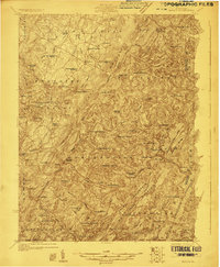
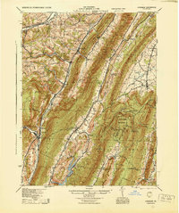
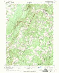
(62)- 1898 Map of Frostburg
 1898 Frostburg1898 Print · USGSMaryland's coal country and the Potomac borderlands are captured here at the height of the Victorian industrial era. Researchers can trace the extensive rail lines and mining infrastructure connecting settlements like Eckhart Mines, Mount Savage, and the historic C & O Canal.
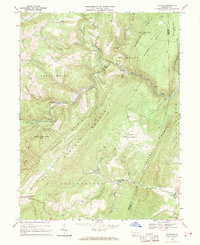
 - 1899 Map of Flintstone
 1899 Flintstone1899 Print · USGSThe Maryland, West Virginia, and Pennsylvania borders converge here during the late nineteenth century as industry follows the river. Genealogists can trace family footprints near Oldtown or locate vanished infrastructure like Patterson Depot and the C. & O. Canal.
 - 1900 Map of Flintstone
 1900 Flintstone1900 Print · USGSThe Maryland and West Virginia border at the close of the nineteenth century centers on the vital Potomac River transportation corridor. Researchers can trace the Chesapeake and Ohio Canal, the B. & O. R. R., and early settlements like Oldtown, Flintstone, and Wolf Mill.6 unique versions available
 - 1901 Map of Frostburg
 1901 Frostburg1901 Print · USGSMaryland's coal country and the critical mountain pass at Cumberland are shown in detail at the turn of the century. Genealogists and industrial historians can locate old mining works at Eckhart Mines, the path of the C. & O. Canal, and the early layout of Frostburg.2 unique versions available
 - 1908 Map of Frostburg
 1908 Frostburg1908 Print · USGSAllegany County mining and rail networks are in full view at the turn of the century. Trace the old coal patches and rail spurs from Eckhart Mines to Borden Shaft, and follow the C & O Canal along the North Branch Potomac River.5 unique versions available
 - 1923 Map of Berlin
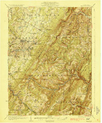
 1923 Berlin1923 Print · USGSSomerset County’s high ridges and deep valleys are documented in the early 1920s as the rail and mining industries shaped the local economy. Genealogists and researchers can locate numerous family-named landmarks and rural hubs, including Butners Mill, Sand Patch, and the Shipley Brothers Mine.3 unique versions available
 - 1927 Map of Hyndman, 1967 Print
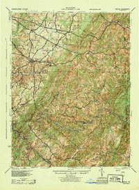
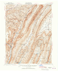 1927 Hyndman1967 Print · USGSThe ridges and valleys of Bedford County appear here at a moment when rural life centered on dozens of mountain schools and the Baltimore and Ohio railroad. Genealogists can trace family footprints at Diehl Cem or locate the sites of St James Ch and the Bedford Valley PO.
 - 1929 Map of Berlin
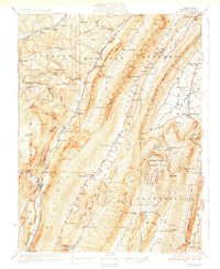
 1929 Berlin1929 Print · USGSSomerset County is shown here in the late twenties, during the peak of the mountain coal and rail era. Genealogists and historians can trace family roots through dozens of rural landmarks like Whiteoak Churches, Salco Mines, and the Falls Cut Tunnel along the B&O line.3 unique versions available
 - 1931 Map of Hyndman
 1931 Hyndman1931 Print · USGSHyndman and the surrounding ridges of Bedford County are captured in the late twenties, showing a landscape of tight mountain gaps and railroad hubs. Researchers can trace family-named schoolhouses like Pender Sch, the old Bedford Valley PO, and the Horseshoe Trail.3 unique versions available
 - 1944 Map of Hyndman
 1944 Hyndman1944 Print · USGSBedford County in the mid-1940s is defined by its strategic mountain gaps and the busy rail corridors of Hyndman and Buffalo Mills. Researchers can trace the early Pennsylvania Turnpike or locate vanished landmarks like Bedford Valley P O and James Ch.
 - 1944 Map of Berlin
 1944 Berlin1944 Print · USGSSomerset County was undergoing a major transformation in the 1940s as the Pennsylvania Turnpike and its Allegheny Tunnel modernised the landscape. Researchers can trace rural family roots at sites like Sandy Hollow Sch, Lebanon Ch, and old operations like the Salco Mines.
 - 1948 Map of Cumberland
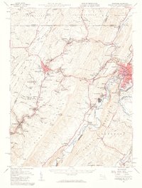
 1948 Cumberland1948 Print · USGSMid-century Appalachia and the Shenandoah Valley are shown in detail, documenting the industrial and transportation hubs of the tri-state area. Genealogists can trace family roots through settlements like Double Tollgate and Bunker Hill or along the Baltimore & Ohio RR.3 unique versions available
 - 1949 Map of Cumberland, 1955 Print
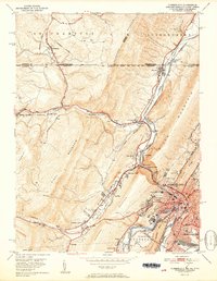
 1949 Cumberland1955 Print · USGSCumberland and the Potomac River valley are shown in detail at mid-century, just as the region's rail and coal infrastructure reached its post-war peak. Local historians can trace the Mason and Dixon Line and locate historic landmarks like Sixmile House and The Narrows.10 unique versions available
 - 1949 Map of Evitts Creek, 1961 Print
 1949 Evitts Creek1961 Print · USGSThe northern edge of Allegany County meets the Mason and Dixon Line in this late-forties survey. Genealogists and local historians can trace rural family sites like Wolfe Mill, Cooks Mills, and the Union Grove Cem nestled between the ridges.3 unique versions available
 - 1950 Map of Frostburg, 1960 Print
 1950 Frostburg1960 Print · USGSMid-century Allegany County is defined here by its intensive coal mining operations and the intricate rail network of the Western Maryland and other lines. Researchers can trace the lineage of vanished mining hamlets and local landmarks like Borden Shaft, Klondike, and the scenic heights of Lovers Leap.3 unique versions available
 - 1951 Map of Cumberland
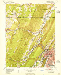
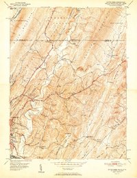
 1951 Cumberland1951 Print · USGSThe industrial and rail hub of Cumberland is captured here at mid-century, where the Potomac River meets a complex web of mountain ridges and state lines. Genealogists and local historians can trace family roots through St Patricks Cem, the streets of Mount Savage, or the historic route of the National Pike.3 unique versions available
 - 1951 Map of Evitts Creek
 1951 Evitts Creek1951 Print · USGSMid-century Cumberland and the surrounding Allegany County ridges are captured here as they appeared just after the war. Researchers can locate family landmarks like Zion Ch, trace the old National Pike, or explore the rail yards of the Western Maryland Railway.2 unique versions available
 - 1951 Map of Frostburg, 1966 Print
 1951 Frostburg1966 Print · USGSThe coal and rail corridor of Maryland's Allegany County comes into focus at mid-century, from the heights of Savage Mountain to the Potomac River. Genealogists and historians can trace industrial roots at Borden Shaft, Lonaconing, and Mount Savage.
 - 1952 Map of Cumberland
 1952 Cumberland1952 Print · USGSThe Potomac Highlands and the Shenandoah Valley are revealed in this early 1950s survey of the Appalachian interior. Researchers can trace the river-and-rail corridors connecting Cumberland, Winchester, and the recreational waters of Deep Creek Lake.
 - 1956 Map of Cumberland, 1966 Print
 1956 Cumberland1966 Print · USGSThe tri-state Highlands in the mid-1950s show a landscape shaped by coal, timber, and the massive presence of the Baltimore & Ohio RR. Researchers can trace the industrial corridor from Cumberland through the Allegheny Mountains to mountain retreats like Deep Creek Lake.6 unique versions available
 - 1957 Map of Cumberland
 1957 Cumberland1957 Print · USGSThe Potomac River valley and the ridges of the Allegheny Front define this mid-century landscape at the intersection of Maryland, West Virginia, and Pennsylvania. Trace the steam-era rail lines of the Baltimore and Ohio RR or locate rural landmarks like St Stephens Church and Stony River Dam.
 - 1961 Map of Cumberland
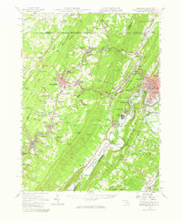
 1961 Cumberland1961 Print · USGSThe tri-state highlands of Maryland, West Virginia, and Pennsylvania are shown in the mid-twentieth century as a complex landscape of ridges and river valleys. Researchers can trace the winding Potomac River and find old rail-and-river towns like Cumberland, Keyser, and Morgantown.
 - 1962 Map of Cumberland
 1962 Cumberland1962 Print · USGSThe central Appalachians meet at the height of the mid-century industrial era, showing the rugged topography between Morgantown and Winchester. Genealogists can trace family lands near Fort Necessity or along the vital Baltimore & Ohio RR corridors.
 - 1967 Map of New Baltimore, 1970 Print
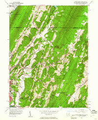
 1967 New Baltimore1970 Print · USGSSomerset County's mountain landscape is captured here in the late sixties, showing the intersection of the Pennsylvania Turnpike and the winding Raystown Branch Juniata River. Genealogists can locate country churches and cemeteries like Sarver Ch and St Johns Cem, or trace old property lines near Glen Savage.3 unique versions available
 - 1967 Map of Fairhope, 1970 Print
 1967 Fairhope1970 Print · USGSSomerset County in the late sixties reveals a landscape of deep valleys and mountain ridges shaped by the Baltimore and Ohio railroad. Genealogists and historians can locate rural landmarks such as Kennells Mill, the Falls Cut Tunnel, and the Covered Bridge near Johnsburg.3 unique versions available
Showing maps 1-25 of 62
Top cities near Londonderry Township
- Cumberland historical maps
- Frostburg historical maps
- La Vale historical maps
- Bedford historical maps
- Napier Township historical maps
- Fairhope Township historical maps
See more
Top neighborhoods of Londonderry Township
- Gravel Pit historical maps
- Madley historical maps
- Fossilville historical maps
- Wills Creek historical maps
- Hoblitzell historical maps
- Stringtown historical maps
See more
Frequently asked questions
- What are the different types of historical maps available for Londonderry Township?
- What is the oldest map of Londonderry Township?
- Where can I purchase historical maps of Londonderry Township for my home or office?
- Where can I download high-res historical maps of Londonderry Township?
- Are there historical topographic maps available for Londonderry Township?
- Is there historical aerial imagery available for Londonderry Township?
- Where are historical maps of Londonderry Township sourced from?