2020s Maps of Londonderry Township, Pennsylvania
Explore 6 historic maps of Londonderry Township from the 2020s. These maps offer a rare glimpse into what life looked like during the 2020s — showing old roads, neighborhoods, homes, and landmarks that have changed or disappeared over time.
Whether you're researching your family's past, planning a metal detecting trip, or studying how Londonderry Township's landscape evolved across the 2020s, these high-resolution maps are a powerful tool for exploring the history of this region.
- Focus on a specific era: All maps on this page are from the 2020s, giving you a focused view of this time period.
- See what’s changed: Compare century-old streets, trails, and buildings to today's modern landscape using overlays and satellite layers.
- Research with precision: Use these maps for genealogy, historical research, land use analysis, or educational projects.
- View, download, or print: Maps are fully viewable online in high resolution, and can be downloaded or printed for your own records.
Start exploring Londonderry Township's history through authentic maps from the 2020s. This is your window into the past.
Londonderry Township, PA maps
(6)- 2023 Map of Fairhope, 2023 Print
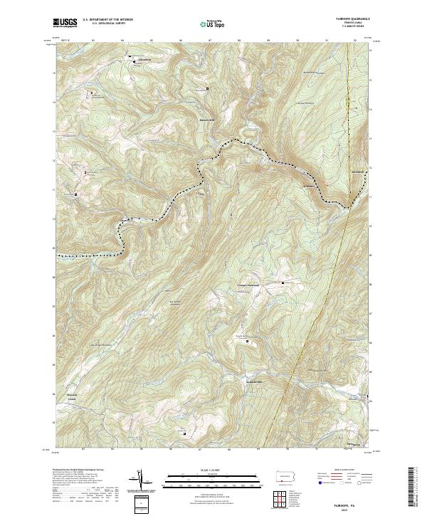 2023 Fairhope2023 Print · USGSThe Allegheny highlands of Somerset County come alive in this map, showing the rural communities and family homesteads of the region. Genealogists can trace deep roots at the Johnsburg Old Cem, Kennells Mill, and the Lepley Family Cem.
 - 2023 Map of Buffalo Mills, 2023 Print
 2023 Buffalo Mills2023 Print · USGSBedford County's ridgeline terrain comes into focus in the early 2020s, showing the historic gaps and hollows of the Appalachian interior. Researchers can locate numerous burial sites like the Wagerman Family Cem and traces of industry at the Gravel Pit.
 - 2023 Map of Hyndman, 2023 Print
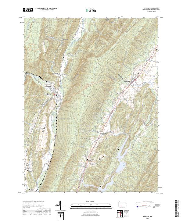 2023 Hyndman2023 Print · USGSThe valleys and ridges of Bedford County are captured here in the early twenty-first century, showing the enduring rural layout of communities like Hyndman and Centerville. Genealogists can locate numerous burial grounds, from the Alto Hilltop Cem to the Union Cem near the Maryland border.
 - 2023 Map of New Baltimore, 2023 Print
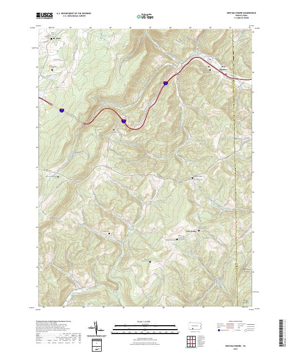 2023 New Baltimore2023 Print · USGSIn the high Allegheny ridges of Somerset and Bedford counties, this modern landscape retains its deep-rooted rural character. Genealogists can trace family heritage through numerous remote sites like Sarver Church Cem, Miller Cem, and the old community at New Baltimore.
 - 2023 Map of Evitts Creek, 2023 Print
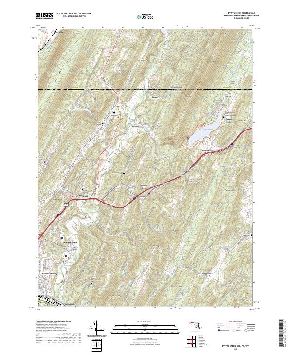 2023 Evitts Creek2023 Print · USGSThe rugged ridge-and-valley landscape east of Cumberland comes into focus in this recent survey. Local historians can trace family roots through sites like the Robinette Family Cem and Wolfe Mill or follow the path of Evitts Creek toward Lake Habeeb.
 - 2023 Map of Cumberland, 2023 Print
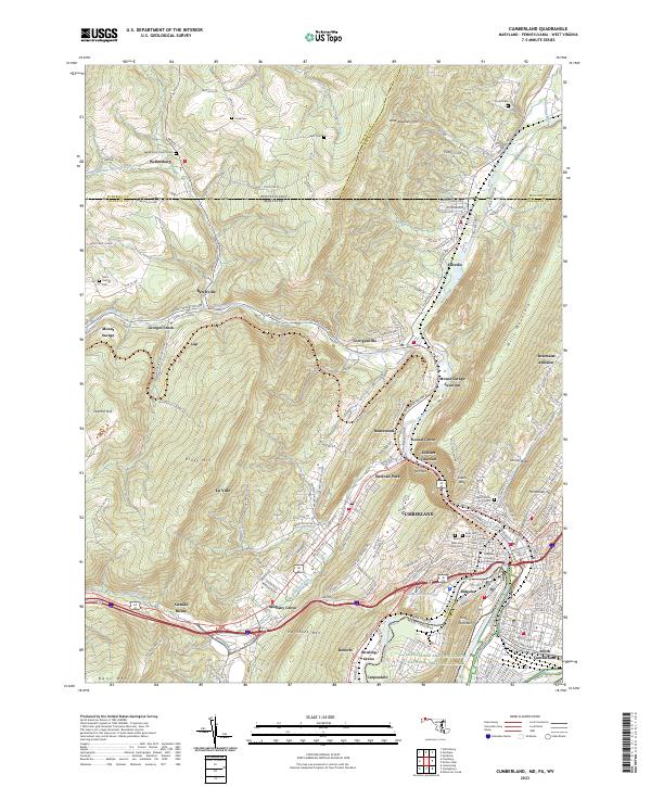 2023 Cumberland2023 Print · USGSCumberland and the Potomac River valley are shown in high detail at the dawn of the 2020s. Genealogists can locate family sites like Wellersburg Church Cem and Sixmile House near the historic passage of The Narrows.
End of results
Showing maps 1-6 of 6
Top cities near Londonderry Township
- Cumberland historical maps
- Frostburg historical maps
- La Vale historical maps
- Bedford historical maps
- Napier Township historical maps
- Fairhope Township historical maps
See more
Top neighborhoods of Londonderry Township
- Gravel Pit historical maps
- Madley historical maps
- Fossilville historical maps
- Wills Creek historical maps
- Hoblitzell historical maps
- Stringtown historical maps
See more
Frequently asked questions
- What are the different types of historical maps available for Londonderry Township?
- What is the oldest map of Londonderry Township?
- Where can I purchase historical maps of Londonderry Township for my home or office?
- Where can I download high-res historical maps of Londonderry Township?
- Are there historical topographic maps available for Londonderry Township?
- Is there historical aerial imagery available for Londonderry Township?
- Where are historical maps of Londonderry Township sourced from?