Old Maps of Bridgeton Township, Pennsylvania for Genealogy
Trace your family roots with 29 historic maps of Bridgeton Township. These high-res maps reveal old neighborhoods, homesites, landmarks, and streets — helping you uncover where your ancestors lived and how the area evolved over time.
- Explore historic neighborhoods: Identify where your relatives may have lived in the 1800s or 1900s.
- Compare maps over time: Trace the changes in streets, buildings, and landmarks for multi-generational research.
- Perfect for genealogy & ancestry research: Used by family historians and researchers to map out lineage and migration.
These maps are an incredible resource for exploring your personal connection to Bridgeton Township's past.
Bridgeton Township, PA maps
(29)- 1890 Map of Easton
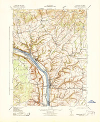
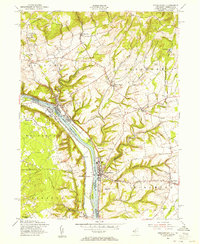
 1890 Easton1890 Print · USGSThe Delaware River valley thrived as a transport hub during the 1890s, where three major canals and multiple railroads met at the Pennsylvania-New Jersey border. Genealogists and industrial historians can trace the paths of the Morris Canal, the works at Durham Furnace, and the strategic Musconetcong Tunnel.
 - 1891 Map of Easton
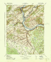
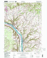
 1891 Easton1891 Print · USGSThe Delaware River valley thrived as a corridor of heavy industry and transit in the 1890s. Trace the path of historic waterways and early rail lines, including the Morris Canal, the ironworks at Durham Furnace, and rural crossroads like Still Valley.8 unique versions available
 - 1932 Map of Easton
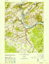
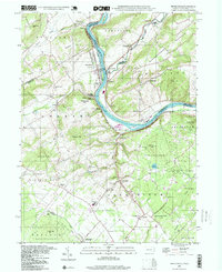
 1932 Easton1932 Print · USGSThe Delaware River valley thrived as a corridor of industry and transport in the early 1930s, bridging Pennsylvania and New Jersey. Genealogists and historians can trace the legacy of early industry along the Morris Canal or locate local landmarks like St Josephs Ch and Mine Hill.5 unique versions available
 - 1943 Map of Frenchtown
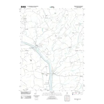
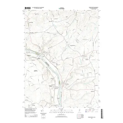
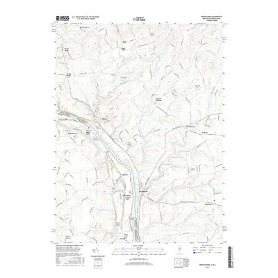
 1943 Frenchtown1943 Print · USGSThe Delaware River valley thrived as a rail and industrial corridor in the early 1940s. Genealogists can trace local roots through numerous landmarks like Frenchtown High School, Alexandria Cemetery, and Baptistown School.
 - 1943 Map of Bethlehem
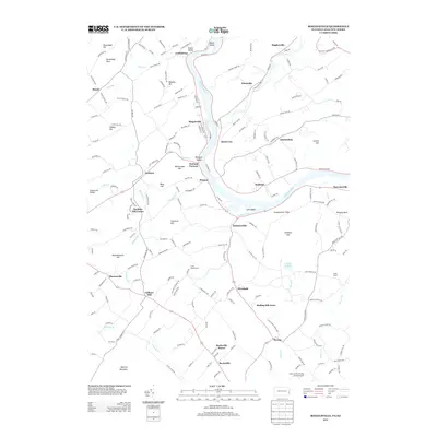
 1943 Bethlehem1943 Print · USGSNorthampton and Lehigh counties hummed with industry and river commerce during the early war years. Researchers can trace the path of the Lehigh Valley RR, locate family-named landmarks like Chief Tatamy, and find rural schools such as Mexico School and Poplar Valley Sch.
 - 1943 Map of Riegelsville
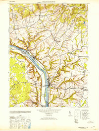
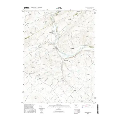
 1943 Riegelsville1943 Print · USGSThe Delaware River corridor comes alive in the early 1940s, highlighting the industrial and transport ties between eastern Pennsylvania and New Jersey. Genealogists and historians can trace the foundations of local industry at Durham Furnace or locate family roots near Durham Union Church and the Finesville School.
 - 1944 Map of Newark, 1971 Print
 1944 Newark1971 Print · USGSThe industrial corridor from Philadelphia to New York was in a period of massive transition during the mid-forties. Genealogists and researchers can trace the rail lines of the Lehigh Valley RR, locate military installations like Picatinny Arsenal, and explore the early sprawl near Levittown.5 unique versions available
 - 1949 Map of Newark
 1949 Newark1949 Print · USGSThe industrial corridor between Philadelphia and New York comes alive in this post-war survey. Genealogists and historians can trace the massive rail networks of the Reading Railroad and locate major installations like Fort Dix or Picatinny Arsenal.2 unique versions available
 - 1953 Map of Riegelsville
 1953 Riegelsville1953 Print · USGSThe Delaware River valley straddles the Pennsylvania and New Jersey border in the early fifties, showcasing a landscape of industrial river towns and upland farms. Genealogists can locate family landmarks from Durham Furnace to Riegelsville, including St Lukes Church and the Stouts School.2 unique versions available
 - 1953 Map of Frenchtown
 1953 Frenchtown1953 Print · USGSThe Delaware River valley thrived mid-century with active rail lines and riverside industry connecting New Jersey and Pennsylvania communities. Genealogists can trace family roots through several rural schoolhouses and landmarks like Alexandria Cemetery, Lodge Hall, and Milford.
 - 1955 Map of Frenchtown, 1956 Print
 1955 Frenchtown1956 Print · USGSThe Delaware River valley thrived as a corridor for rail and commerce in the mid-1950s, bridging New Jersey and Pennsylvania communities. Researchers can trace family roots through riverside settlements like Frenchtown and Milford, or locate rural landmarks such as Milford Union Ch and Alexandria Cem.5 unique versions available
 - 1956 Map of Newark
 1956 Newark1956 Print · USGSThe industrial heart of the Mid-Atlantic is captured here at the dawn of the highway era, tracing the dense corridors between Newark and Philadelphia. Genealogists and local historians can map the rail networks of the Reading RR or locate mid-century military life at Fort Dix Military Reservation.2 unique versions available
 - 1956 Map of Riegelsville, 1958 Print
 1956 Riegelsville1958 Print · USGSThe Delaware River valley in the mid-fifties reveals a landscape of ridge-top farms and industrial remnants near the New Jersey border. Researchers can locate family landmarks like the Durham Union Church, Township School, and the site of the Durham Furnace.6 unique versions available
 - 1957 Map of Newark
 1957 Newark1957 Print · USGSThe industrial and military heart of the Mid-Atlantic is mapped during its post-war suburban boom. Genealogists and historians can trace the intricate rail corridors of the Reading Railroad and locate key landmarks from Princeton University to Fort Hancock.
 - 1960 Map of Newark
 1960 Newark1960 Print · USGSThe industrial heart of the Mid-Atlantic is shown at mid-century, stretching from the dense urban centers of Newark and Philadelphia to the Blue Mountain ridges. Researchers can trace historic rail lines, coastal defenses at Fort Hancock, and the riverfront growth of Trenton and Easton.3 unique versions available
 - 1964 Map of Newark
 1964 Newark1964 Print · USGSGreater New Jersey and eastern Pennsylvania appear at the peak of their industrial and rail-centered development in the mid-sixties. Genealogists and historians can trace the paths of the Pennsylvania RR, identify mid-century landmarks like CAMP KILMER, or follow the Schuylkill River through READING.2 unique versions available
 - 1984 Map of Allentown, 1985 Print
 1984 Allentown1985 Print · USGSThe Lehigh Valley and southern Poconos are captured in the mid-eighties as industry and academic life converge along the river corridor. Trace the rail-and-water networks connecting Jim Thorpe and Bethlehem, or explore landmarks like Lehigh University and the Delaware Water Gap.3 unique versions available
 - 1997 Map of Frenchtown, 1999 Print
 1997 Frenchtown1999 Print · USGSThe Delaware River valley at the close of the twentieth century remains a landscape of historic river towns and steep ridge-lines. Genealogists and hikers can trace the geography of Frenchtown, Upper Black Eddy, and the upland Alexandria Cem.
 - 1997 Map of Riegelsville, 1999 Print
 1997 Riegelsville1999 Print · USGSThe Delaware River valley at the turn of the millennium shows a landscape defined by historic industrial sites and riverside settlements. Researchers can trace local genealogy and land use through landmarks like Durham Furnace, Union Cem, and the Durham Sch.
 - 2011 Map of Riegelsville, 2011 Print
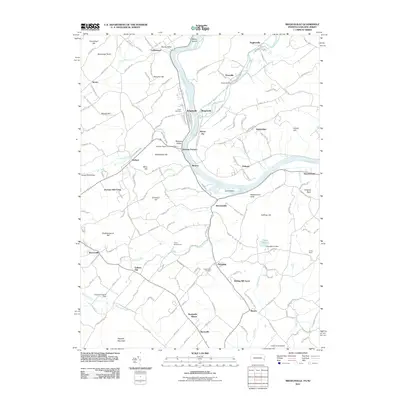 2011 Riegelsville2011 Print · USGSCovers Bridgeton Township, including Holland Township, Tinicum Township, and other nearby areas
 - 2011 Map of Frenchtown, 2011 Print
 2011 Frenchtown2011 Print · USGSCovers Bridgeton Township, including Union, Holland Township, and other nearby areas
 - 2013 Map of Riegelsville, 2013 Print
 2013 Riegelsville2013 Print · USGSCovers Bridgeton Township, including Holland Township, Tinicum Township, and other nearby areas
 - 2014 Map of Frenchtown, 2014 Print
 2014 Frenchtown2014 Print · USGSCovers Bridgeton Township, including Union, Holland Township, and other nearby areas
 - 2016 Map of Riegelsville, 2016 Print
 2016 Riegelsville2016 Print · USGSCovers Bridgeton Township, including Holland Township, Tinicum Township, and other nearby areas
 - 2016 Map of Frenchtown, 2016 Print
 2016 Frenchtown2016 Print · USGSCovers Bridgeton Township, including Union, Holland Township, and other nearby areas
Showing maps 1-25 of 29
Top cities near Bridgeton Township
- Bethlehem historical maps
- Easton historical maps
- Raritan Township historical maps
- Buckingham Township historical maps
- Hopewell Township historical maps
- Phillipsburg historical maps
See more
Top neighborhoods of Bridgeton Township
- Chestnut Ridge Acres historical maps
- Upper Black Eddy historical maps
- Narrowsville historical maps
- Yocum Estates historical maps
- Ruppletown historical maps
- Golden Acres Estates historical maps
Frequently asked questions
- What are the different types of historical maps available for Bridgeton Township?
- What is the oldest map of Bridgeton Township?
- Where can I purchase historical maps of Bridgeton Township for my home or office?
- Where can I download high-res historical maps of Bridgeton Township?
- Are there historical topographic maps available for Bridgeton Township?
- Is there historical aerial imagery available for Bridgeton Township?
- Where are historical maps of Bridgeton Township sourced from?