1960s Maps of Cambria County, Pennsylvania
Explore 20 historic maps of Cambria County from the 1960s. These maps offer a rare glimpse into what life looked like during the 1960s — showing old roads, neighborhoods, homes, and landmarks that have changed or disappeared over time.
Whether you're researching your family's past, planning a metal detecting trip, or studying how Cambria County's landscape evolved across the 1960s, these high-resolution maps are a powerful tool for exploring the history of this region.
- Focus on a specific era: All maps on this page are from the 1960s, giving you a focused view of this time period.
- See what’s changed: Compare century-old streets, trails, and buildings to today's modern landscape using overlays and satellite layers.
- Research with precision: Use these maps for genealogy, historical research, land use analysis, or educational projects.
- View, download, or print: Maps are fully viewable online in high resolution, and can be downloaded or printed for your own records.
Start exploring Cambria County's history through authentic maps from the 1960s. This is your window into the past.
Cambria County, PA maps
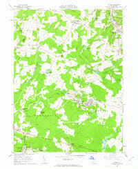
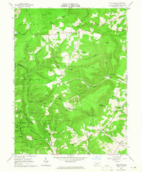
(20)- 1961 Map of Carrolltown, 1963 Print
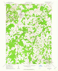 1961 Carrolltown1963 Print · USGSCambria County in the early sixties reveals a landscape of devout Catholic institutions and coal industry. Genealogists can trace family roots through Carrolltown and Loretto, locating landmarks like St Francis College and Eckenrode Mill.2 unique versions available
 - 1961 Map of Hastings, 1963 Print
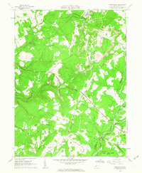
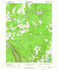
 1961 Hastings1963 Print · USGSCambria County during the early 1960s shows a landscape shaped by coal mining and a dense network of small communities. Researchers can trace the industrial heritage of Hastings and Patton, locate family plots at St Bernard Cem, or find the St Lawrence Lookout Tower.5 unique versions available
 - 1961 Map of Coalport, 1963 Print
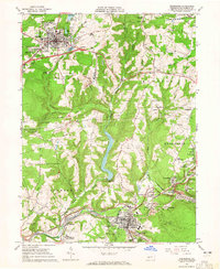
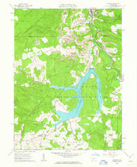 1961 Coalport1963 Print · USGSThe northern edge of the Allegheny Plateau comes into focus in the early sixties as industrial coal operations sit alongside a newly formed Glendale Lake. Trace the local rail-and-river economy through Coalport, Flinton, and numerous Strip Mines.7 unique versions available
 - 1961 Map of Barnesboro, 1963 Print
 1961 Barnesboro1963 Print · USGSIn the early 1960s, the mining communities of Cambria and Indiana counties were at their peak along the West Branch Susquehanna River. Genealogists can trace family roots through numerous sites like St Marys Cem, McDowell Cem, and the small settlement of Moss Creek.6 unique versions available
 - 1961 Map of Colver, 1963 Print
 1961 Colver1963 Print · USGSCambria County coal country is captured here during the early sixties, centered on the company-built hub of Colver. Genealogists and local historians can trace family locations near Nine Row, find rural landmarks like St Nicholas Sch, or locate burials at Colver Cem.4 unique versions available
 - 1961 Map of Strongstown, 1963 Print
 1961 Strongstown1963 Print · USGSIndiana County and the Cambria County border appear here during the early sixties, a landscape where coal mining and timbering met traditional farming. Researchers can trace the Cherry Tree and Dixonville Railroad or locate local landmarks like Ewings Mill and Barkley Ch.4 unique versions available
 - 1961 Map of Ashville, 1963 Print
 1961 Ashville1963 Print · USGSThe Allegheny Front in the early sixties was a landscape defined by the Pennsylvania Railroad and the coal mining industry. Genealogists and local historians can trace family roots through the clusters of churches and cemeteries at Ashville, Spindley City, and Coupon.3 unique versions available
 - 1963 Map of Tipton, 1965 Print
 1963 Tipton1965 Print · USGSThe Little Juniata River valley near Tyrone was a bustling transit corridor in the early 1960s. Researchers can trace the Pennsylvania railroad line through Grazierville and Tipton, or locate historic sites like the Fox Cem and a Covered Bridge.3 unique versions available
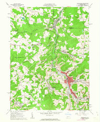
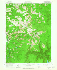
 - 1963 Map of Ebensburg, 1965 Print
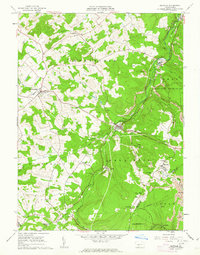
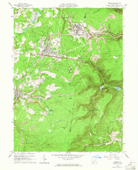
 1963 Ebensburg1965 Print · USGSEbensburg and the surrounding coal towns of Cambria County are captured in the early sixties during a period of industrial transition. Researchers can trace family roots through numerous local churches and cemeteries, or locate defunct industrial sites like Miller Shaft and Plane Bank along the PENNSYLVANIA railroad.5 unique versions available
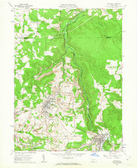
 - 1963 Map of Cresson, 1965 Print
 1963 Cresson1965 Print · USGSThe Allegheny Front was a beehive of coal mining and rail engineering in the early sixties. Genealogists and historians can trace family roots at St Aloysius Ch, locate the grounds of the Lawrence Flick State Hospital, or follow the Pennsylvania railroad tracks through Tunnel Hill.6 unique versions available
 - 1963 Map of Beaverdale, 1965 Print
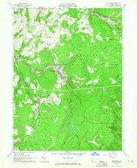 1963 Beaverdale1965 Print · USGSCoal mining and rail transport shaped these Cambria County valleys in the early 1960s. Researchers can trace family ties at Sherbine Cem, locate the old Buckhorn Grange, or study the footprint of towns like Beaverdale and Dunlo during their industrial peak.4 unique versions available
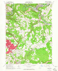
 - 1963 Map of Altoona, 1965 Print
 1963 Altoona1965 Print · USGSAltoona and its mountain suburbs are captured here in the early sixties, showing the city's transition from a rail industrial center to a regional academic and civic hub. Researchers can trace family roots through numerous parish schools and cemeteries or locate defunct mountain settlements like Wopsononock and Highland Fling.6 unique versions available
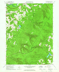
 - 1963 Map of Blue Knob, 1965 Print
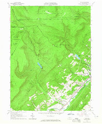
 1963 Blue Knob1965 Print · USGSThe high ridges of the Allegheny Front come into sharp focus in the early sixties as recreational spaces like Blue Knob State Park expand alongside traditional mountain settlements. Genealogists can trace family landmarks like Stiefler Corner and the Lost Cox Children Monument among the hollows of Bobs Creek.4 unique versions available
 - 1963 Map of Blandburg, 1965 Print
 1963 Blandburg1965 Print · USGSThe coal and rail landscape of the Allegheny Front comes to life in the early 1960s, showing the intersection of industry and rural life. Trace family roots at Roseland Ch and Cambria Mills Cem, or locate mining heritage through the Tipple and Strip Mines near Blandburg.4 unique versions available
 - 1964 Map of Pittsburgh
 1964 Pittsburgh1964 Print · USGSWestern Pennsylvania in the late fifties and early sixties shows a landscape of powerful river industries and expanding highways. Genealogists and historians can trace the rail corridors of the Pennsylvania RR through industrial hubs like Johnstown, Altoona, and Nanty Glo.
 - 1964 Map of Geistown, 1965 Print
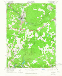
 1964 Geistown1965 Print · USGSCambria County in the mid-sixties reveals an industrial landscape defined by river-valley mining and growing suburban centers. Genealogists can trace family names through local landmarks like St Anthony Cem, Sidman (Lovett Sta), and Locust Grove Ch.5 unique versions available
 - 1964 Map of Rachelwood, 1966 Print
 1964 Rachelwood1966 Print · USGSLaurel Ridge and the Conemaugh River define this Pennsylvania mountain landscape during the early sixties. Researchers can trace family sites and local landmarks like Legat Cem, the historic Baldwin Furnace, and Ross Mountain Park.3 unique versions available
 - 1964 Map of Vintondale, 1966 Print
 1964 Vintondale1966 Print · USGSCambria and Indiana counties were defined by the coal and rail industries during the early sixties. Genealogists can trace family roots through the settlements of Vintondale and Dilltown, or locate landmarks like the Delano Sch and Wehrum Mine Dump.3 unique versions available
 - 1964 Map of Nanty Glo, 1966 Print
 1964 Nanty Glo1966 Print · USGSCambria County's industrial heart is captured in the mid-1960s, showing the intersection of mining, rail, and community life. Genealogists and historians can locate family landmarks like St Marys Cem and trace the paths of the Pennsylvania Railroad through Nanty Glo and Summerhill.4 unique versions available
 - 1964 Map of Johnstown, 1966 Print
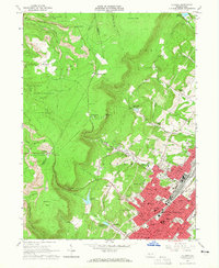
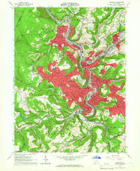 1964 Johnstown1966 Print · USGSThe Conemaugh River valley is captured in the mid-1960s as a dense industrial and rail hub. Genealogists can trace family roots through neighborhood landmarks like Grandview Cemetery, St Nicholas Ch, and the many schools of Westmont and Southmont.6 unique versions available
End of results
Showing maps 1-20 of 20
Top cities of Cambria County
- Johnstown historical maps
- Franklin historical maps
- Westmont historical maps
- Northern Cambria historical maps
- Ebensburg historical maps
- Stonycreek Township historical maps
See more
Frequently asked questions
- What are the different types of historical maps available for Cambria County?
- What is the oldest map of Cambria County?
- Where can I purchase historical maps of Cambria County for my home or office?
- Where can I download high-res historical maps of Cambria County?
- Are there historical topographic maps available for Cambria County?
- Is there historical aerial imagery available for Cambria County?
- Where are historical maps of Cambria County sourced from?