1900s (20th Century) Maps of Blacklick Township, Pennsylvania
Explore 17 historic maps of Blacklick Township from the 1900s (20th Century). These maps offer a rare glimpse into what life looked like during the 1900s — showing old roads, neighborhoods, homes, and landmarks that have changed or disappeared over time.
Whether you're researching your family's past, planning a metal detecting trip, or studying how Blacklick Township's landscape evolved across the 1900s, these high-resolution maps are a powerful tool for exploring the history of this region.
- Focus on a specific era: All maps on this page are from the 1900s, giving you a focused view of this time period.
- See what’s changed: Compare century-old streets, trails, and buildings to today's modern landscape using overlays and satellite layers.
- Research with precision: Use these maps for genealogy, historical research, land use analysis, or educational projects.
- View, download, or print: Maps are fully viewable online in high resolution, and can be downloaded or printed for your own records.
Start exploring Blacklick Township's history through authentic maps from the 1900s. This is your window into the past.
Blacklick Township, PA maps
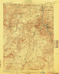
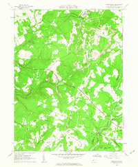
(17)- 1902 Map of Barnesboro, 1956 Print
 1902 Barnesboro1956 Print · USGSCovers Blacklick Township, including Northern Cambria, Rayne Township, and other nearby areas
 - 1904 Map of Barnesboro
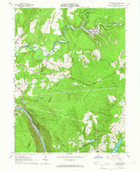
 1904 Barnesboro1904 Print · USGSCovers Blacklick Township, including Northern Cambria, Rayne Township, and other nearby areas5 unique versions available
 - 1904 Map of Johnstown, 1954 Print
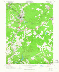
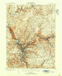 1904 Johnstown1954 Print · USGSCovers Blacklick Township, including Johnstown, Franklin, and other nearby areas2 unique versions available
 - 1907 Map of Johnstown
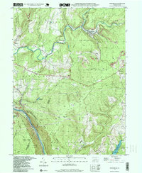
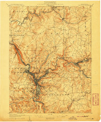 1907 Johnstown1907 Print · USGSCovers Blacklick Township, including Johnstown, Franklin, and other nearby areas6 unique versions available
 - 1943 Map of Punxsutawney
 1943 Punxsutawney1943 Print · USGSCovers Blacklick Township, including Punxsutawney, Northern Cambria, and other nearby areas
 - 1953 Map of Pittsburgh
 1953 Pittsburgh1953 Print · USGSCovers Blacklick Township, including Pittsburgh, Penn Hills, and other nearby areas
 - 1954 Map of Pittsburgh
 1954 Pittsburgh1954 Print · USGSCovers Blacklick Township, including Pittsburgh, Penn Hills, and other nearby areas2 unique versions available
 - 1958 Map of Pittsburgh
 1958 Pittsburgh1958 Print · USGSCovers Blacklick Township, including Pittsburgh, Penn Hills, and other nearby areas5 unique versions available
 - 1959 Map of Pittsburgh
 1959 Pittsburgh1959 Print · USGSCovers Blacklick Township, including Pittsburgh, Penn Hills, and other nearby areas
 - 1961 Map of Colver, 1963 Print
 1961 Colver1963 Print · USGSCovers Blacklick Township, including East Carroll Township, Cambria Township, and other nearby areas4 unique versions available
 - 1961 Map of Strongstown, 1963 Print
 1961 Strongstown1963 Print · USGSCovers Blacklick Township, including Brush Valley Township, Ewings Mill, and other nearby areas4 unique versions available
 - 1964 Map of Pittsburgh
 1964 Pittsburgh1964 Print · USGSCovers Blacklick Township, including Pittsburgh, Penn Hills, and other nearby areas
 - 1964 Map of Vintondale, 1966 Print
 1964 Vintondale1966 Print · USGSCovers Blacklick Township, including Vintondale, Middle Taylor Township, and other nearby areas3 unique versions available
 - 1964 Map of Nanty Glo, 1966 Print
 1964 Nanty Glo1966 Print · USGSCovers Blacklick Township, including Nanty Glo, Summerhill, and other nearby areas4 unique versions available
 - 1981 Map of Johnstown, 1983 Print
 1981 Johnstown1983 Print · USGSCovers Blacklick Township, including Altoona, Johnstown, and other nearby areas
 - 1984 Map of Tyrone, 1985 Print
 1984 Tyrone1985 Print · USGSCovers Blacklick Township, including Altoona, Frankstown Township, and other nearby areas
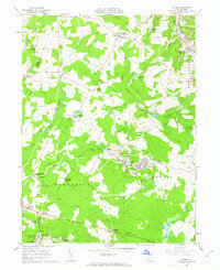
 - 1998 Map of Vintondale, 1999 Print
 1998 Vintondale1999 Print · USGSCovers Blacklick Township, including Vintondale, Middle Taylor Township, and other nearby areas
End of results
Showing maps 1-17 of 17
Top cities near Blacklick Township
- Johnstown historical maps
- Franklin historical maps
- Westmont historical maps
- Northern Cambria historical maps
- Rayne Township historical maps
- Ebensburg historical maps
See more
Top neighborhoods of Blacklick Township
- Charlies Grove historical maps
- Red Mill historical maps
- Twin Rocks historical maps
- Cardiff historical maps
- Belsano historical maps
- Belsano Crossing historical maps
See more
Frequently asked questions
- What are the different types of historical maps available for Blacklick Township?
- What is the oldest map of Blacklick Township?
- Where can I purchase historical maps of Blacklick Township for my home or office?
- Where can I download high-res historical maps of Blacklick Township?
- Are there historical topographic maps available for Blacklick Township?
- Is there historical aerial imagery available for Blacklick Township?
- Where are historical maps of Blacklick Township sourced from?