1940s Maps of First Fork, Grove Township
Explore 3 historic maps of First Fork from the 1940s. These maps offer a rare glimpse into what life looked like during the 1940s — showing old roads, neighborhoods, homes, and landmarks that have changed or disappeared over time.
Whether you're researching your family's past, planning a metal detecting trip, or studying how First Fork's landscape evolved across the 1940s, these high-resolution maps are a powerful tool for exploring the history of this region.
- Focus on a specific era: All maps on this page are from the 1940s, giving you a focused view of this time period.
- See what’s changed: Compare century-old streets, trails, and buildings to today's modern landscape using overlays and satellite layers.
- Research with precision: Use these maps for genealogy, historical research, land use analysis, or educational projects.
- View, download, or print: Maps are fully viewable online in high resolution, and can be downloaded or printed for your own records.
Start exploring First Fork's history through authentic maps from the 1940s. This is your window into the past.
First Fork, Grove Township maps
(3)- 1945 Map of Driftwood, 1953 Print
 1945 Driftwood1953 Print · USGSCameron County communities thrive along the river bends and rail lines at the end of World War II. Researchers can trace the dual rail paths of the Pennsylvania and Baltimore and Ohio railroads through Driftwood and locate the First Fork Sch.4 unique versions available
 - 1945 Map of First Fork, 1954 Print
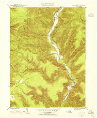 1945 First Fork1954 Print · USGSThe deep valleys of Cameron and Potter counties appear here in the mid-1940s, centered on the First Fork Sinnemahoning Creek corridor. Local researchers can locate the First Fork School, Gilmore Cem, and early ridge-top routes like Square Timber Road.3 unique versions available
 - 1947 Map of First Fork
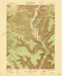 1947 First Fork1947 Print · USGSNorth-central Pennsylvania's mountain valleys are captured here in the mid-1940s, as small settlements and logging-era roads traced the winding First Fork Sinnemahoning Creek. Genealogists can locate the First Fork Sch and family burial sites like Smith Cem and Gilmore Cem.2 unique versions available
End of results
Showing maps 1-3 of 3
Top cities near First Fork
- Emporium historical maps
- Liberty Township historical maps
- Norwich Township historical maps
- Austin historical maps
- Leidy Township historical maps
- Abbott Township historical maps
See more
Frequently asked questions
- What are the different types of historical maps available for First Fork?
- What is the oldest map of First Fork?
- Where can I purchase historical maps of First Fork for my home or office?
- Where can I download high-res historical maps of First Fork?
- Are there historical topographic maps available for First Fork?
- Is there historical aerial imagery available for First Fork?
- Where are historical maps of First Fork sourced from?