2020s Maps of Shippen Township, Pennsylvania
Explore 6 historic maps of Shippen Township from the 2020s. These maps offer a rare glimpse into what life looked like during the 2020s — showing old roads, neighborhoods, homes, and landmarks that have changed or disappeared over time.
Whether you're researching your family's past, planning a metal detecting trip, or studying how Shippen Township's landscape evolved across the 2020s, these high-resolution maps are a powerful tool for exploring the history of this region.
- Focus on a specific era: All maps on this page are from the 2020s, giving you a focused view of this time period.
- See what’s changed: Compare century-old streets, trails, and buildings to today's modern landscape using overlays and satellite layers.
- Research with precision: Use these maps for genealogy, historical research, land use analysis, or educational projects.
- View, download, or print: Maps are fully viewable online in high resolution, and can be downloaded or printed for your own records.
Start exploring Shippen Township's history through authentic maps from the 2020s. This is your window into the past.
Shippen Township, PA maps
(6)- 2023 Map of Cameron, 2023 Print
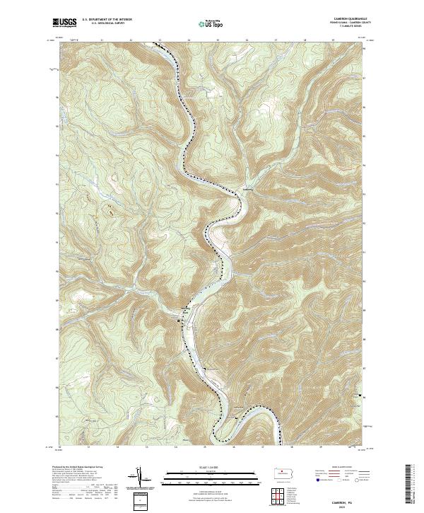 2023 Cameron2023 Print · USGSThe Driftwood Branch Sinnemahoning Creek valley near Sterling Run is shown here in the 2020s. Genealogists and hikers can trace family burial sites at Sterling Run Cem or explore the Bucktail Path Trl and Elk State Forest Snowmobile Trails Trl.
 - 2023 Map of Emporium, 2023 Print
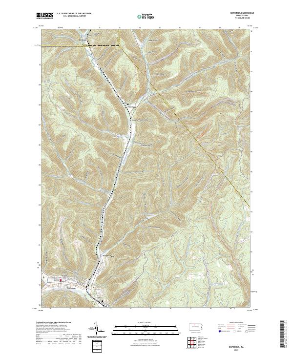 2023 Emporium2023 Print · USGSEmporium and the upper Sinnemahoning valley are shown here in the contemporary era, illustrating the deep-cut hollows of the Pennsylvania Wilds. Genealogists can locate family sites at Newton Cem and Portage Township Cem or trace the early paths of Gardeau.
 - 2023 Map of West Creek, 2023 Print
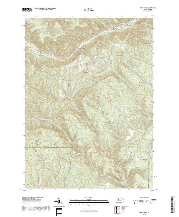 2023 West Creek2023 Print · USGSCameron and Elk counties meet in this 2020s survey of the Pennsylvania Wilds, a landscape defined by deep hollows and remote ridges. Genealogists can trace family names at Morrison Cem or Moore Hill Cem and explore the legacy of Howard Siding and Truman.
 - 2023 Map of Rich Valley, 2023 Print
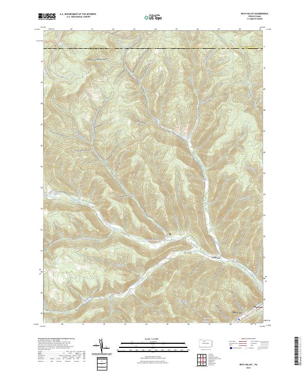 2023 Rich Valley2023 Print · USGSRich Valley and the surrounding Cameron County hollows are shown in detail as they appeared recently. Genealogists and hikers can trace local landmarks like Rich Valley Cem, the small hamlet of Lockwood, and the West Creek Recreational Trail near Emporium.
 - 2023 Map of Wildwood Fire Tower, 2023 Print
 2023 Wildwood Fire Tower2023 Print · USGSThe Elk and Cameron County borderlands appear here in the 2020s, showing a terrain defined by deep hollows and high ridges. Trace family history and land use through St. Marys, the remote settlement of Straight Creek, and landmarks like Jarrets Summit.
 - 2023 Map of Rathbun, 2023 Print
 2023 Rathbun2023 Print · USGSThe borderlands of Elk and Cameron counties come into focus in the 2020s, showing the deep valley of West Creek. Trace local history through the Market Cem and the small settlements of Rathbun, Beechwood, and Swissmont.
End of results
Showing maps 1-6 of 6
Top cities near Shippen Township
- Saint Marys historical maps
- Emporium historical maps
- Liberty Township historical maps
- Roulette Township historical maps
- Norwich Township historical maps
- Austin historical maps
See more
Top neighborhoods of Shippen Township
- Weber City historical maps
- Prospect Park historical maps
- Lawn View historical maps
- Lockwood historical maps
- Rich Valley historical maps
- Beechwood historical maps
See more
Frequently asked questions
- What are the different types of historical maps available for Shippen Township?
- What is the oldest map of Shippen Township?
- Where can I purchase historical maps of Shippen Township for my home or office?
- Where can I download high-res historical maps of Shippen Township?
- Are there historical topographic maps available for Shippen Township?
- Is there historical aerial imagery available for Shippen Township?
- Where are historical maps of Shippen Township sourced from?