Old Maps of West Creek, Shippen Township for Metal Detecting
Plan your next treasure hunt with 13 historic maps of West Creek. Find old homesites, ghost towns, trails, and gathering spots that may be lost to time — perfect for identifying promising metal detecting locations.
- Locate forgotten sites: Uncover places like long-lost settlements, abandoned rail lines, or gathering spots.
- Plan better hunts: Use map overlays combined with LiDAR or satellite views to narrow in on historically rich areas.
- Made for detectorists: Thousands of hobbyists use these maps to discover relics, coins, and hidden history.
Use these historic maps to boost your research and find new opportunities beneath the surface of West Creek.
West Creek, Shippen Township maps
(13)- 1941 Map of Benezette, 1952 Print
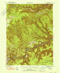 1941 Benezette1952 Print · USGSElk County at the start of the 1940s reveals a network of valley settlements defined by the Pennsylvania RR and Sinnemahoning Creek. Researchers can trace rural life through scattered landmarks like Mt Zion Ch, Rathbun Sch, and the high point at Winslow Hill.3 unique versions available
 - 1943 Map of Benezette
 1943 Benezette1943 Print · USGSElk and Cameron counties are captured during the early 1940s, showing a landscape of deep timber-run hollows and active rail corridors. Local historians can locate vanished schoolhouses like Rathbun Sch, mountain churches such as Mt Zion Ch, and the winding tracks of the Pennsylvania railroad.2 unique versions available
 - 1957 Map of Warren, 1964 Print
 1957 Warren1964 Print · USGSThe northern Pennsylvania oil and timber country comes into focus in the mid-fifties, showing the region before modern highway expansions. Trace the industrial rail networks of the Pennsylvania RR and the early Allegheny River Reservoir near Warren and Oil City.4 unique versions available
 - 1958 Map of Warren
 1958 Warren1958 Print · USGSNorthern Pennsylvania’s timber and oil country is captured here during the late fifties, showing the interplay of industrial valleys and vast state forests. Genealogists can trace family connections across the Cornplanter Indian Reservation or through rail hubs like Oil City and Saint Marys.
 - 1959 Map of Warren
 1959 Warren1959 Print · USGSNorthern Pennsylvania's oil and timber country comes alive in this late-fifties study of the forest-clad plateaus. Trace the historic Cornplanter (Indian Reservation), the sprawling Oil Field, and the rail lines of the Pennsylvania RR.2 unique versions available
 - 1969 Map of West Creek, 1972 Print
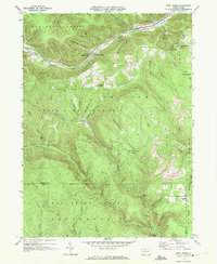 1969 West Creek1972 Print · USGSCameron and Elk Counties appear here in the late sixties, showing a landscape defined by deep-woods industry and the Penn Central railroad. Trace old property lines near Truman, survey Strip Mines on the ridge, and find sites like Whippoorwill Camp.3 unique versions available
 - 1971 Map of Warren
 1971 Warren1971 Print · USGSNorth Central Pennsylvania is captured here in the early seventies, showing a landscape defined by industrial centers and massive state forests. Genealogists and historians can trace the rail lines of the Penn Central and Erie Lackawanna connecting towns like Warren, Kane, and Du Bois.
 - 1983 Map of Clearfield, 1984 Print
 1983 Clearfield1984 Print · USGSPennsylvania's coal and timber heartland is captured in the early eighties as industrial hubs like Du Bois and Saint Marys thrived among the state forests. Genealogists can locate family landmarks like Morningside Cemetery, the old works at Dagus Mines, and the rural community of Byrnedale.
 - 2010 Map of West Creek, 2010 Print
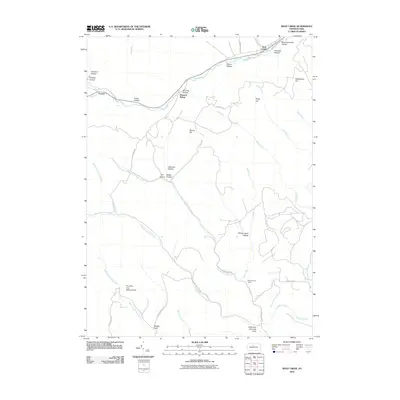 2010 West Creek2010 Print · USGSCovers West Creek, including Benezette Township, Gibson Township, and other nearby areas
 - 2013 Map of West Creek, 2013 Print
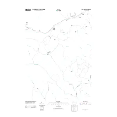 2013 West Creek2013 Print · USGSCovers West Creek, including Benezette Township, Gibson Township, and other nearby areas
 - 2016 Map of West Creek, 2016 Print
 2016 West Creek2016 Print · USGSCovers West Creek, including Benezette Township, Gibson Township, and other nearby areas
 - 2019 Map of West Creek, 2019 Print
 2019 West Creek2019 Print · USGSCovers West Creek, including Benezette Township, Gibson Township, and other nearby areas
 - 2023 Map of West Creek, 2023 Print
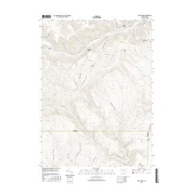
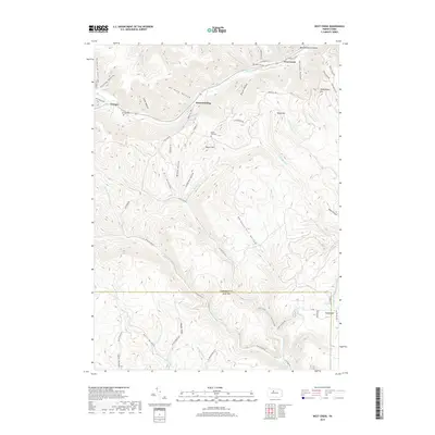
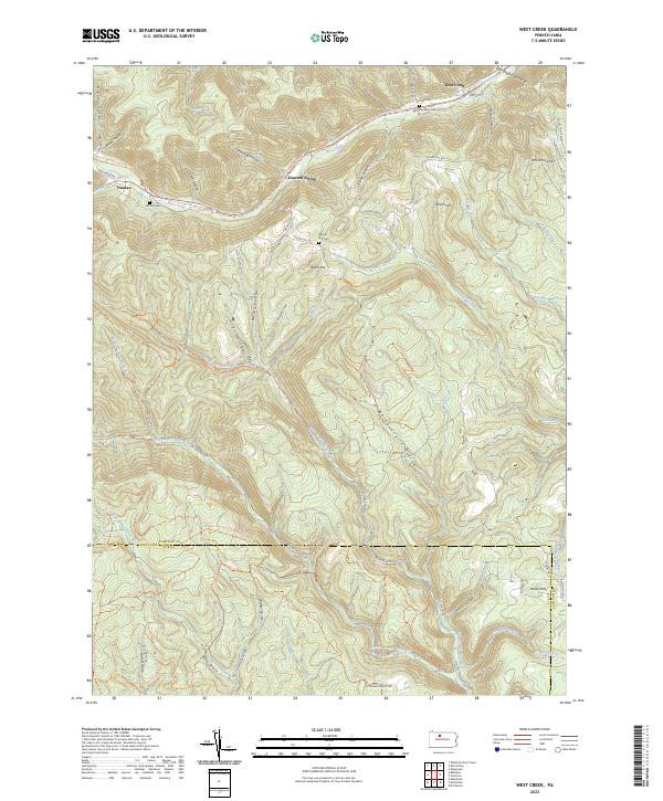 2023 West Creek2023 Print · USGSCameron and Elk counties meet in this 2020s survey of the Pennsylvania Wilds, a landscape defined by deep hollows and remote ridges. Genealogists can trace family names at Morrison Cem or Moore Hill Cem and explore the legacy of Howard Siding and Truman.
End of results
Showing maps 1-13 of 13
Top cities near West Creek
- Saint Marys historical maps
- Emporium historical maps
- Liberty Township historical maps
- Norwich Township historical maps
- Austin historical maps
- Benezette Township historical maps
See more
Frequently asked questions
- What are the different types of historical maps available for West Creek?
- What is the oldest map of West Creek?
- Where can I purchase historical maps of West Creek for my home or office?
- Where can I download high-res historical maps of West Creek?
- Are there historical topographic maps available for West Creek?
- Is there historical aerial imagery available for West Creek?
- Where are historical maps of West Creek sourced from?