Old Maps of Albrightsville, Kidder Township for Academic Research
Study the evolution of Albrightsville with 19 high-resolution historic maps. Whether you're teaching, researching, or modeling changes in land use, these maps provide essential visual documentation of urban, environmental, and geographic change.
- Analyze long-term change: Track patterns in development, transportation, and natural features.
- Ideal for environmental or urban studies: Support academic projects with primary historical map data.
- Use in the classroom or lab: Educators and researchers rely on these maps to bring historical context to life.
These maps are a powerful tool for teaching, research, and visualizing how Albrightsville has changed over the decades.
Albrightsville, Kidder Township maps
(19)- 1922 Map of Stoddartsville, 1958 Print
 1922 Stoddartsville1958 Print · USGSThe Pennsylvania Poconos at the turn of the century show a landscape of high timber ridges and early mountain resorts. Genealogists and hikers can trace the original paths to Stoddartsville, identify the old Fayette School, or follow the Wilkes-Barre and Eastern rail line.2 unique versions available
 - 1924 Map of Stoddartsville
 1924 Stoddartsville1924 Print · USGSUpper Carbon and Monroe counties are shown in the early twenties as a landscape of timbered hills and headwater streams. Genealogists can locate old rural landmarks like Bradys Switch, the Leonardsville settlement, and the Locust Ridge School.5 unique versions available
 - 1943 Map of Scranton
 1943 Scranton1943 Print · USGSNortheastern Pennsylvania’s coal and rail corridor comes to life in the 1940s, showcasing the dense urban industrial centers of the Wyoming Valley. Genealogists can locate family landmarks like the Fayette School and Locust Ridge School or trace the early paths of the DL & W and Erie railroads.
 - 1943 Map of Stoddartsville
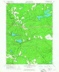
 1943 Stoddartsville1943 Print · USGSThe Pocono Plateau at the height of the Second World War shows a landscape defined by river valleys and developing recreation preserves. Genealogists and local historians can trace rural schoolhouses and small settlements like Stoddartsville, Albrightsville, and the Fishery Sch.
 - 1950 Map of Scranton, 1952 Print
 1950 Scranton1952 Print · USGSMid-century Northeast Pennsylvania and the Hudson Valley come alive in this survey of the tri-state region. Genealogists and historians can trace the dense rail networks of the Erie RR and DL&W RR between industrial hubs like Scranton and Wilkes-Barre.
 - 1953 Map of Scranton
 1953 Scranton1953 Print · USGSNortheastern Pennsylvania and the Catskills are shown in great detail during the early fifties, a time when rail lines and river valleys dictated the region's growth. Genealogists and historians can trace the industrial hearts of Scranton and Wilkes-Barre or locate remote landmarks like High Point and Lake Wallenpaupack.
 - 1959 Map of Scranton
 1959 Scranton1959 Print · USGSThe northern coalfields and the Hudson Valley meet in this mid-century survey of the Pennsylvania and New York borderlands. Genealogists and historians can trace the intricate rail networks of the Erie Railroad and the vast waters of Lake Wallenpaupack.2 unique versions available
 - 1962 Map of Scranton, 1977 Print
 1962 Scranton1977 Print · USGSThe industrial heart of eastern Pennsylvania and the New York Catskills are captured here in the early sixties. Genealogists and historians can trace the dense valley settlements from Scranton to Wilkes-Barre and the rail lines of the Erie Lackawanna Railroad.2 unique versions available
 - 1965 Map of Scranton
 1965 Scranton1965 Print · USGSThe tri-state highlands of Pennsylvania, New York, and New Jersey come alive in the mid-sixties as industry and recreation converge. Trace the intricate rail lines of the Erie Lackawanna RR or locate landmarks like the U S Military Academy.2 unique versions available
 - 1965 Map of Blakeslee, 1967 Print
 1965 Blakeslee1967 Print · USGSThe Pocono region undergoes a major shift toward recreation and transit in the 1960s as new highways bisect the forest. You can trace the footprint of Pocono International Raceway and early resorts like Big Boulder Ski Resort or Split Rock.4 unique versions available
 - 1976 Map of Blakeslee, 1978 Print
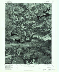 1976 Blakeslee1978 Print · USGSMonroe County was undergoing significant recreational growth in the mid-1970s, as captured in this detailed aerial orthophotograph. Researchers can trace the development of residential communities at Indian Mountain Lake and Split Rock or study the shoreline of Pocono Lake.
 - 1986 Map of Scranton
 1986 Scranton1986 Print · USGSNortheastern Pennsylvania in the mid-eighties shows an era of transition between its deep-rooted mining history and modern transit growth. Researchers can trace the industrial footprint of a Strip Mine, locate the Tobyhanna Army Depot, or find family sites near St Marys Cem and Wilkes College.2 unique versions available
 - 1992 Map of Blakeslee, 1995 Print
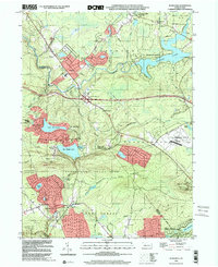
 1992 Blakeslee1995 Print · USGSMonroe and Carbon counties are shown in the early nineties as the region's resort and racing identity was firmly set. Genealogists and historians can trace Blakeslee and Albrightsville, or locate landmarks like Pilgrim Ch and the Pocono International Raceway.
 - 1999 Map of Blakeslee, 2001 Print
 1999 Blakeslee2001 Print · USGSThe Pocono Mountains at the end of the century reveal a landscape where wilderness preserves meet major recreation hubs. Trace the development of Locust Lakes Village and Split Rock or locate the sprawling Pocono International Raceway and Big Boulder Ski Resort.
 - 2010 Map of Blakeslee, 2010 Print
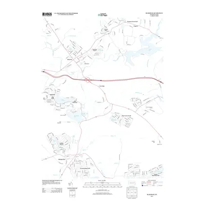
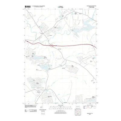 2010 Blakeslee2010 Print · USGSCovers Albrightsville, including Kidder Township, William Warke's Acres, and other nearby areas
 - 2013 Map of Blakeslee, 2013 Print
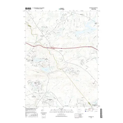
 2013 Blakeslee2013 Print · USGSCovers Albrightsville, including Kidder Township, William Warke's Acres, and other nearby areas
 - 2016 Map of Blakeslee, 2016 Print
 2016 Blakeslee2016 Print · USGSCovers Albrightsville, including Kidder Township, William Warke's Acres, and other nearby areas
 - 2019 Map of Blakeslee, 2019 Print
 2019 Blakeslee2019 Print · USGSCovers Albrightsville, including Kidder Township, William Warke's Acres, and other nearby areas
 - 2023 Map of Blakeslee, 2023 Print
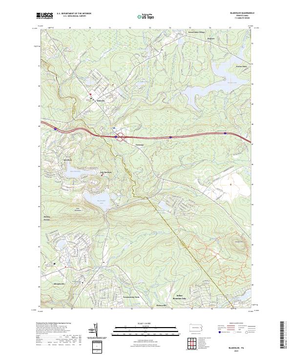 2023 Blakeslee2023 Print · USGSMonroe and Carbon Counties are captured here in a moment of continued growth within the Pocono plateau. Researchers can trace family sites at Blakeslee Cem and Old Albrightsville Cem or locate the historic Saint Paul's Lutheran Church.
End of results
Showing maps 1-19 of 19
Top cities near Albrightsville
- Wilkes-Barre historical maps
- Plains Township historical maps
- Tobyhanna historical maps
- Palmerton historical maps
- Lehighton historical maps
- Jim Thorpe historical maps
See more
Frequently asked questions
- What are the different types of historical maps available for Albrightsville?
- What is the oldest map of Albrightsville?
- Where can I purchase historical maps of Albrightsville for my home or office?
- Where can I download high-res historical maps of Albrightsville?
- Are there historical topographic maps available for Albrightsville?
- Is there historical aerial imagery available for Albrightsville?
- Where are historical maps of Albrightsville sourced from?