Old Maps of Pancake, Snow Shoe Township for Genealogy
Trace your family roots with 15 historic maps of Pancake. These high-res maps reveal old neighborhoods, homesites, landmarks, and streets — helping you uncover where your ancestors lived and how the area evolved over time.
- Explore historic neighborhoods: Identify where your relatives may have lived in the 1800s or 1900s.
- Compare maps over time: Trace the changes in streets, buildings, and landmarks for multi-generational research.
- Perfect for genealogy & ancestry research: Used by family historians and researchers to map out lineage and migration.
These maps are an incredible resource for exploring your personal connection to Pancake's past.
Pancake, Snow Shoe Township maps
(15)- 1928 Map of Snow Shoe
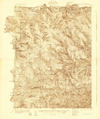 1928 Snow Shoe1928 Print · USGSCentre County's coal and timber country is documented here in the late 1920s, showing the intersection of heavy industry and wilderness. Researchers can locate active operations like Mine No 25, the village of Gillintown, and the remote Soldiers Home Camp.5 unique versions available
 - 1931 Map of Show Shoe
 1931 Show Shoe1931 Print · USGSThe Pennsylvania coalfields and river valleys are captured here in the early 1930s, showing a rugged landscape defined by mountain camps and mining towns. Genealogists can trace family roots through industrial settlements like Clarence and Snow Shoe or locate old schools such as Cherry Run Sch.3 unique versions available
 - 1954 Map of Williamsport
 1954 Williamsport1954 Print · USGSNorth-central Pennsylvania in the mid-fifties is defined by the winding West Branch Susquehanna River and its industrial valley. Local historians can trace the massive Susquehanna Ordnance Depot and the extensive rail networks of the Pennsylvania Railroad.
 - 1960 Map of Williamsport
 1960 Williamsport1960 Print · USGSNorth-central Pennsylvania in the mid-twentieth century was a vital corridor of rail and river industry stretching from the New York line to the coal regions. Genealogists can trace the rail networks of the Pennsylvania RR and Lehigh Valley RR connecting towns like Williamsport, Towanda, and Lock Haven.
 - 1960 Map of Snow Shoe, 1963 Print
 1960 Snow Shoe1963 Print · USGSIn the early sixties, the coal-rich highlands of Centre County were defined by active extraction and small mountain settlements. Genealogists and historians can locate family cemeteries like St Marys Cem and trace the winding paths of the New York Central through Snow Shoe and Clarence.4 unique versions available
 - 1962 Map of Williamsport, 1966 Print
 1962 Williamsport1966 Print · USGSNorth-central Pennsylvania was a landscape of industrial river hubs and vast state woodlands in the early sixties. Researchers can trace the path of the Pennsylvania Railroad through Williamsport and explore the remote reaches of Bucktail State Park.5 unique versions available
 - 1965 Map of Williamsport
 1965 Williamsport1965 Print · USGSNorth-central Pennsylvania in the mid-1960s is defined by the industrial river towns and vast timberlands of the Allegheny Plateau. Researchers can trace historic rail lines like the Erie Lackawanna and Reading as they thread through Williamsport, Lock Haven, and Jersey Shore.
 - 1966 Map of Williamsport
 1966 Williamsport1966 Print · USGSThe Susquehanna Valley was a hub of transit and industry in the mid-seventies, where the river's West Branch connected major college towns and timberlands. Researchers can trace historical rail lines like the Reading or locate regional landmarks from Jersey Shore to Ricketts Glen State Park.
 - 1984 Map of Williamsport West, 1985 Print
 1984 Williamsport West1985 Print · USGSCentral Pennsylvania in the mid-eighties was a landscape of dense state forests and industrious river towns along the West Branch Susquehanna River. Trace the rail lines of Conrail through Renovo or locate the historic grounds of Lock Haven State College.2 unique versions available
 - 1996 Map of Snow Shoe, 1999 Print
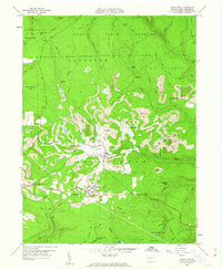
 1996 Snow Shoe1999 Print · USGSCentre County's rugged plateau is captured here in the mid-1990s, showcasing the intersection of industrial coal mining and deep forest conservation. Researchers can trace family roots in settlements like Snow Shoe and Clarence, or locate landmarks such as St Michaels Cem and the Beech Creek Lodge.
 - 2010 Map of Snow Shoe, 2010 Print
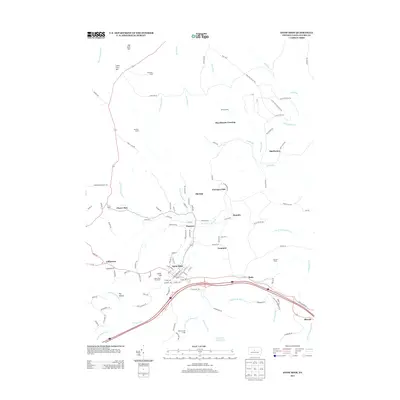
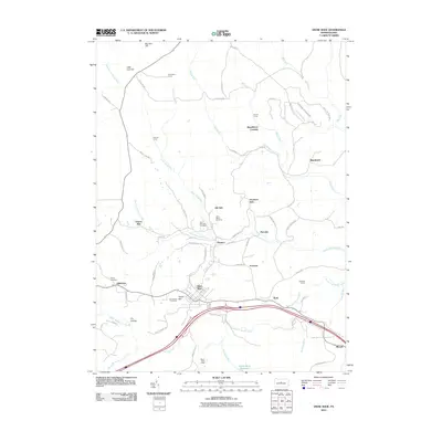 2010 Snow Shoe2010 Print · USGSCovers Pancake, including Snow Shoe, Rhoads, and other nearby areas
 - 2013 Map of Snow Shoe, 2013 Print
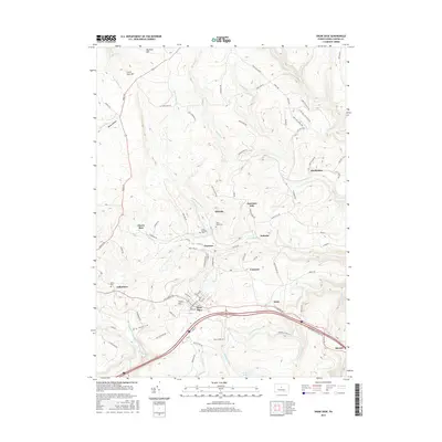
 2013 Snow Shoe2013 Print · USGSCovers Pancake, including Snow Shoe, Rhoads, and other nearby areas
 - 2016 Map of Snow Shoe, 2016 Print
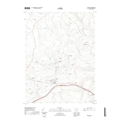
 2016 Snow Shoe2016 Print · USGSCovers Pancake, including Snow Shoe, Rhoads, and other nearby areas
 - 2019 Map of Snow Shoe, 2019 Print
 2019 Snow Shoe2019 Print · USGSCovers Pancake, including Snow Shoe, Rhoads, and other nearby areas
 - 2023 Map of Snow Shoe, 2023 Print
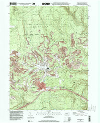
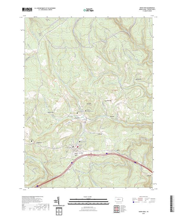 2023 Snow Shoe2023 Print · USGSSnow Shoe and the surrounding Centre County ridges are captured here in the early twenty-first century, showing a landscape defined by mountain trails and mining history. Researchers can locate family sites at Saint Michaels Cem or trace old neighborhood boundaries in Old Side and Poorman Side.
End of results
Showing maps 1-15 of 15
Top cities near Pancake
- Bellefonte historical maps
- Pleasant Gap historical maps
- Milesburg historical maps
- Karthaus Township historical maps
- Snow Shoe historical maps
- Curtin historical maps
See more
Frequently asked questions
- What are the different types of historical maps available for Pancake?
- What is the oldest map of Pancake?
- Where can I purchase historical maps of Pancake for my home or office?
- Where can I download high-res historical maps of Pancake?
- Are there historical topographic maps available for Pancake?
- Is there historical aerial imagery available for Pancake?
- Where are historical maps of Pancake sourced from?