2020s Maps of East Marlborough Township, Pennsylvania
Explore 4 historic maps of East Marlborough Township from the 2020s. These maps offer a rare glimpse into what life looked like during the 2020s — showing old roads, neighborhoods, homes, and landmarks that have changed or disappeared over time.
Whether you're researching your family's past, planning a metal detecting trip, or studying how East Marlborough Township's landscape evolved across the 2020s, these high-resolution maps are a powerful tool for exploring the history of this region.
- Focus on a specific era: All maps on this page are from the 2020s, giving you a focused view of this time period.
- See what’s changed: Compare century-old streets, trails, and buildings to today's modern landscape using overlays and satellite layers.
- Research with precision: Use these maps for genealogy, historical research, land use analysis, or educational projects.
- View, download, or print: Maps are fully viewable online in high resolution, and can be downloaded or printed for your own records.
Start exploring East Marlborough Township's history through authentic maps from the 2020s. This is your window into the past.
East Marlborough Township, PA maps
(4)- 2023 Map of Unionville, 2023 Print
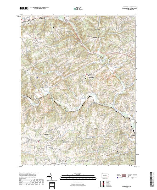 2023 Unionville2023 Print · USGSChester County at the modern turn shows a landscape deeply marked by its early Quaker settlements and river valleys. Genealogists can trace family footprints at Bradford Friends Burial Ground, Almshouse Cem, and the historic Saverys Mill.
 - 2023 Map of Coatesville, 2023 Print
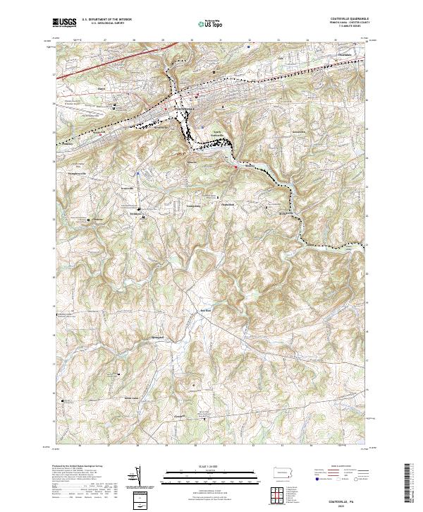 2023 Coatesville2023 Print · USGSChester County in the 2020s shows a landscape where industrial heritage meets rural preservation. Genealogists can trace deep local roots at Saint Malachi Catholic Cemetery, the Fallowfield Cemetery, and the historic hamlet of Ercildoun.
 - 2023 Map of West Grove, 2023 Print
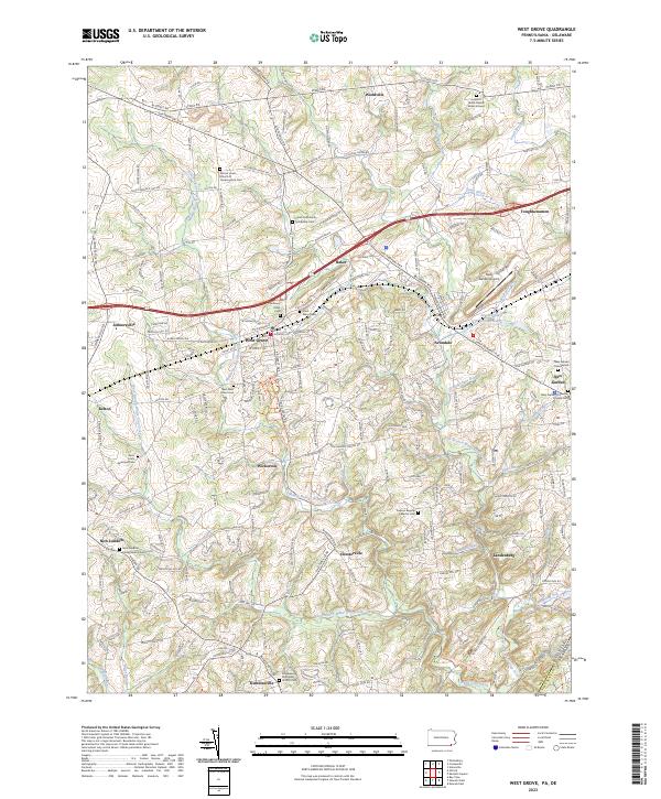 2023 West Grove2023 Print · USGSChester County's rolling landscape near the Delaware line is mapped here at the height of its modern settlement. Genealogists can trace family names through the London Grove Friends Burial Ground, Saint Marys Cem, and New West Grove Cem.
 - 2023 Map of Kennett Square, 2023 Print
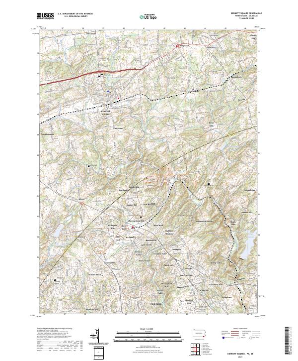 2023 Kennett Square2023 Print · USGSThe Brandywine Valley borderlands come alive in this detailed record of the rolling country between Kennett Square and Hockessin. Researchers can trace ancestral sites like Kennett Friends Burial Ground and the historic settlement of Burnt Mills.
End of results
Showing maps 1-4 of 4
Top cities near East Marlborough Township
- Wilmington historical maps
- Newark historical maps
- West Goshen Township historical maps
- West Chester historical maps
- Hockessin historical maps
- Pennsville Township historical maps
See more
Top neighborhoods of East Marlborough Township
- Marlboro historical maps
- Red Lion historical maps
- Anvil historical maps
- Unionville historical maps
- Willowdale historical maps
- Willowdale Crossing historical maps
See more
Frequently asked questions
- What are the different types of historical maps available for East Marlborough Township?
- What is the oldest map of East Marlborough Township?
- Where can I purchase historical maps of East Marlborough Township for my home or office?
- Where can I download high-res historical maps of East Marlborough Township?
- Are there historical topographic maps available for East Marlborough Township?
- Is there historical aerial imagery available for East Marlborough Township?
- Where are historical maps of East Marlborough Township sourced from?