Old Maps of Schuylkill Township, Pennsylvania for Metal Detecting
Plan your next treasure hunt with 43 historic maps of Schuylkill Township. Find old homesites, ghost towns, trails, and gathering spots that may be lost to time — perfect for identifying promising metal detecting locations.
- Locate forgotten sites: Uncover places like long-lost settlements, abandoned rail lines, or gathering spots.
- Plan better hunts: Use map overlays combined with LiDAR or satellite views to narrow in on historically rich areas.
- Made for detectorists: Thousands of hobbyists use these maps to discover relics, coins, and hidden history.
Use these historic maps to boost your research and find new opportunities beneath the surface of Schuylkill Township.
Schuylkill Township, PA maps
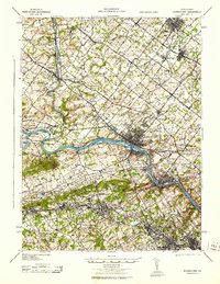
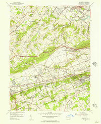
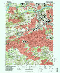
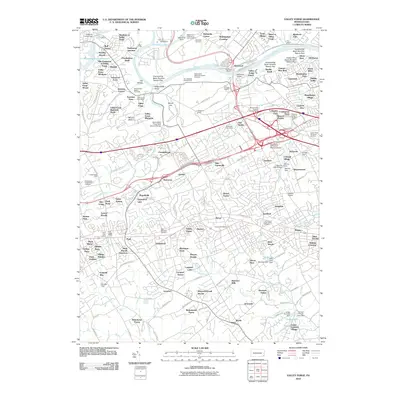
(43)- 1894 Map of Norristown, 1959 Print
 1894 Norristown1959 Print · USGSSoutheast Pennsylvania at the end of the nineteenth century reveals a landscape defined by the Schuylkill River and a dense network of early railroads. Researchers can trace ancestral roots through old settlements like Skippack, Lansdale, and the rail junctions of the Perkiomen RR and Stony Creek RR.
 - 1895 Map of Norristown, 1898 Print
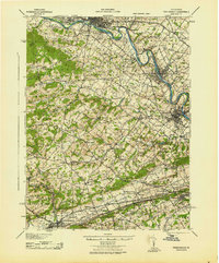
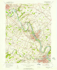
 1895 Norristown1898 Print · USGSMontgomery County at the end of the 19th century is a landscape of thriving river towns and bustling rail corridors. Researchers can trace the Victorian-era footprints of Norristown and Lansdale or locate historic landmarks like Valley Forge and Perkiomen Bridge.11 unique versions available
 - 1896 Map of Norristown
 1896 Norristown1896 Print · USGSMontgomery County in the mid-1890s reveals a landscape of growing railroad towns and historic creek-side settlements. Genealogists can trace family footprints near Waterloo Mills, the historic Perkiomen Bridge, and across the townships from Lansdale to Norristown.
 - 1906 Map of Phoenixville
 1906 Phoenixville1906 Print · USGSThe industrial corridor along the Schuylkill River thrives in the early 1900s as rail networks expand through Chester and Montgomery counties. Genealogists and historians can trace old community centers like Seven Stars, Limerick, and the Paoli Monument.8 unique versions available
 - 1942 Map of Norristown
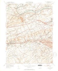
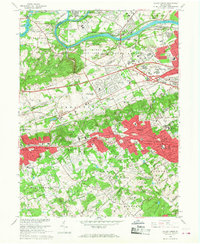
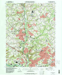
 1942 Norristown1942 Print · USGSSoutheastern Pennsylvania at the onset of World War II shows a landscape of busy industrial river towns and expanding rail suburbs. Genealogists and historians can trace the early transit networks connecting Norristown, Doylestown, and the riverfront at New Hope.
 - 1943 Map of Norristown
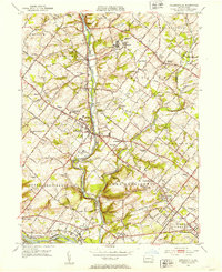
 1943 Norristown1943 Print · USGSMontgomery County in the early 1940s is a thriving network of rail-side industrial hubs and established borough centers. Genealogists and local historians can trace the development of Norristown and Lansdale or locate landmarks like the Eastern State Penitentiary.
 - 1943 Map of Phoenixville
 1943 Phoenixville1943 Print · USGSSoutheastern Pennsylvania during the early war years shows a landscape defined by the winding Schuylkill River and heavy rail traffic. Genealogists and historians can trace the early Pennsylvania Turnpike and explore historic locales like Fricks Lock and Nantmeal Village.
 - 1944 Map of Newark, 1971 Print
 1944 Newark1971 Print · USGSThe industrial corridor from Philadelphia to New York was in a period of massive transition during the mid-forties. Genealogists and researchers can trace the rail lines of the Lehigh Valley RR, locate military installations like Picatinny Arsenal, and explore the early sprawl near Levittown.5 unique versions available
 - 1949 Map of Newark
 1949 Newark1949 Print · USGSThe industrial corridor between Philadelphia and New York comes alive in this post-war survey. Genealogists and historians can trace the massive rail networks of the Reading Railroad and locate major installations like Fort Dix or Picatinny Arsenal.2 unique versions available
 - 1951 Map of Collegeville, 1953 Print
 1951 Collegeville1953 Print · USGSMontgomery County was a landscape of historic institutional grounds and creek-side villages in the early fifties. Local historians can trace the footprint of Ursinus College, locate the Eastern State Penitentiary, and find old schools like Henry R Boyer Sch.2 unique versions available
 - 1952 Map of Valley Forge, 1953 Print
 1952 Valley Forge1953 Print · USGSThe Main Line and Valley Forge area are captured here during the early fifties suburban expansion. Genealogists and researchers can trace local landmarks like Washington Memorial Chapel, the School for Blind, and the Norbertine Monastery.3 unique versions available
 - 1955 Map of Malvern, 1957 Print
 1955 Malvern1957 Print · USGSChester County during the mid-fifties is captured here as suburban growth begins to meet established rail towns and historic valley farms. Genealogists and local historians can trace the footprint of Immaculata College, the Valley Forge Army Hospital, and early housing at General Warren Village.6 unique versions available
 - 1955 Map of Phoenixville, 1957 Print
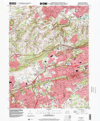
 1955 Phoenixville1957 Print · USGSPhoenixville and the surrounding townships are captured in the mid-1950s as they expanded along the winding Schuylkill River. Genealogists can trace family names through the Revolutionary Soldiers Cem, Mingo Cem, and landmarks like the Pennhurst State School.6 unique versions available
 - 1956 Map of Newark
 1956 Newark1956 Print · USGSThe industrial heart of the Mid-Atlantic is captured here at the dawn of the highway era, tracing the dense corridors between Newark and Philadelphia. Genealogists and local historians can map the rail networks of the Reading RR or locate mid-century military life at Fort Dix Military Reservation.2 unique versions available
 - 1957 Map of Newark
 1957 Newark1957 Print · USGSThe industrial and military heart of the Mid-Atlantic is mapped during its post-war suburban boom. Genealogists and historians can trace the intricate rail corridors of the Reading Railroad and locate key landmarks from Princeton University to Fort Hancock.
 - 1960 Map of Newark
 1960 Newark1960 Print · USGSThe industrial heart of the Mid-Atlantic is shown at mid-century, stretching from the dense urban centers of Newark and Philadelphia to the Blue Mountain ridges. Researchers can trace historic rail lines, coastal defenses at Fort Hancock, and the riverfront growth of Trenton and Easton.3 unique versions available
 - 1964 Map of Newark
 1964 Newark1964 Print · USGSGreater New Jersey and eastern Pennsylvania appear at the peak of their industrial and rail-centered development in the mid-sixties. Genealogists and historians can trace the paths of the Pennsylvania RR, identify mid-century landmarks like CAMP KILMER, or follow the Schuylkill River through READING.2 unique versions available
 - 1966 Map of Valley Forge, 1968 Print
 1966 Valley Forge1968 Print · USGSThe Main Line and Valley Forge regions are captured here in the mid-1960s as suburban growth began to surround the Revolutionary War's most famous encampment. Local historians can trace the legacy of the Schuylkill valley through Washingtons Headquarters, Great Valley Mills, and old school sites like Roberts Sch.4 unique versions available
 - 1966 Map of Collegeville, 1968 Print
 1966 Collegeville1968 Print · USGSMid-century Montgomery County comes to life as Collegeville and its neighbors expand along the Perkiomen Creek. Researchers can trace institutional history at the State Correctional Institution or find local landmarks like Ursinus College and Markleys Pond.5 unique versions available
 - 1984 Map of Reading, 1986 Print
 1984 Reading1986 Print · USGSSoutheastern Pennsylvania in the mid-eighties shows a landscape of established industrial hubs and rapid suburban expansion. Trace local history through landmarks like Valley Forge National Historical Park, the Willow Grove Naval Air Station, and Kutztown University.2 unique versions available
 - 1992 Map of Valley Forge, 1998 Print
 1992 Valley Forge1998 Print · USGSThe hallowed grounds of Chester County are captured here in the late twentieth century as suburban growth surrounds the Revolutionary War site. Genealogists can trace local landmarks like Abram Cem, St Monica's Cem, and the historic Great Valley Mills among the rising developments.
 - 1992 Map of Collegeville, 1998 Print
 1992 Collegeville1998 Print · USGSMontgomery County in the early nineties shows a landscape of growing suburbs and historic institutions. Trace local foundations at Ursinus College, the Schuylkill Canal, and family landmarks like Keelys Ch Cem.
 - 1999 Map of Malvern, 2001 Print
 1999 Malvern2001 Print · USGSChester County at the end of the millennium shows a landscape of deep-rooted heritage meeting modern infrastructure. Trace the evolution of the Main Line through Malvern, locate historic landmarks like Hershey Mill, and follow the old rail lines to Ship Road Station.
 - 2010 Map of Phoenixville, 2010 Print
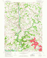
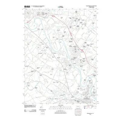 2010 Phoenixville2010 Print · USGSCovers Schuylkill Township, including Pottstown, Limerick Township, and other nearby areas
 - 2010 Map of Valley Forge, 2010 Print
 2010 Valley Forge2010 Print · USGSCovers Schuylkill Township, including Radnor Township, King of Prussia, and other nearby areas
Showing maps 1-25 of 43
Top cities near Schuylkill Township
- Philadelphia historical maps
- Upper Darby historical maps
- Norristown historical maps
- Radnor Township historical maps
- Marple Township historical maps
- Springfield Township historical maps
See more
Top neighborhoods of Schuylkill Township
- Ironsides historical maps
- Corner Stores historical maps
- Pickering historical maps
- Williams Corner historical maps
- Perkiomen Junction historical maps
- Brittains Corner historical maps
See more
Frequently asked questions
- What are the different types of historical maps available for Schuylkill Township?
- What is the oldest map of Schuylkill Township?
- Where can I purchase historical maps of Schuylkill Township for my home or office?
- Where can I download high-res historical maps of Schuylkill Township?
- Are there historical topographic maps available for Schuylkill Township?
- Is there historical aerial imagery available for Schuylkill Township?
- Where are historical maps of Schuylkill Township sourced from?