1990s Maps of Boggs Township, Pennsylvania
Explore 2 historic maps of Boggs Township from the 1990s. These maps offer a rare glimpse into what life looked like during the 1990s — showing old roads, neighborhoods, homes, and landmarks that have changed or disappeared over time.
Whether you're researching your family's past, planning a metal detecting trip, or studying how Boggs Township's landscape evolved across the 1990s, these high-resolution maps are a powerful tool for exploring the history of this region.
- Focus on a specific era: All maps on this page are from the 1990s, giving you a focused view of this time period.
- See what’s changed: Compare century-old streets, trails, and buildings to today's modern landscape using overlays and satellite layers.
- Research with precision: Use these maps for genealogy, historical research, land use analysis, or educational projects.
- View, download, or print: Maps are fully viewable online in high resolution, and can be downloaded or printed for your own records.
Start exploring Boggs Township's history through authentic maps from the 1990s. This is your window into the past.
Boggs Township, PA maps
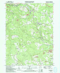
(2)- 1993 Map of Glen Richey, 1994 Print
 1993 Glen Richey1994 Print · USGSClearfield County in the early 1990s reveals a landscape shaped by coal mining and winding river valleys. Genealogists and local historians can trace family connections through sites like Thompson Cem, the Mt Zion Ch, and the settlement at Glen Richey.
 - 1993 Map of Wallaceton, 1994 Print
 1993 Wallaceton1994 Print · USGSClearfield County's coal country comes into focus in the early nineties, showing a landscape shaped by rail lines and resource extraction. Genealogists and local historians can locate many rural landmarks, including Spring Valley Cem, Bigler, and Summit Hill Ch.
End of results
Showing maps 1-2 of 2
Top cities near Boggs Township
- Clearfield historical maps
- Philipsburg historical maps
- Curwensville historical maps
- Beccaria Township historical maps
- Warriors Mark Township historical maps
- Graham historical maps
See more
Top neighborhoods of Boggs Township
- Krebs historical maps
- West Decatur historical maps
- Blue Ball historical maps
- Spring Valley historical maps
Frequently asked questions
- What are the different types of historical maps available for Boggs Township?
- What is the oldest map of Boggs Township?
- Where can I purchase historical maps of Boggs Township for my home or office?
- Where can I download high-res historical maps of Boggs Township?
- Are there historical topographic maps available for Boggs Township?
- Is there historical aerial imagery available for Boggs Township?
- Where are historical maps of Boggs Township sourced from?