1950s Maps of Lawrence Township, Pennsylvania
Explore 12 historic maps of Lawrence Township from the 1950s. These maps offer a rare glimpse into what life looked like during the 1950s — showing old roads, neighborhoods, homes, and landmarks that have changed or disappeared over time.
Whether you're researching your family's past, planning a metal detecting trip, or studying how Lawrence Township's landscape evolved across the 1950s, these high-resolution maps are a powerful tool for exploring the history of this region.
- Focus on a specific era: All maps on this page are from the 1950s, giving you a focused view of this time period.
- See what’s changed: Compare century-old streets, trails, and buildings to today's modern landscape using overlays and satellite layers.
- Research with precision: Use these maps for genealogy, historical research, land use analysis, or educational projects.
- View, download, or print: Maps are fully viewable online in high resolution, and can be downloaded or printed for your own records.
Start exploring Lawrence Township's history through authentic maps from the 1950s. This is your window into the past.
Lawrence Township, PA maps
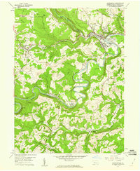
(12)- 1953 Map of Pittsburgh
 1953 Pittsburgh1953 Print · USGSWestern Pennsylvania's industrial landscape at the start of the fifties shows the steel and rail corridors between Pittsburgh and Altoona. Trace family roots in river towns like Tarentum or follow the Pennsylvania Turnpike across Laurel Hill.
 - 1954 Map of Pittsburgh
 1954 Pittsburgh1954 Print · USGSWestern Pennsylvania in the early fifties remains a powerhouse of heavy industry and vital transit corridors. Genealogists and historians can trace the rail-and-river network connecting Pittsburgh, Johnstown, and Altoona via the Pennsylvania RR and the Lincoln Highway.2 unique versions available
 - 1957 Map of Warren, 1964 Print
 1957 Warren1964 Print · USGSThe northern Pennsylvania oil and timber country comes into focus in the mid-fifties, showing the region before modern highway expansions. Trace the industrial rail networks of the Pennsylvania RR and the early Allegheny River Reservoir near Warren and Oil City.4 unique versions available
 - 1958 Map of Pittsburgh
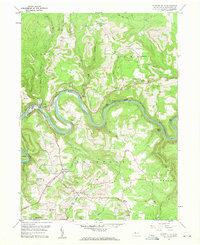
 1958 Pittsburgh1958 Print · USGSWestern Pennsylvania in the late fifties shows an industrial heartland defined by the confluence of the Allegheny River and Monongahela River. Researchers can trace the sprawling rail networks of the Pennsylvania RR and find established towns like Butler, Latrobe, and Windber.5 unique versions available
 - 1958 Map of Warren
 1958 Warren1958 Print · USGSNorthern Pennsylvania’s timber and oil country is captured here during the late fifties, showing the interplay of industrial valleys and vast state forests. Genealogists can trace family connections across the Cornplanter Indian Reservation or through rail hubs like Oil City and Saint Marys.
 - 1959 Map of Warren
 1959 Warren1959 Print · USGSNorthern Pennsylvania's oil and timber country comes alive in this late-fifties study of the forest-clad plateaus. Trace the historic Cornplanter (Indian Reservation), the sprawling Oil Field, and the rail lines of the Pennsylvania RR.2 unique versions available
 - 1959 Map of Pittsburgh
 1959 Pittsburgh1959 Print · USGSWestern Pennsylvania in the late fifties is captured here at the height of its industrial era. Genealogists and historians can trace the riverfront growth of Pittsburgh, the rail works at Altoona, and the mountain gaps of Laurel Hill.
 - 1959 Map of Lecontes Mills, 1960 Print
 1959 Lecontes Mills1960 Print · USGSThis late-fifties survey of the Clearfield County highlands shows a landscape defined by the winding West Branch Susquehanna River and a booming coal industry. Researchers can trace the New York Central rail line through the Shawville Tunnel to rural outposts like Needful and Gallows Harbor.6 unique versions available
 - 1959 Map of Elliott Park, 1960 Print
 1959 Elliott Park1960 Print · USGSThe Clearfield County high country is documented here in the late fifties as coal extraction and reforestation shaped the landscape. Genealogists and historians can trace family locations near Greenville, Pleasant Grove Ch, and numerous Strip Mines.5 unique versions available
 - 1959 Map of Curwensville, 1960 Print
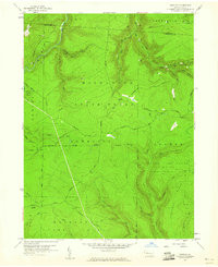
 1959 Curwensville1960 Print · USGSThe West Branch Susquehanna River region in the late 1950s shows a landscape of deep valleys and coal mining. Genealogists and historians can trace rail lines to settlements like Lumber City and Grampian, or locate sites like Zion Ch and Oak Hill Cemetery.5 unique versions available
 - 1959 Map of Huntley, 1960 Print
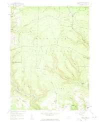
 1959 Huntley1960 Print · USGSThe high woods of Clearfield and Elk counties are captured here at the end of the 1950s, showing a land balanced between resource extraction and recreation. Researchers can trace early energy development at various Gas Well sites or locate landmarks like Panther Rocks and Parker Dam State Park.3 unique versions available
 - 1959 Map of Clearfield, 1961 Print
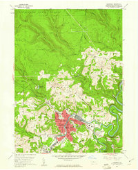 1959 Clearfield1961 Print · USGSClearfield and the Susquehanna River valley are captured here at a peak of industrial activity in the late fifties. Genealogists and historians can trace family-named sites like the Baney Settlement or locate records at Hillcrest Cem and St Francis Sch.5 unique versions available
End of results
Showing maps 1-12 of 12
Top cities near Lawrence Township
- Sandy Township historical maps
- Clearfield historical maps
- Philipsburg historical maps
- Curwensville historical maps
- Graham historical maps
- Bigler historical maps
See more
Top neighborhoods of Lawrence Township
- Mount Hope historical maps
- Oshanter historical maps
- Pine Grove historical maps
- Plymptonville historical maps
- Plymtonville historical maps
- Riverview historical maps
See more
Frequently asked questions
- What are the different types of historical maps available for Lawrence Township?
- What is the oldest map of Lawrence Township?
- Where can I purchase historical maps of Lawrence Township for my home or office?
- Where can I download high-res historical maps of Lawrence Township?
- Are there historical topographic maps available for Lawrence Township?
- Is there historical aerial imagery available for Lawrence Township?
- Where are historical maps of Lawrence Township sourced from?