Old Maps of Leidy Township, Pennsylvania for Metal Detecting
Plan your next treasure hunt with 37 historic maps of Leidy Township. Find old homesites, ghost towns, trails, and gathering spots that may be lost to time — perfect for identifying promising metal detecting locations.
- Locate forgotten sites: Uncover places like long-lost settlements, abandoned rail lines, or gathering spots.
- Plan better hunts: Use map overlays combined with LiDAR or satellite views to narrow in on historically rich areas.
- Made for detectorists: Thousands of hobbyists use these maps to discover relics, coins, and hidden history.
Use these historic maps to boost your research and find new opportunities beneath the surface of Leidy Township.
Leidy Township, PA maps
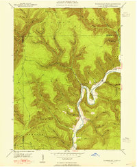
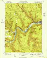
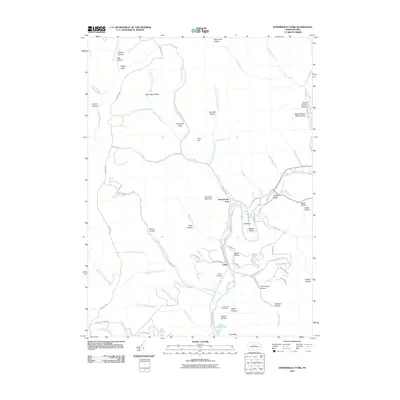
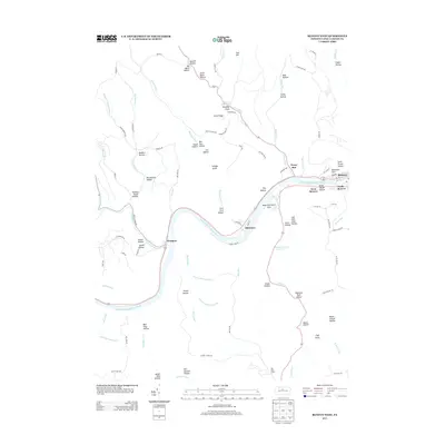
(37)- 1946 Map of Renovo West, 1953 Print
 1946 Renovo West1953 Print · USGSClinton County's river valleys and ridgelines come alive in this mid-century survey of the Pennsylvania wilds. Trace the industrial footprint of the Pennsylvania RR through Renovo or find family history at Laurel Hill Cem and Summerson Cem.9 unique versions available
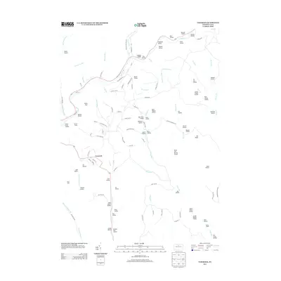
 - 1946 Map of Hammersley Fork, 1954 Print
 1946 Hammersley Fork1954 Print · USGSThe deep valleys of north-central Pennsylvania appear just after the war as small creek-side settlements remain the primary nodes of local life. Genealogists can trace family names at Summerson Cem and McCoy Cem or locate the old Central Sch near Hammersley Fork.4 unique versions available
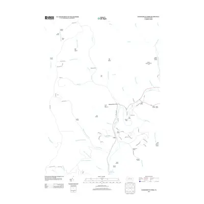
 - 1946 Map of Keating, 1954 Print
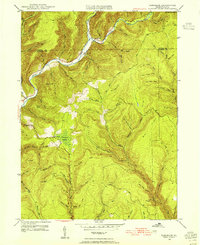
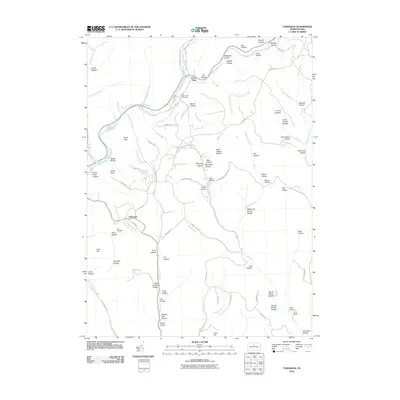
 1946 Keating1954 Print · USGSClinton County’s deep river valleys and high ridges are shown just after the war, centered on the strategic rail junction at Keating. Genealogists and industrial historians can trace the New York Central line through the mountains and locate the settlement at Bitumen.4 unique versions available
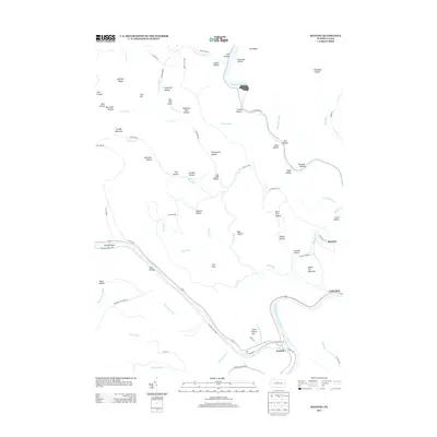
 - 1946 Map of Tamarack, 1955 Print
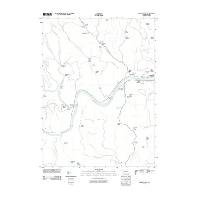
 1946 Tamarack1955 Print · USGSClinton and Potter Counties appear in the mid-forties as a landscape of deep valleys and vital watershed headwaters. Genealogists and historians can trace the remote highlands surrounding Tamarack, locating local landmarks like Browns Mill and the Tamarack Lookout Tower.4 unique versions available
 - 1946 Map of Renovo West, 1959 Print
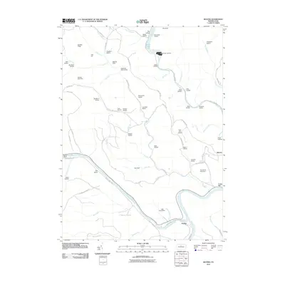
 1946 Renovo West1959 Print · USGSClinton County during the post-war era shows a landscape of river-valley industry and upland extraction. You can trace the rail networks through Renovo, find family plots at Noyes Cem, and locate the Strip Mine operations above Westport.4 unique versions available
 - 1948 Map of Keating
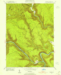
 1948 Keating1948 Print · USGSThe confluence of the Susquehanna and Sinnemahoning Creek appears in the late 1940s as a vital railroad corridor through the mountains. Genealogists and historians can trace the riverside rail stops at Keating and Wistar or the upland community of Bitumen.
 - 1948 Map of Hammersley Fork
 1948 Hammersley Fork1948 Print · USGSClinton and Potter counties appear here in the late 1940s, highlighting the rural communities nestled along the winding waters of Kettle Creek. Genealogists can locate family landmarks such as Summerson Cem, McCoy Cem, and the Central Sch.2 unique versions available
 - 1948 Map of Tamarack
 1948 Tamarack1948 Print · USGSThe northern reaches of Clinton County are captured here just after the war, showing a landscape defined by deep creek valleys and forest fire lookouts. Researchers can locate the Tamarack Lookout Tower, the Cem near Cross Fork, and the distinct boggy terrain of Tamarack Swamp.2 unique versions available
 - 1949 Map of Renovo West
 1949 Renovo West1949 Print · USGSClinton County's river-and-rail corridor is captured in the late 1940s as industry thrives along the riverbanks. Researchers can trace family roots at St Josephs Cem, explore the mountain village of Westport, and follow the old PENNSYLVANIA railroad line.2 unique versions available
 - 1954 Map of Williamsport
 1954 Williamsport1954 Print · USGSNorth-central Pennsylvania in the mid-fifties is defined by the winding West Branch Susquehanna River and its industrial valley. Local historians can trace the massive Susquehanna Ordnance Depot and the extensive rail networks of the Pennsylvania Railroad.
 - 1960 Map of Williamsport
 1960 Williamsport1960 Print · USGSNorth-central Pennsylvania in the mid-twentieth century was a vital corridor of rail and river industry stretching from the New York line to the coal regions. Genealogists can trace the rail networks of the Pennsylvania RR and Lehigh Valley RR connecting towns like Williamsport, Towanda, and Lock Haven.
 - 1962 Map of Williamsport, 1966 Print
 1962 Williamsport1966 Print · USGSNorth-central Pennsylvania was a landscape of industrial river hubs and vast state woodlands in the early sixties. Researchers can trace the path of the Pennsylvania Railroad through Williamsport and explore the remote reaches of Bucktail State Park.5 unique versions available
 - 1965 Map of Williamsport
 1965 Williamsport1965 Print · USGSNorth-central Pennsylvania in the mid-1960s is defined by the industrial river towns and vast timberlands of the Allegheny Plateau. Researchers can trace historic rail lines like the Erie Lackawanna and Reading as they thread through Williamsport, Lock Haven, and Jersey Shore.
 - 1966 Map of Williamsport
 1966 Williamsport1966 Print · USGSThe Susquehanna Valley was a hub of transit and industry in the mid-seventies, where the river's West Branch connected major college towns and timberlands. Researchers can trace historical rail lines like the Reading or locate regional landmarks from Jersey Shore to Ricketts Glen State Park.
 - 1984 Map of Williamsport West, 1985 Print
 1984 Williamsport West1985 Print · USGSCentral Pennsylvania in the mid-eighties was a landscape of dense state forests and industrious river towns along the West Branch Susquehanna River. Trace the rail lines of Conrail through Renovo or locate the historic grounds of Lock Haven State College.2 unique versions available
 - 1994 Map of Hammersley Fork, 1999 Print
 1994 Hammersley Fork1999 Print · USGSClinton and Potter Counties are shown here in the 1990s, dominated by the winding valley of Kettle Creek. Genealogists and local historians can locate Hammersley Fork, trace the grounds of Summerson Cem, or find the former Central Sch.
 - 1994 Map of Tamarack, 1999 Print
 1994 Tamarack1999 Print · USGSClinton and Potter counties are shown here in the mid-1990s, capturing a landscape defined by the deep woods of the Susquehannock and Sproul State Forests. Researchers can locate the Tamarack Lookout Tower, the small settlement of Cross Fork, and the Tamarack Swamp Natural Area.
 - 2010 Map of Renovo West, 2010 Print
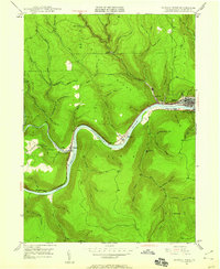
 2010 Renovo West2010 Print · USGSCovers Leidy Township, including Shintown, West Renovo, and other nearby areas
 - 2010 Map of Tamarack, 2010 Print
 2010 Tamarack2010 Print · USGSCovers Leidy Township, including Wharton Township, Stewardson Township, and other nearby areas
 - 2010 Map of Keating, 2010 Print
 2010 Keating2010 Print · USGSCovers Leidy Township, including East Keating Township, Bitumen, and other nearby areas
 - 2010 Map of Hammersley Fork, 2010 Print
 2010 Hammersley Fork2010 Print · USGSCovers Leidy Township, including Wharton Township, East Keating Township, and other nearby areas
 - 2013 Map of Tamarack, 2013 Print
 2013 Tamarack2013 Print · USGSCovers Leidy Township, including Wharton Township, Stewardson Township, and other nearby areas
 - 2013 Map of Hammersley Fork, 2013 Print
 2013 Hammersley Fork2013 Print · USGSCovers Leidy Township, including Wharton Township, East Keating Township, and other nearby areas
 - 2013 Map of Keating, 2013 Print
 2013 Keating2013 Print · USGSCovers Leidy Township, including East Keating Township, Bitumen, and other nearby areas
 - 2013 Map of Renovo West, 2013 Print
 2013 Renovo West2013 Print · USGSCovers Leidy Township, including Shintown, West Renovo, and other nearby areas
Showing maps 1-25 of 37
Top cities near Leidy Township
- Karthaus Township historical maps
- South Renovo historical maps
- Abbott Township historical maps
- Wharton Township historical maps
Top neighborhoods of Leidy Township
Frequently asked questions
- What are the different types of historical maps available for Leidy Township?
- What is the oldest map of Leidy Township?
- Where can I purchase historical maps of Leidy Township for my home or office?
- Where can I download high-res historical maps of Leidy Township?
- Are there historical topographic maps available for Leidy Township?
- Is there historical aerial imagery available for Leidy Township?
- Where are historical maps of Leidy Township sourced from?