Old Maps of Logan Township, Pennsylvania for Academic Research
Study the evolution of Logan Township with 53 high-resolution historic maps. Whether you're teaching, researching, or modeling changes in land use, these maps provide essential visual documentation of urban, environmental, and geographic change.
- Analyze long-term change: Track patterns in development, transportation, and natural features.
- Ideal for environmental or urban studies: Support academic projects with primary historical map data.
- Use in the classroom or lab: Educators and researchers rely on these maps to bring historical context to life.
These maps are a powerful tool for teaching, research, and visualizing how Logan Township has changed over the decades.
Logan Township, PA maps
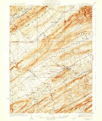
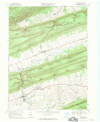
(53)- 1921 Map of Lock Haven, 1958 Print
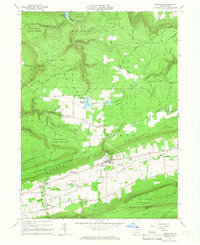
 1921 Lock Haven1958 Print · USGSLock Haven and the Susquehanna River West Branch are captured in the early twenties, showing a landscape defined by industry and mountain ridges. Researchers can trace historic schools and family hamlets from Woolrich to Logan Mills, or locate the State Normal School and Great Island.2 unique versions available
 - 1923 Map of Lock Haven
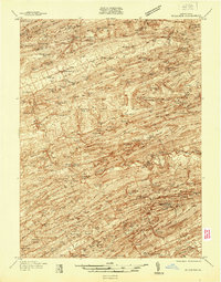
 1923 Lock Haven1923 Print · USGSThe West Branch Susquehanna River corridor in the early twenties reveals a landscape of industrial river towns and isolated mountain valleys. Genealogists can locate family landmarks like the Swissdale School, Liberty Church, and the grounds of the State Normal School.7 unique versions available
 - 1924 Map of Centre Hall, 1958 Print
 1924 Centre Hall1958 Print · USGSCentral Pennsylvania's ridge-and-valley landscape is captured here in the 1920s, showing a world of limestone springs and mountain gaps. Genealogists can locate family homesteads near Old Fort, Tusseyville, and dozens of rural schoolhouses like Gentzel School.2 unique versions available
 - 1929 Map of Centre Hall
 1929 Centre Hall1929 Print · USGSCentral Pennsylvania's ridge-and-valley country is shown here in the late 1920s as a landscape of rural schools and water mills. Genealogists can trace family footprints at Old Fort, Penn Cave, and dozens of school sites like Gentzel School.4 unique versions available
 - 1937 Map of Millheim
 1937 Millheim1937 Print · USGSThe Seven Mountains region of central Pennsylvania is shown here in the late thirties, when rural valleys were tied together by narrow gaps. Researchers can locate family landmarks like Wolfs Chapel, Lose Sch, and vanished stopovers such as Wolfs Store.
 - 1941 Map of Millheim
 1941 Millheim1941 Print · USGSCentral Pennsylvania's ridge-and-valley landscape is documented here just before the mid-century, showing a network of mountain gaps and small valley settlements. Researchers can locate family landmarks like Wolfs Chapel, the Hironimus Sch, and the BM Sawmill along the banks of Penns Creek.3 unique versions available
 - 1943 Map of Lewistown
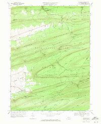
 1943 Lewistown1943 Print · USGSCentral Pennsylvania's rugged ridge-and-valley landscape is documented here during the mid-forties, showing the deep integration of rail lines and mountain gaps. Genealogists can trace family footprints through numerous rural landmarks like Emma Chapel, Mattern Junction, and the McNitt School.
 - 1944 Map of Lock Haven
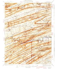
 1944 Lock Haven1944 Print · USGSClinton County during the mid-forties shows a landscape defined by the river-and-rail economy and its transition to early aviation. Genealogists can trace family names at rural sites like Gravel Hill School, Fairpoint Church, and the industrial village of Woolrich.
 - 1950 Map of Harrisburg, 1952 Print
 1950 Harrisburg1952 Print · USGSMid-century Central Pennsylvania comes alive through its dense rail networks and river valley settlements during the post-war industrial era. Genealogists and historians can trace family roots through hubs like Harrisburg, locate Carlisle Barracks, or follow the Pennsylvania RR through the Lebanon Valley.
 - 1954 Map of Williamsport
 1954 Williamsport1954 Print · USGSNorth-central Pennsylvania in the mid-fifties is defined by the winding West Branch Susquehanna River and its industrial valley. Local historians can trace the massive Susquehanna Ordnance Depot and the extensive rail networks of the Pennsylvania Railroad.
 - 1957 Map of Harrisburg
 1957 Harrisburg1957 Print · USGSMid-century Central Pennsylvania comes into focus as a bustling network of rail, river, and mountain ridges. Genealogists and historians can trace the development of the State Capitol and surrounding hubs like Middletown, Columbia, and Pottsville.7 unique versions available
 - 1957 Map of Millheim, 1959 Print
 1957 Millheim1959 Print · USGSThe Pennsylvania Ridge-and-Valley landscape comes to life in the late 1950s, showing the intersection of rural agriculture and state forestry. Researchers can trace historic church sites like St Peters Ch or find recreation spots at Poe Valley State Park and Camp Hironimus.3 unique versions available
 - 1960 Map of Williamsport
 1960 Williamsport1960 Print · USGSNorth-central Pennsylvania in the mid-twentieth century was a vital corridor of rail and river industry stretching from the New York line to the coal regions. Genealogists can trace the rail networks of the Pennsylvania RR and Lehigh Valley RR connecting towns like Williamsport, Towanda, and Lock Haven.
 - 1961 Map of Harrisburg
 1961 Harrisburg1961 Print · USGSCentral Pennsylvania is shown at a mid-century peak of industrial and military activity, from the Susquehanna water gaps to the fertile Dutch Country. Genealogists and historians can trace the rail corridors of the Pennsylvania RR and find landmarks like Carlisle Barracks or the Anthracite Coal Fields.2 unique versions available
 - 1962 Map of Williamsport, 1966 Print
 1962 Williamsport1966 Print · USGSNorth-central Pennsylvania was a landscape of industrial river hubs and vast state woodlands in the early sixties. Researchers can trace the path of the Pennsylvania Railroad through Williamsport and explore the remote reaches of Bucktail State Park.5 unique versions available
 - 1964 Map of Harrisburg
 1964 Harrisburg1964 Print · USGSCentral Pennsylvania in the mid-fifties reveals a landscape shaped by ridge-and-valley geology and critical Cold War infrastructure. Researchers can trace the massive Indiantown Gap Military Reservation or the rail corridors of the Pennsylvania RR and Reading RR.
 - 1965 Map of Williamsport
 1965 Williamsport1965 Print · USGSNorth-central Pennsylvania in the mid-1960s is defined by the industrial river towns and vast timberlands of the Allegheny Plateau. Researchers can trace historic rail lines like the Erie Lackawanna and Reading as they thread through Williamsport, Lock Haven, and Jersey Shore.
 - 1965 Map of Loganton, 1966 Print
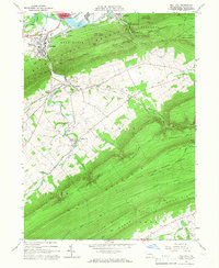
 1965 Loganton1966 Print · USGSCentral Pennsylvania's isolated Sugar Valley is seen here in the mid-1960s, showing a string of agricultural hamlets between forested ridges. Genealogists can locate family sites at Booneville, Greenburr, and the Old Schracktown Cem.3 unique versions available
 - 1965 Map of Mill Hall, 1966 Print
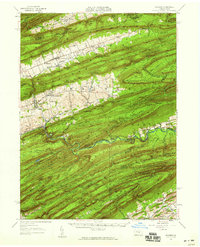
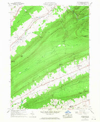
 1965 Mill Hall1966 Print · USGSCentral Pennsylvania’s valley and ridge landscape is captured here in the mid-1960s, showing a mix of industrial hubs and remote state forest. Trace local roots in Mill Hall, Salona, or Mackeyville, and locate family sites like Cedar Hill Cem and the Lamar Sch.3 unique versions available
 - 1966 Map of Williamsport
 1966 Williamsport1966 Print · USGSThe Susquehanna Valley was a hub of transit and industry in the mid-seventies, where the river's West Branch connected major college towns and timberlands. Researchers can trace historical rail lines like the Reading or locate regional landmarks from Jersey Shore to Ricketts Glen State Park.
 - 1966 Map of Madisonburg, 1968 Print
 1966 Madisonburg1968 Print · USGSCentre County at the height of the mid-sixties reveals a landscape of high ridges and agricultural valleys. Genealogists and historians can trace family locations near Madisonburg, the site of Penns Cave, and rural landmarks like St Marks Cem Ch.4 unique versions available
 - 1968 Map of Woodward, 1971 Print
 1968 Woodward1971 Print · USGSPennsylvania’s central ridges are captured here in the late sixties, showing a landscape of state forest lands and narrow valley gaps. Researchers can locate small communities like Woodward and Livonia, or trace old paths and natural features such as Horse Path Spring and Wolfs Store Gap.3 unique versions available
 - 1968 Map of Millheim, 1971 Print
 1968 Millheim1971 Print · USGSIn the late 1960s, these Pennsylvania valleys remained a landscape of tight-knit agricultural villages and steep forested ridges. Genealogists and historians can trace family locations through Aaronsburg and Millheim, finding landmarks like Woodward Cave and Salem Ch.4 unique versions available
 - 1977 Map of Madisonburg, 1979 Print
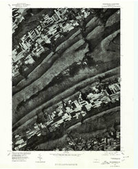 1977 Madisonburg1979 Print · USGSCentre County's ridge-and-valley landscape is captured in this 1970s orthophotograph, showing the rural character of the region. Local researchers can trace field patterns and land use around Madisonburg, Penn s Valley, and Nittany Mountain.
 - 1977 Map of Millheim, 1979 Print
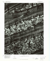 1977 Millheim1979 Print · USGSCentral Pennsylvania's Brush Valley is captured here in the late seventies, showing a landscape defined by traditional agriculture and ridge-top forests. Trace the development of Rebersburg and Millheim along the banks of Elk Creek.
Showing maps 1-25 of 53
Top cities near Logan Township
- Lock Haven historical maps
- Jersey Shore historical maps
- Lamar historical maps
- Mill Hall historical maps
- Avis historical maps
- Flemington historical maps
See more
Top neighborhoods of Logan Township
- Booneville historical maps
- Greenburr historical maps
- Tylersville historical maps
- Logan Mills historical maps
Frequently asked questions
- What are the different types of historical maps available for Logan Township?
- What is the oldest map of Logan Township?
- Where can I purchase historical maps of Logan Township for my home or office?
- Where can I download high-res historical maps of Logan Township?
- Are there historical topographic maps available for Logan Township?
- Is there historical aerial imagery available for Logan Township?
- Where are historical maps of Logan Township sourced from?