Old Maps of Wayne Township, Pennsylvania for Genealogy
Trace your family roots with 46 historic maps of Wayne Township. These high-res maps reveal old neighborhoods, homesites, landmarks, and streets — helping you uncover where your ancestors lived and how the area evolved over time.
- Explore historic neighborhoods: Identify where your relatives may have lived in the 1800s or 1900s.
- Compare maps over time: Trace the changes in streets, buildings, and landmarks for multi-generational research.
- Perfect for genealogy & ancestry research: Used by family historians and researchers to map out lineage and migration.
These maps are an incredible resource for exploring your personal connection to Wayne Township's past.
Wayne Township, PA maps
(46)- 1909 Map of Franklin, 1956 Print
 1909 Franklin1956 Print · USGSVenango County at the dawn of the twentieth century is a landscape defined by the deep meanders of the Allegheny River and a dense network of competing railroads. Genealogists can trace rural life through numerous landmarks like Five Points School, Hickory Grove Church, and the State Institute for Feeble Minded at Polk.2 unique versions available
 - 1911 Map of Franklin
 1911 Franklin1911 Print · USGSVenango County at the peak of the rail era shows the busy confluence of the Allegheny River and French Creek. Trace the legacy of early industrial settlements like Coal City, family landmarks at McKenzie Cors, and the grounds of the State Institute for Feeble Minded.4 unique versions available
 - 1911 Map of Stoneboro, 1960 Print
 1911 Stoneboro1960 Print · USGSMercer County at the height of its rural rail era was a dense network of farming hamlets and local schools. Genealogists can trace family names at Williams Corners, find many one-room schools like Ross School, or locate the hamlet of Fiddlers Green.
 - 1913 Map of Stoneboro
 1913 Stoneboro1913 Print · USGSMercer County at the turn of the century shows a landscape of river-valley agriculture and developing rail lines. Researchers can trace family history through dozens of rural schools like Pike School and settlements such as Sheakleyville or Fiddlers Green.5 unique versions available
 - 1923 Map of Meadville, 1962 Print
 1923 Meadville1962 Print · USGSCrawford County's river valleys and rail corridors are captured here in the early 1920s, centered on the growing industrial hub of Meadville. Researchers can locate dozens of country schoolhouses like Huller School and trace the paths of the Erie R R and Perry Highway.
 - 1925 Map of Meadville
 1925 Meadville1925 Print · USGSCrawford County settlements and rail corridors are captured in detail here during the mid-twenties. Genealogists can locate dozens of family-named schoolhouses and landmarks, from Booths Church to the County Farm and Frenchtown.3 unique versions available
 - 1927 Map of Townville
 1927 Townville1927 Print · USGSNorthwestern Pennsylvania's rural landscape is captured here in the late 1920s, revealing a network of small townships and family settlements. Genealogists can locate family landmarks like the Donation School, Mt Hope Church, and the lakeside community at Sugar Lake.3 unique versions available
 - 1932 Map of Townville
 1932 Townville1932 Print · USGSCrawford and Venango Counties are captured here in the early thirties, showing a rural landscape of crossroads hamlets and family-named schools. Genealogists can trace ancestral sites from Little Cooley to Dempseytown, including landmarks like Wilson Mills and Sugar Lake.2 unique versions available
 - 1943 Map of Meadville
 1943 Meadville1943 Print · USGSCrawford County's river valleys and rail corridors are captured in high detail in the early 1940s, centered on the bustling city of Meadville. Genealogists and researchers can trace local landmarks like the County Farm, dozens of rural schools such as Hatch Sch, and the winding path of the ERIE railroad.
 - 1943 Map of Stoneboro
 1943 Stoneboro1943 Print · USGSMercer County during the Second World War remains a patchwork of rail-side boroughs and family crossroads. Researchers can trace the legacy of early industry and education through landmarks like Reeds Furnace, Stoneboro, and the many rural schoolhouses like Kerrtown Sch.
 - 1945 Map of Townville
 1945 Townville1945 Print · USGSCrawford and Venango Counties are documented here during the late 1920s and early 1940s, showing a landscape of small farming hamlets and rural school districts. Genealogists can trace family roots through numerous named locations like Hamilton Cors, Mt Hope Ch, and the many schools like Sugar Grove Sch.
 - 1950 Map of Cleveland
 1950 Cleveland1950 Print · USGSCovers Wayne Township, including Cleveland, Akron, and other nearby areas
 - 1956 Map of Cleveland, 1967 Print
 1956 Cleveland1967 Print · USGSNortheast Ohio and Western Pennsylvania are shown at their industrial height during the mid-fifties, from the steel mills to the lakeshore. Researchers can trace the massive Ravenna Arsenal, the Ohio Turnpike, and vanished rail sidings of the B & O RR.3 unique versions available
 - 1957 Map of Warren, 1964 Print
 1957 Warren1964 Print · USGSThe northern Pennsylvania oil and timber country comes into focus in the mid-fifties, showing the region before modern highway expansions. Trace the industrial rail networks of the Pennsylvania RR and the early Allegheny River Reservoir near Warren and Oil City.4 unique versions available
 - 1958 Map of Warren
 1958 Warren1958 Print · USGSNorthern Pennsylvania’s timber and oil country is captured here during the late fifties, showing the interplay of industrial valleys and vast state forests. Genealogists can trace family connections across the Cornplanter Indian Reservation or through rail hubs like Oil City and Saint Marys.
 - 1959 Map of Warren
 1959 Warren1959 Print · USGSNorthern Pennsylvania's oil and timber country comes alive in this late-fifties study of the forest-clad plateaus. Trace the historic Cornplanter (Indian Reservation), the sprawling Oil Field, and the rail lines of the Pennsylvania RR.2 unique versions available
 - 1960 Map of New Lebanon, 1962 Print
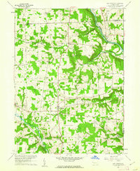 1960 New Lebanon1962 Print · USGSMercer and Crawford counties meet in this 1960s rural landscape where the river and rail converge near Carlton. Researchers can trace old family roots through scattered settlements and sites like Milledgeville Cem, New Lebanon Ch, and Five Points.3 unique versions available
 - 1962 Map of Cleveland
 1962 Cleveland1962 Print · USGSNortheast Ohio and the Pennsylvania borderlands appear here during the industrial peak of the early sixties. Genealogists and historians can trace the expansive rail lines of the Nickel Plate Road and the growth of suburbs from Parma to Lyndhurst.
 - 1963 Map of Utica, 1964 Print
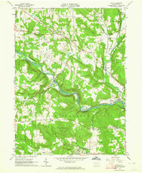 1963 Utica1964 Print · USGSVenango County's river valleys and hills are captured here in the early 1960s, showing the interaction between the winding French Creek and local industry. Genealogists and historians can locate old rural landmarks like Reynolds Ch, the Polk State School campus, and the Erie-Lackawanna rail line.5 unique versions available
 - 1967 Map of Cochranton, 1970 Print
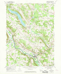 1967 Cochranton1970 Print · USGSPennsylvania's Crawford County comes into focus during the late 1960s, showing a landscape shaped by the French Creek valley and the Erie-Lackawanna railroad. Genealogists can trace family names at numerous crossroads like Frenchtown and Kasters Corners or locate local landmarks including St Marks Ch and Ponce de Leon Spring.2 unique versions available
 - 1967 Map of Sugar Lake, 1972 Print
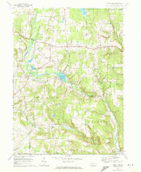 1967 Sugar Lake1972 Print · USGSNorthwestern Pennsylvania's rural townships are captured here in the late sixties, showing a landscape defined by conservation and agriculture. Researchers can locate local landmarks like Black Ash Ch, the Brawley Cem, and the old settlement at Wilson Mills.2 unique versions available
 - 1971 Map of Warren
 1971 Warren1971 Print · USGSNorth Central Pennsylvania is captured here in the early seventies, showing a landscape defined by industrial centers and massive state forests. Genealogists and historians can trace the rail lines of the Penn Central and Erie Lackawanna connecting towns like Warren, Kane, and Du Bois.
 - 1983 Map of Oil City, 1984 Print
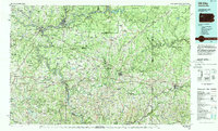 1983 Oil City1984 Print · USGSThe Allegheny and Clarion river valleys are shown in the early eighties as a hub of rail lines and conservation lands. Genealogists can trace family connections in Oil City and Franklin or locate rural sites like the Pennsylvania State Hospital and School and Coal City.
 - 1983 Map of Warren, 1984 Print
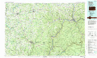 1983 Warren1984 Print · USGSNorthwestern Pennsylvania at the dawn of the 1980s reveals a landscape defined by the petroleum industry and expansive public lands. Trace the legacy of early oil at Drake Well Memorial Park and Pithole City Historical Site, or locate family sites near Warren State Hospital and Kellettville.
 - 1986 Map of Ashtabula
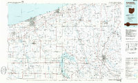 1986 Ashtabula1986 Print · USGSThe Lake Erie shoreline and the rural borderlands of Ohio and Pennsylvania are captured here as they appeared in the 1980s. You can trace industrial rail lines like the BESSEMER AND LAKE ERIE or locate family sites near Kelloggsville Cem and Pymatuning State Park.2 unique versions available
Showing maps 1-25 of 46
Top cities near Wayne Township
- Meadville historical maps
- Cranberry Township historical maps
- Franklin historical maps
- Sugarcreek historical maps
- Cherrytree Township historical maps
- Rockland Township historical maps
See more
Top neighborhoods of Wayne Township
Frequently asked questions
- What are the different types of historical maps available for Wayne Township?
- What is the oldest map of Wayne Township?
- Where can I purchase historical maps of Wayne Township for my home or office?
- Where can I download high-res historical maps of Wayne Township?
- Are there historical topographic maps available for Wayne Township?
- Is there historical aerial imagery available for Wayne Township?
- Where are historical maps of Wayne Township sourced from?