1960s Maps of Cumberland County, Pennsylvania
Explore 10 historic maps of Cumberland County from the 1960s. These maps offer a rare glimpse into what life looked like during the 1960s — showing old roads, neighborhoods, homes, and landmarks that have changed or disappeared over time.
Whether you're researching your family's past, planning a metal detecting trip, or studying how Cumberland County's landscape evolved across the 1960s, these high-resolution maps are a powerful tool for exploring the history of this region.
- Focus on a specific era: All maps on this page are from the 1960s, giving you a focused view of this time period.
- See what’s changed: Compare century-old streets, trails, and buildings to today's modern landscape using overlays and satellite layers.
- Research with precision: Use these maps for genealogy, historical research, land use analysis, or educational projects.
- View, download, or print: Maps are fully viewable online in high resolution, and can be downloaded or printed for your own records.
Start exploring Cumberland County's history through authentic maps from the 1960s. This is your window into the past.
Cumberland County, PA maps
(10)- 1961 Map of Harrisburg
 1961 Harrisburg1961 Print · USGSCentral Pennsylvania is shown at a mid-century peak of industrial and military activity, from the Susquehanna water gaps to the fertile Dutch Country. Genealogists and historians can trace the rail corridors of the Pennsylvania RR and find landmarks like Carlisle Barracks or the Anthracite Coal Fields.2 unique versions available
 - 1961 Map of Baltimore
 1961 Baltimore1961 Print · USGSMaryland and Pennsylvania are captured at a mid-century peak of industrial and military expansion. Genealogists and historians can trace rail corridors like the Western Maryland Ry or locate regional landmarks such as Camp Detrick and Kent Island.
 - 1963 Map of Harrisburg West
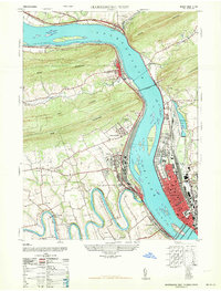 1963 Harrisburg West1963 Print · USGSThe Susquehanna River valley and Pennsylvania's capital region appear here in the early 1960s, showing the intersection of ridge-top wilderness and industrial growth. Genealogists and historians can trace family sites at Mt Zion Church & Cemetery, the Enola rail yards, and Good Hope Mills.
 - 1963 Map of Steelton, 1965 Print
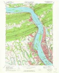
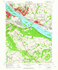 1963 Steelton1965 Print · USGSThe Susquehanna River corridor south of Harrisburg is shown here at its industrial and military peak in the early sixties. Genealogists can trace family names at Paddletown Cem and Fisher Cem or locate the historic Redland Friends Meetinghouse.3 unique versions available
 - 1963 Map of Lemoyne, 1965 Print
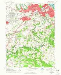 1963 Lemoyne1965 Print · USGSCumberland County was undergoing rapid postwar growth in the early sixties as new suburbs filled the spaces between historic creek-side towns. Genealogists and historians can trace the development of Shiremanstown, the Messiah College campus, and local landmarks like Eberlys Mill and St Johns Cem.5 unique versions available
 - 1964 Map of Harrisburg
 1964 Harrisburg1964 Print · USGSCentral Pennsylvania in the mid-fifties reveals a landscape shaped by ridge-and-valley geology and critical Cold War infrastructure. Researchers can trace the massive Indiantown Gap Military Reservation or the rail corridors of the Pennsylvania RR and Reading RR.
 - 1966 Map of Newburg, 1968 Print
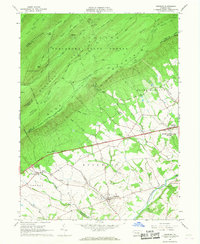 1966 Newburg1968 Print · USGSCumberland County life in the mid-sixties is centered on the valley around Newburg as the modern highway age reshapes the rural landscape. Genealogists can trace family names and local landmarks like Hanna Cem, Hopewell Ch, and the small settlement of McKinney.2 unique versions available
 - 1966 Map of Doylesburg, 1968 Print
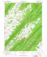 1966 Doylesburg1968 Print · USGSFranklin County's ridge-and-valley landscape is captured here in the mid-1960s, showing a region defined by high timber and narrow farming gaps. Researchers can locate family sites at St Marys Ch Cem, the rural crossroads of Doylesburg, and the path of the Pennsylvania Turnpike.4 unique versions available
 - 1966 Map of Shippensburg, 1968 Print
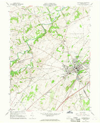 1966 Shippensburg1968 Print · USGSShippensburg and the fertile Cumberland Valley are captured here in the mid-sixties during a period of steady institutional and rail-driven growth. Genealogists and researchers can trace the neighborhoods around Shippensburg State College and the rural villages of Orrstown and Mainsville.3 unique versions available
 - 1969 Map of Harrisburg West, 1972 Print
 1969 Harrisburg West1972 Print · USGSThe Susquehanna River and its massive rail crossings define the Harrisburg area in the late sixties. Genealogists and historians can trace the development of riverfront boroughs like Wormleysburg and find local landmarks such as Good Hope Mill or the Heckton Ch.4 unique versions available
End of results
Showing maps 1-10 of 10
Top cities of Cumberland County
- Carlisle historical maps
- New Cumberland historical maps
- Lower Allen historical maps
- Camp Hill historical maps
- Middlesex Township historical maps
- Schlusser historical maps
See more
Frequently asked questions
- What are the different types of historical maps available for Cumberland County?
- What is the oldest map of Cumberland County?
- Where can I purchase historical maps of Cumberland County for my home or office?
- Where can I download high-res historical maps of Cumberland County?
- Are there historical topographic maps available for Cumberland County?
- Is there historical aerial imagery available for Cumberland County?
- Where are historical maps of Cumberland County sourced from?