Old Maps of Carlisle, Pennsylvania for Genealogy
Trace your family roots with 15 historic maps of Carlisle. These high-res maps reveal old neighborhoods, homesites, landmarks, and streets — helping you uncover where your ancestors lived and how the area evolved over time.
- Explore historic neighborhoods: Identify where your relatives may have lived in the 1800s or 1900s.
- Compare maps over time: Trace the changes in streets, buildings, and landmarks for multi-generational research.
- Perfect for genealogy & ancestry research: Used by family historians and researchers to map out lineage and migration.
These maps are an incredible resource for exploring your personal connection to Carlisle's past.
Carlisle, PA maps
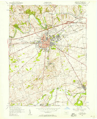
(15)- 1904 Map of Carlisle
 1904 Carlisle1904 Print · USGSCumberland County at the opening of the century is a network of thriving rail hubs and rural gaps. Genealogists and historians can trace the foundations of Carlisle, find the grounds of the Carlisle Indian School, and locate rural landmarks like Salem Church and Boiling Springs.7 unique versions available
 - 1943 Map of Carlisle, 1944 Print
 1943 Carlisle1944 Print · USGSCumberland County during the mid-forties reveals a landscape transitioning between its deep industrial roots and new high-speed transit. Genealogists and historians can trace family locations through numerous rural landmarks like Farmers Academy, Reading Banks, and the Carlisle Barracks.3 unique versions available
 - 1950 Map of Harrisburg, 1952 Print
 1950 Harrisburg1952 Print · USGSMid-century Central Pennsylvania comes alive through its dense rail networks and river valley settlements during the post-war industrial era. Genealogists and historians can trace family roots through hubs like Harrisburg, locate Carlisle Barracks, or follow the Pennsylvania RR through the Lebanon Valley.
 - 1952 Map of Carlisle, 1958 Print
 1952 Carlisle1958 Print · USGSCumberland County at the start of the 1950s shows a landscape defined by its strategic military history and emerging turnpike traffic. Researchers can trace family roots at Westminster Cemetery or locate old school sites like Union Hall School and the Basin Hill School.6 unique versions available
 - 1952 Map of Carlisle, 1959 Print
 1952 Carlisle1959 Print · USGSCumberland County at the midpoint of the century shows a landscape defined by its historic military presence and the emerging Turnpike. Genealogists and hikers can trace the Appalachian Trail over Long Mountain or locate family sites at Churchtown and Deardorffs Mill.2 unique versions available
 - 1957 Map of Harrisburg
 1957 Harrisburg1957 Print · USGSMid-century Central Pennsylvania comes into focus as a bustling network of rail, river, and mountain ridges. Genealogists and historians can trace the development of the State Capitol and surrounding hubs like Middletown, Columbia, and Pottsville.7 unique versions available
 - 1961 Map of Harrisburg
 1961 Harrisburg1961 Print · USGSCentral Pennsylvania is shown at a mid-century peak of industrial and military activity, from the Susquehanna water gaps to the fertile Dutch Country. Genealogists and historians can trace the rail corridors of the Pennsylvania RR and find landmarks like Carlisle Barracks or the Anthracite Coal Fields.2 unique versions available
 - 1964 Map of Harrisburg
 1964 Harrisburg1964 Print · USGSCentral Pennsylvania in the mid-fifties reveals a landscape shaped by ridge-and-valley geology and critical Cold War infrastructure. Researchers can trace the massive Indiantown Gap Military Reservation or the rail corridors of the Pennsylvania RR and Reading RR.
 - 1984 Map of Carlisle, 1985 Print
 1984 Carlisle1985 Print · USGSSouth-central Pennsylvania is shown during the mid-eighties as a hub of military activity and mountain transit. Genealogists and historians can trace the development of Carlisle Barracks and Letterkenny Army Depot, alongside rail routes like Conrail.2 unique versions available
 - 1994 Map of Carlisle, 1999 Print
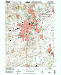 1994 Carlisle1999 Print · USGSCumberland County at the close of the twentieth century shows a landscape where historic military grounds and borough streets meet the fertile valley floor. Trace local roots at Westminster Cem, Springville, or the grounds of the Carlisle Barracks.
 - 2010 Map of Carlisle, 2010 Print
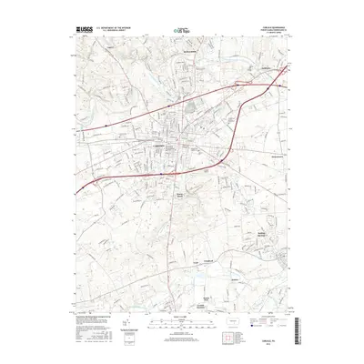
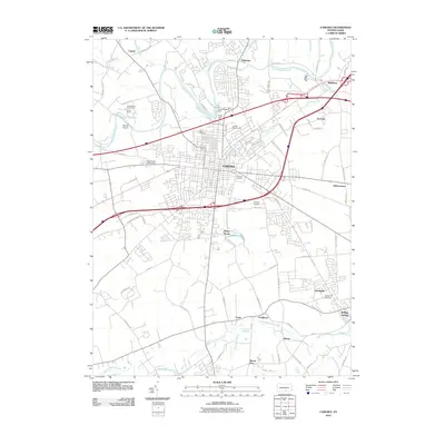 2010 Carlisle2010 Print · USGSCovers Carlisle, including Middlesex Township, Schlusser, and other nearby areas
 - 2013 Map of Carlisle, 2013 Print
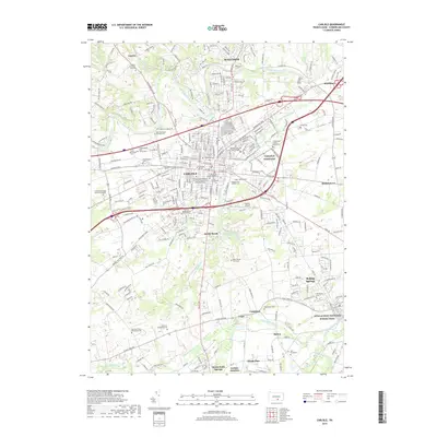
 2013 Carlisle2013 Print · USGSCovers Carlisle, including Middlesex Township, Schlusser, and other nearby areas
 - 2016 Map of Carlisle, 2016 Print
 2016 Carlisle2016 Print · USGSCovers Carlisle, including Middlesex Township, Schlusser, and other nearby areas
 - 2019 Map of Carlisle, 2019 Print
 2019 Carlisle2019 Print · USGSCovers Carlisle, including Middlesex Township, Schlusser, and other nearby areas
 - 2023 Map of Carlisle, 2023 Print
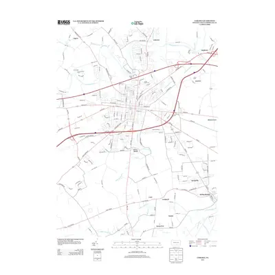
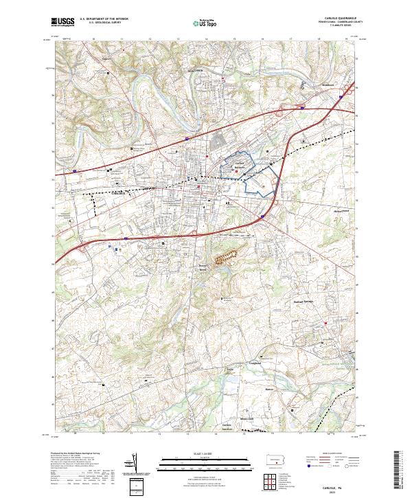 2023 Carlisle2023 Print · USGSCumberland County at the start of the 2020s shows a landscape deeply shaped by its military and academic heritage. Researchers can trace historic lineage at the Old Graveyard, visit the grounds of the Army War College, or locate the Carlisle Indian School Cem.
End of results
Showing maps 1-15 of 15
Top cities near Carlisle
- Lower Allen historical maps
- Middlesex Township historical maps
- Schlusser historical maps
- Dickinson historical maps
- Boiling Springs historical maps
- Latimore Township historical maps
See more
Frequently asked questions
- What are the different types of historical maps available for Carlisle?
- What is the oldest map of Carlisle?
- Where can I purchase historical maps of Carlisle for my home or office?
- Where can I download high-res historical maps of Carlisle?
- Are there historical topographic maps available for Carlisle?
- Is there historical aerial imagery available for Carlisle?
- Where are historical maps of Carlisle sourced from?