1950s Maps of Southampton Township, Pennsylvania
Explore 10 historic maps of Southampton Township from the 1950s. These maps offer a rare glimpse into what life looked like during the 1950s — showing old roads, neighborhoods, homes, and landmarks that have changed or disappeared over time.
Whether you're researching your family's past, planning a metal detecting trip, or studying how Southampton Township's landscape evolved across the 1950s, these high-resolution maps are a powerful tool for exploring the history of this region.
- Focus on a specific era: All maps on this page are from the 1950s, giving you a focused view of this time period.
- See what’s changed: Compare century-old streets, trails, and buildings to today's modern landscape using overlays and satellite layers.
- Research with precision: Use these maps for genealogy, historical research, land use analysis, or educational projects.
- View, download, or print: Maps are fully viewable online in high resolution, and can be downloaded or printed for your own records.
Start exploring Southampton Township's history through authentic maps from the 1950s. This is your window into the past.
Southampton Township, PA maps
(10)- 1950 Map of Harrisburg, 1952 Print
 1950 Harrisburg1952 Print · USGSMid-century Central Pennsylvania comes alive through its dense rail networks and river valley settlements during the post-war industrial era. Genealogists and historians can trace family roots through hubs like Harrisburg, locate Carlisle Barracks, or follow the Pennsylvania RR through the Lebanon Valley.
 - 1951 Map of Fairfield, 1954 Print
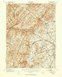 1951 Fairfield1954 Print · USGSSouth Mountain and the Adams County fruit belt are captured here in the early fifties. Genealogists can trace family footprints through numerous rural schools like Pitzer Sch and settlements such as Arendtsville and Maria Furnace.3 unique versions available
 - 1952 Map of Dickinson, 1958 Print
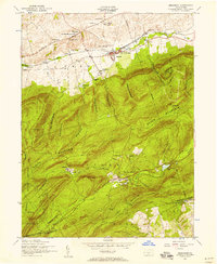 1952 Dickinson1958 Print · USGSCumberland County's agricultural valleys and forested ridges meet in the early fifties as the Reading railroad serves the settlements along the Yellow Breeches. Trace the grounds of the Pine Grove Furnace or locate family sites like Longsdorf Cemetery and Moore Mill.6 unique versions available
 - 1952 Map of Walnut Bottom, 1958 Print
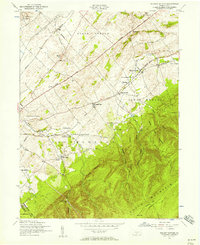 1952 Walnut Bottom1958 Print · USGSCumberland County at the mid-century shows a landscape of ridge-top trails and valley schoolhouses. Genealogists can locate family landmarks like Lees Cross Roads and Cleversburg, or trace the rural routes between Newton Township Consolidated School and Spring Hill School.4 unique versions available
 - 1952 Map of Newville, 1959 Print
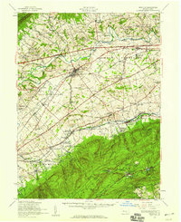 1952 Newville1959 Print · USGSCumberland County communities and traditional farmsteads are documented here in the early fifties, just as the turnpike began to reshape the valley. Genealogists can locate family landmarks like Moors Mill, Bethany Ch, and the many rural schoolhouses from Gillespie Sch to Pine Road Sch.3 unique versions available
 - 1954 Map of Baltimore
 1954 Baltimore1954 Print · USGSThe Mid-Atlantic region in the early fifties shows a landscape of growing suburban centers and heavy rail corridors. Trace mid-century transit networks and military landmarks from the Aberdeen Proving Ground to the Gettysburg National Military Park.
 - 1956 Map of Arendtsville
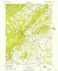 1956 Arendtsville1956 Print · USGSMid-century Adams County is captured in this 1956 survey as an established agricultural landscape of boroughs and orchard lands. Researchers can trace historic local sites like Eicholtz Mill, Sheelys School, and the community of Arendtsville.
 - 1956 Map of Baltimore
 1956 Baltimore1956 Print · USGSMid-century Maryland and Pennsylvania are captured here during a period of massive suburban and military growth across the Chesapeake region. Genealogists and historians can trace the rail corridors of the Baltimore & Ohio RR and locate landmarks like Fort McHenry or the Aberdeen Proving Ground.
 - 1957 Map of Harrisburg
 1957 Harrisburg1957 Print · USGSMid-century Central Pennsylvania comes into focus as a bustling network of rail, river, and mountain ridges. Genealogists and historians can trace the development of the State Capitol and surrounding hubs like Middletown, Columbia, and Pottsville.7 unique versions available
 - 1957 Map of Baltimore, 1964 Print
 1957 Baltimore1964 Print · USGSMaryland and Southern Pennsylvania are shown during the mid-century expansion of the Baltimore-Washington corridor. Researchers can trace the extensive rail lines of the Baltimore & Ohio RR and locate sites like Fort Detrick and Gettysburg National Military Park.5 unique versions available
End of results
Showing maps 1-10 of 10
Top cities near Southampton Township
- Chambersburg historical maps
- Carlisle historical maps
- Gettysburg historical maps
- Quincy Township historical maps
- Shippensburg historical maps
- Dickinson historical maps
See more
Top neighborhoods of Southampton Township
- Chestnut Crossroads historical maps
- Cleversburg historical maps
- Cleversburg Junction historical maps
- Tusculum historical maps
- Lees Cross Roads historical maps
Frequently asked questions
- What are the different types of historical maps available for Southampton Township?
- What is the oldest map of Southampton Township?
- Where can I purchase historical maps of Southampton Township for my home or office?
- Where can I download high-res historical maps of Southampton Township?
- Are there historical topographic maps available for Southampton Township?
- Is there historical aerial imagery available for Southampton Township?
- Where are historical maps of Southampton Township sourced from?