Old Maps of Southampton Township, Pennsylvania for Genealogy
Trace your family roots with 51 historic maps of Southampton Township. These high-res maps reveal old neighborhoods, homesites, landmarks, and streets — helping you uncover where your ancestors lived and how the area evolved over time.
- Explore historic neighborhoods: Identify where your relatives may have lived in the 1800s or 1900s.
- Compare maps over time: Trace the changes in streets, buildings, and landmarks for multi-generational research.
- Perfect for genealogy & ancestry research: Used by family historians and researchers to map out lineage and migration.
These maps are an incredible resource for exploring your personal connection to Southampton Township's past.
Southampton Township, PA maps
(51)- 1909 Map of Fairfield
 1909 Fairfield1909 Print · USGSAdams County at the turn of the century shows a landscape of mountain sanitaria, early iron works, and a dense network of country schoolhouses. Genealogists and researchers can trace the old Western Maryland Railroad route and locate landmarks like Maria Furnace, Cashtown, and the South Mountain Sanatorium.6 unique versions available
 - 1919 Map of Newville
 1919 Newville1919 Print · USGSCumberland County life in the late teens centers on the rail corridors and water mills between the mountains. Trace family roots at Newville or Pine Grove Furnace, and locate rural landmarks like Reiters Mill and Miller Church.6 unique versions available
 - 1923 Map of Shippensburg
 1923 Shippensburg1923 Print · USGSShippensburg and its surrounding valley floor were defined by the rail lines and agricultural networks of the early twentieth century. Genealogists can locate dozens of country schools and churches, including Brookside School, Lurgan Sta, and the State Normal School campus.3 unique versions available
 - 1942 Map of Gettysburg, 1944 Print
 1942 Gettysburg1944 Print · USGSGettysburg and its surrounding borderlands are shown in great detail during the early 1940s, capturing the region's dense network of rural schools and mills. Genealogists can trace family-named landmarks such as Galt Kump PO, Hafers Mill, and Philips Delight Sch.
 - 1943 Map of Shippensburg, 1965 Print
 1943 Shippensburg1965 Print · USGSCumberland and Franklin Counties are captured here during the Second World War as modern infrastructure began to pierce the ridges. Researchers can trace family roots through dozens of rural landmarks like State Normal Sch, Orrstown, and the Union Ch.
 - 1944 Map of Flat Ridge
 1944 Flat Ridge1944 Print · USGSThe South Mountain high country in the mid-1940s is defined by vast state forests and conservation lands. Hikers and historians can trace the Appalachian Trail past Caledonia Park, Strasbaugh School, and the Chambersburg Reservoir.6 unique versions available
 - 1944 Map of Arendtsville
 1944 Arendtsville1944 Print · USGSAdams County orchard country and the eastern slopes of South Mountain are captured here during the mid-1940s. Genealogists and local historians can locate several rural schoolhouses, including Shellys School, and old mill sites like Genoltz Mill near Arendtsville.7 unique versions available
 - 1945 Map of Newville
 1945 Newville1945 Print · USGSCumberland County at the end of the war shows a landscape where the new turnpike crosses a valley of established farms and mills. Researchers can trace family-named sites like Elliotts Mill, the Greythorne Walnut Bottom PO, and schools like Bluehill Sch.
 - 1945 Map of Shippensburg
 1945 Shippensburg1945 Print · USGSCumberland and Franklin counties meet at the base of the ridges in the mid-1940s, just as modern infrastructure begins to reshape the valley. Genealogists and historians can trace numerous rural schoolhouses like Clay Hill Sch and early infrastructure like the Kittatinny Tunnel and State Normal Sch.
 - 1948 Map of Baltimore
 1948 Baltimore1948 Print · USGSMaryland and Pennsylvania crossroads are captured in the late 1940s, showing a landscape defined by historic rail lines and major military installations. Genealogists can trace family connections in Gettysburg, Westminster, and near the U.S. Naval Academy in Annapolis.2 unique versions available
 - 1950 Map of Harrisburg, 1952 Print
 1950 Harrisburg1952 Print · USGSMid-century Central Pennsylvania comes alive through its dense rail networks and river valley settlements during the post-war industrial era. Genealogists and historians can trace family roots through hubs like Harrisburg, locate Carlisle Barracks, or follow the Pennsylvania RR through the Lebanon Valley.
 - 1951 Map of Fairfield, 1954 Print
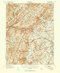 1951 Fairfield1954 Print · USGSSouth Mountain and the Adams County fruit belt are captured here in the early fifties. Genealogists can trace family footprints through numerous rural schools like Pitzer Sch and settlements such as Arendtsville and Maria Furnace.3 unique versions available
 - 1952 Map of Dickinson, 1958 Print
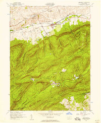 1952 Dickinson1958 Print · USGSCumberland County's agricultural valleys and forested ridges meet in the early fifties as the Reading railroad serves the settlements along the Yellow Breeches. Trace the grounds of the Pine Grove Furnace or locate family sites like Longsdorf Cemetery and Moore Mill.6 unique versions available
 - 1952 Map of Walnut Bottom, 1958 Print
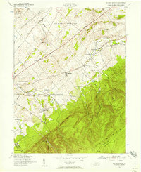 1952 Walnut Bottom1958 Print · USGSCumberland County at the mid-century shows a landscape of ridge-top trails and valley schoolhouses. Genealogists can locate family landmarks like Lees Cross Roads and Cleversburg, or trace the rural routes between Newton Township Consolidated School and Spring Hill School.4 unique versions available
 - 1952 Map of Newville, 1959 Print
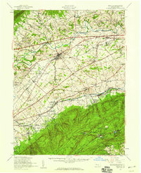 1952 Newville1959 Print · USGSCumberland County communities and traditional farmsteads are documented here in the early fifties, just as the turnpike began to reshape the valley. Genealogists can locate family landmarks like Moors Mill, Bethany Ch, and the many rural schoolhouses from Gillespie Sch to Pine Road Sch.3 unique versions available
 - 1954 Map of Baltimore
 1954 Baltimore1954 Print · USGSThe Mid-Atlantic region in the early fifties shows a landscape of growing suburban centers and heavy rail corridors. Trace mid-century transit networks and military landmarks from the Aberdeen Proving Ground to the Gettysburg National Military Park.
 - 1956 Map of Arendtsville
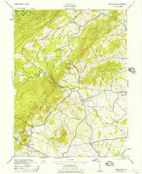 1956 Arendtsville1956 Print · USGSMid-century Adams County is captured in this 1956 survey as an established agricultural landscape of boroughs and orchard lands. Researchers can trace historic local sites like Eicholtz Mill, Sheelys School, and the community of Arendtsville.
 - 1956 Map of Baltimore
 1956 Baltimore1956 Print · USGSMid-century Maryland and Pennsylvania are captured here during a period of massive suburban and military growth across the Chesapeake region. Genealogists and historians can trace the rail corridors of the Baltimore & Ohio RR and locate landmarks like Fort McHenry or the Aberdeen Proving Ground.
 - 1957 Map of Harrisburg
 1957 Harrisburg1957 Print · USGSMid-century Central Pennsylvania comes into focus as a bustling network of rail, river, and mountain ridges. Genealogists and historians can trace the development of the State Capitol and surrounding hubs like Middletown, Columbia, and Pottsville.7 unique versions available
 - 1957 Map of Baltimore, 1964 Print
 1957 Baltimore1964 Print · USGSMaryland and Southern Pennsylvania are shown during the mid-century expansion of the Baltimore-Washington corridor. Researchers can trace the extensive rail lines of the Baltimore & Ohio RR and locate sites like Fort Detrick and Gettysburg National Military Park.5 unique versions available
 - 1961 Map of Harrisburg
 1961 Harrisburg1961 Print · USGSCentral Pennsylvania is shown at a mid-century peak of industrial and military activity, from the Susquehanna water gaps to the fertile Dutch Country. Genealogists and historians can trace the rail corridors of the Pennsylvania RR and find landmarks like Carlisle Barracks or the Anthracite Coal Fields.2 unique versions available
 - 1961 Map of Baltimore
 1961 Baltimore1961 Print · USGSMaryland and Pennsylvania are captured at a mid-century peak of industrial and military expansion. Genealogists and historians can trace rail corridors like the Western Maryland Ry or locate regional landmarks such as Camp Detrick and Kent Island.
 - 1964 Map of Harrisburg
 1964 Harrisburg1964 Print · USGSCentral Pennsylvania in the mid-fifties reveals a landscape shaped by ridge-and-valley geology and critical Cold War infrastructure. Researchers can trace the massive Indiantown Gap Military Reservation or the rail corridors of the Pennsylvania RR and Reading RR.
 - 1966 Map of Shippensburg, 1968 Print
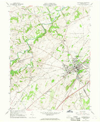 1966 Shippensburg1968 Print · USGSShippensburg and the fertile Cumberland Valley are captured here in the mid-sixties during a period of steady institutional and rail-driven growth. Genealogists and researchers can trace the neighborhoods around Shippensburg State College and the rural villages of Orrstown and Mainsville.3 unique versions available
 - 1983 Map of Hagerstown, 1984 Print
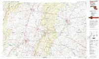 1983 Hagerstown1984 Print · USGSThe tri-state borderlands of Maryland, Pennsylvania, and West Virginia are shown in the early eighties as a hub of military installations and valley towns. Genealogists and historians can trace the landscape from Gettysburg National Military Park to the banks of the Potomac River.2 unique versions available
Showing maps 1-25 of 51
Top cities near Southampton Township
- Chambersburg historical maps
- Carlisle historical maps
- Gettysburg historical maps
- Quincy Township historical maps
- Shippensburg historical maps
- Dickinson historical maps
See more
Top neighborhoods of Southampton Township
- Chestnut Crossroads historical maps
- Cleversburg historical maps
- Cleversburg Junction historical maps
- Tusculum historical maps
- Lees Cross Roads historical maps
Frequently asked questions
- What are the different types of historical maps available for Southampton Township?
- What is the oldest map of Southampton Township?
- Where can I purchase historical maps of Southampton Township for my home or office?
- Where can I download high-res historical maps of Southampton Township?
- Are there historical topographic maps available for Southampton Township?
- Is there historical aerial imagery available for Southampton Township?
- Where are historical maps of Southampton Township sourced from?