2020s Maps of Elliotts Mill, West Pennsboro Township
Explore 1 historic maps of Elliotts Mill from the 2020s. These maps offer a rare glimpse into what life looked like during the 2020s — showing old roads, neighborhoods, homes, and landmarks that have changed or disappeared over time.
Whether you're researching your family's past, planning a metal detecting trip, or studying how Elliotts Mill's landscape evolved across the 2020s, these high-resolution maps are a powerful tool for exploring the history of this region.
- Focus on a specific era: All maps on this page are from the 2020s, giving you a focused view of this time period.
- See what’s changed: Compare century-old streets, trails, and buildings to today's modern landscape using overlays and satellite layers.
- Research with precision: Use these maps for genealogy, historical research, land use analysis, or educational projects.
- View, download, or print: Maps are fully viewable online in high resolution, and can be downloaded or printed for your own records.
Start exploring Elliotts Mill's history through authentic maps from the 2020s. This is your window into the past.
Elliotts Mill, West Pennsboro Township maps
(1)- 2023 Map of Plainfield, 2023 Print
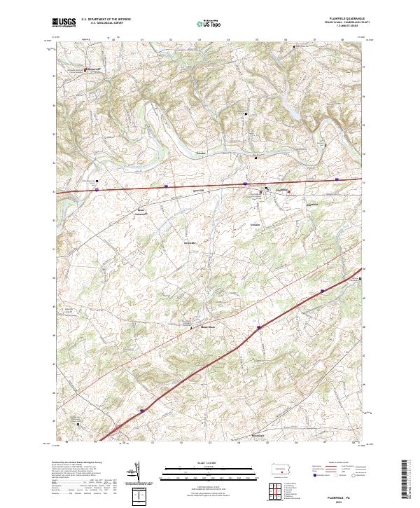 2023 Plainfield2023 Print · USGSCumberland County’s valley floor is mapped here in the modern era, revealing a landscape still defined by its traditional farmsteads and historic churchyards. Researchers can locate numerous ancestral sites including the Blosserville Reformed Church Graveyard and Salem Stone Church Cem.
End of results
Showing maps 1-1 of 1
Top cities near Elliotts Mill
- Carlisle historical maps
- Middlesex Township historical maps
- Schlusser historical maps
- Dickinson historical maps
- Boiling Springs historical maps
- Latimore Township historical maps
See more
Frequently asked questions
- What are the different types of historical maps available for Elliotts Mill?
- What is the oldest map of Elliotts Mill?
- Where can I purchase historical maps of Elliotts Mill for my home or office?
- Where can I download high-res historical maps of Elliotts Mill?
- Are there historical topographic maps available for Elliotts Mill?
- Is there historical aerial imagery available for Elliotts Mill?
- Where are historical maps of Elliotts Mill sourced from?