1960s Maps of Jackson Township, Pennsylvania
Explore 9 historic maps of Jackson Township from the 1960s. These maps offer a rare glimpse into what life looked like during the 1960s — showing old roads, neighborhoods, homes, and landmarks that have changed or disappeared over time.
Whether you're researching your family's past, planning a metal detecting trip, or studying how Jackson Township's landscape evolved across the 1960s, these high-resolution maps are a powerful tool for exploring the history of this region.
- Focus on a specific era: All maps on this page are from the 1960s, giving you a focused view of this time period.
- See what’s changed: Compare century-old streets, trails, and buildings to today's modern landscape using overlays and satellite layers.
- Research with precision: Use these maps for genealogy, historical research, land use analysis, or educational projects.
- View, download, or print: Maps are fully viewable online in high resolution, and can be downloaded or printed for your own records.
Start exploring Jackson Township's history through authentic maps from the 1960s. This is your window into the past.
Jackson Township, PA maps
(9)- 1961 Map of Harrisburg
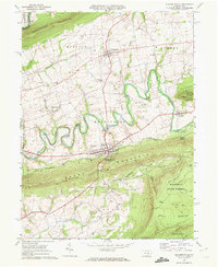
 1961 Harrisburg1961 Print · USGSCentral Pennsylvania is shown at a mid-century peak of industrial and military activity, from the Susquehanna water gaps to the fertile Dutch Country. Genealogists and historians can trace the rail corridors of the Pennsylvania RR and find landmarks like Carlisle Barracks or the Anthracite Coal Fields.2 unique versions available
 - 1964 Map of Harrisburg
 1964 Harrisburg1964 Print · USGSCentral Pennsylvania in the mid-fifties reveals a landscape shaped by ridge-and-valley geology and critical Cold War infrastructure. Researchers can trace the massive Indiantown Gap Military Reservation or the rail corridors of the Pennsylvania RR and Reading RR.
 - 1968 Map of Tower City
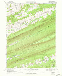
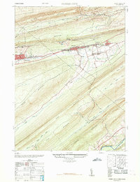 1968 Tower City1968 Print · USGSThe anthracite region's industrial footprint is on full display here in the late sixties, where valley towns are hemmed in by massive mountain ridges. Genealogists and historians can trace the foundations of Tower City and Williamstown alongside an Abandoned Coal Breaker and several local schools.
 - 1969 Map of Halifax, 1972 Print
 1969 Halifax1972 Print · USGSThe Susquehanna River corridor at the end of the 1960s reveals a landscape of river-crossing settlements and mountain ridges. Trace the river economy and rail routes through Halifax, or locate family sites like Victoria Furnace and Fetterhoff Ch.2 unique versions available
 - 1969 Map of Lykens, 1972 Print
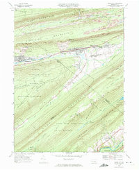
 1969 Lykens1972 Print · USGSDauphin County coal country comes into sharp focus during the late sixties as industry and local recreation overlap. Researchers can trace the Penn Central rail corridor and find family sites at Fairview Cem or the Williams Valley Sch.4 unique versions available
 - 1969 Map of Tower City, 1972 Print
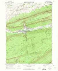
 1969 Tower City1972 Print · USGSSchuylkill and Dauphin counties show a sharp contrast between coal-mining towns and deep mountain forests in the late sixties. Trace the rail-and-road corridor through Tower City and Williamstown or find the remote paths of the Appalachian Trail and Bendigo Airfield.4 unique versions available
 - 1969 Map of Elizabethville, 1972 Print
 1969 Elizabethville1972 Print · USGSDauphin County’s ridge-and-valley landscape is captured here in the late sixties, showing the agricultural and industrial character of the Wiconisco Creek valley. Researchers can locate family landmarks such as St Johns Ch, Maple Grove Cem, and the historic Oakdale Station along the Penn Central tracks.2 unique versions available
 - 1969 Map of Enders, 1972 Print
 1969 Enders1972 Print · USGSDauphin County’s ridge-and-valley landscape is shown in detail during the late sixties, highlighting the intersection of mountain wilderness and small-town life. Genealogists and hikers can trace the Appalachian Trail past the Stony Mountain Lookout Tower or locate family sites at Gusler Cem and Victoria Furnace.4 unique versions available
 - 1969 Map of Millersburg, 1972 Print
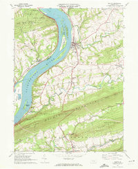
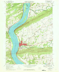 1969 Millersburg1972 Print · USGSThe Susquehanna River valley near Millersburg comes alive in the late sixties, showcasing the area's rail-and-river heritage. Genealogists and historians can trace family-named sites like Rickard Memorial Cem Ch, the historic Ferry, and Montgomery Ferry.4 unique versions available
End of results
Showing maps 1-9 of 9
Top cities near Jackson Township
- Harrisburg historical maps
- Colonial Park historical maps
- Hershey historical maps
- Palmyra historical maps
- Linglestown historical maps
- Enola historical maps
See more
Top neighborhoods of Jackson Township
Frequently asked questions
- What are the different types of historical maps available for Jackson Township?
- What is the oldest map of Jackson Township?
- Where can I purchase historical maps of Jackson Township for my home or office?
- Where can I download high-res historical maps of Jackson Township?
- Are there historical topographic maps available for Jackson Township?
- Is there historical aerial imagery available for Jackson Township?
- Where are historical maps of Jackson Township sourced from?