1900s (20th Century) Maps of Erie County, Pennsylvania
Explore 70 historic maps of Erie County from the 1900s (20th Century). These maps offer a rare glimpse into what life looked like during the 1900s — showing old roads, neighborhoods, homes, and landmarks that have changed or disappeared over time.
Whether you're researching your family's past, planning a metal detecting trip, or studying how Erie County's landscape evolved across the 1900s, these high-resolution maps are a powerful tool for exploring the history of this region.
- Focus on a specific era: All maps on this page are from the 1900s, giving you a focused view of this time period.
- See what’s changed: Compare century-old streets, trails, and buildings to today's modern landscape using overlays and satellite layers.
- Research with precision: Use these maps for genealogy, historical research, land use analysis, or educational projects.
- View, download, or print: Maps are fully viewable online in high resolution, and can be downloaded or printed for your own records.
Start exploring Erie County's history through authentic maps from the 1900s. This is your window into the past.
Erie County, PA maps
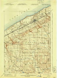
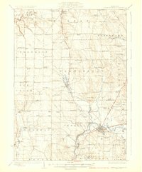
(70)- 1900 Map of Girard
 1900 Girard1900 Print · USGSCovers Erie County, including Fairview Township, Spring Township, and other nearby areas5 unique versions available
 - 1900 Map of Erie
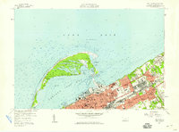
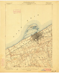 1900 Erie1900 Print · USGSCovers Erie County, including Erie, Harborcreek Township, and other nearby areas8 unique versions available
 - 1900 Map of Fairview
 1900 Fairview1900 Print · USGSCovers Erie County, including Fairview Township, Girard, and other nearby areas5 unique versions available
 - 1906 Map of Conneaut, 1943 Print
 1906 Conneaut1943 Print · USGSCovers Erie County, including Conneaut, Jefferson Township, and other nearby areas2 unique versions available
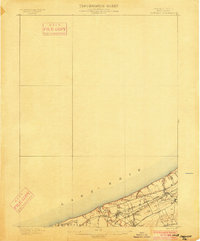
 - 1913 Map of North East, 1962 Print
 1913 North East1962 Print · USGSCovers Erie County, including Harborcreek Township, North East, and other nearby areas
 - 1915 Map of North East
 1915 North East1915 Print · USGSCovers Erie County, including Harborcreek Township, North East, and other nearby areas5 unique versions available
 - 1923 Map of Cambridge Springs, 1964 Print
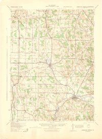
 1923 Cambridge Springs1964 Print · USGSCovers Erie County, including Fairview Township, Edinboro, and other nearby areas
 - 1925 Map of Cambridge Springs
 1925 Cambridge Springs1925 Print · USGSCovers Erie County, including Fairview Township, Edinboro, and other nearby areas4 unique versions available
 - 1929 Map of Corry
 1929 Corry1929 Print · USGSCovers Erie County, including Corry, Harmony, and other nearby areas2 unique versions available
 - 1929 Map of Union City, 1961 Print
 1929 Union City1961 Print · USGSCovers Erie County, including Union City, Waterford, and other nearby areas
 - 1932 Map of Corry
 1932 Corry1932 Print · USGSCovers Erie County, including Corry, Harmony, and other nearby areas3 unique versions available
 - 1932 Map of Union City
 1932 Union City1932 Print · USGSCovers Erie County, including Union City, Waterford, and other nearby areas3 unique versions available
 - 1943 Map of North East
 1943 North East1943 Print · USGSCovers Erie County, including Harborcreek Township, North East, and other nearby areas
 - 1943 Map of Cambridge Springs
 1943 Cambridge Springs1943 Print · USGSCovers Erie County, including Fairview Township, Edinboro, and other nearby areas
 - 1950 Map of Cleveland
 1950 Cleveland1950 Print · USGSCovers Erie County, including Cleveland, Akron, and other nearby areas
 - 1950 Map of Erie, 1953 Print
 1950 Erie1953 Print · USGSCovers Erie County, including London, Erie, and other nearby areas
 - 1956 Map of Cleveland, 1967 Print
 1956 Cleveland1967 Print · USGSCovers Erie County, including Cleveland, Akron, and other nearby areas3 unique versions available
 - 1957 Map of Fairview SW, 1958 Print
 1957 Fairview SW1958 Print · USGSCovers Erie County, including Springfield Township, Girard Township, and other nearby areas3 unique versions available
 - 1957 Map of Fairview, 1958 Print
 1957 Fairview1958 Print · USGSCovers Erie County, including Fairview Township, Girard, and other nearby areas4 unique versions available
 - 1957 Map of Erie South, 1959 Print
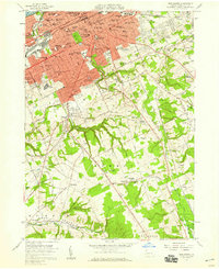 1957 Erie South1959 Print · USGSCovers Erie County, including Erie, Harborcreek Township, and other nearby areas4 unique versions available
 - 1957 Map of Swanville, 1959 Print
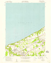
 1957 Swanville1959 Print · USGSCovers Erie County, including Erie, Fairview Township, and other nearby areas5 unique versions available
 - 1957 Map of Erie North, 1959 Print
 1957 Erie North1959 Print · USGSCovers Erie County, including Erie, Harborcreek Township, and other nearby areas4 unique versions available
 - 1957 Map of Warren, 1964 Print
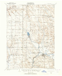
 1957 Warren1964 Print · USGSCovers Erie County, including Saint Marys, Sandy Township, and other nearby areas4 unique versions available
 - 1958 Map of Warren
 1958 Warren1958 Print · USGSCovers Erie County, including Saint Marys, Sandy Township, and other nearby areas
 - 1959 Map of Warren
 1959 Warren1959 Print · USGSCovers Erie County, including Saint Marys, Sandy Township, and other nearby areas2 unique versions available
Showing maps 1-25 of 70
Top cities of Erie County
- Erie historical maps
- Harborcreek Township historical maps
- Fairview Township historical maps
- North East historical maps
- Corry historical maps
- Edinboro historical maps
See more
Frequently asked questions
- What are the different types of historical maps available for Erie County?
- What is the oldest map of Erie County?
- Where can I purchase historical maps of Erie County for my home or office?
- Where can I download high-res historical maps of Erie County?
- Are there historical topographic maps available for Erie County?
- Is there historical aerial imagery available for Erie County?
- Where are historical maps of Erie County sourced from?