2020s Maps of Concord Township, Pennsylvania
Explore 6 historic maps of Concord Township from the 2020s. These maps offer a rare glimpse into what life looked like during the 2020s — showing old roads, neighborhoods, homes, and landmarks that have changed or disappeared over time.
Whether you're researching your family's past, planning a metal detecting trip, or studying how Concord Township's landscape evolved across the 2020s, these high-resolution maps are a powerful tool for exploring the history of this region.
- Focus on a specific era: All maps on this page are from the 2020s, giving you a focused view of this time period.
- See what’s changed: Compare century-old streets, trails, and buildings to today's modern landscape using overlays and satellite layers.
- Research with precision: Use these maps for genealogy, historical research, land use analysis, or educational projects.
- View, download, or print: Maps are fully viewable online in high resolution, and can be downloaded or printed for your own records.
Start exploring Concord Township's history through authentic maps from the 2020s. This is your window into the past.
Concord Township, PA maps
(6)- 2023 Map of Spring Creek, 2023 Print
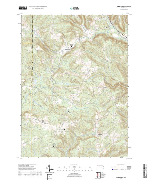 2023 Spring Creek2023 Print · USGSThe rolling hills of Warren County appear here in a recent survey of its rural landscapes and family farmsteads. Genealogists can trace family lines through the Gilson Family Farm Burial Plot, Trimm Cem, and old settlements like Sanford.
 - 2023 Map of Columbus, 2023 Print
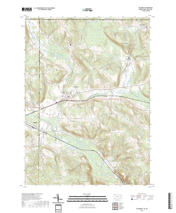 2023 Columbus2023 Print · USGSThe rural valleys of Warren County appear here during the early twenty-first century, centered on the historic crossroads of Columbus. Genealogists can locate family sites at Saint John Cem or trace the old paths of Plank Rd and Brokenstraw Creek.
 - 2023 Map of Corry, 2023 Print
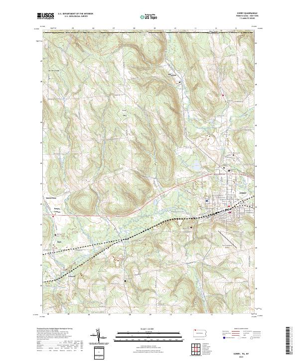 2023 Corry2023 Print · USGSThe Pennsylvania and New York border country comes alive in this contemporary record of the Upper French Creek valley. Genealogists can trace family names through rural landmarks like McCray Cem and Saint Thomas Cem, or explore the crossroads at Ranges Corners and Lovell.
 - 2023 Map of Lake Canadohta, 2023 Print
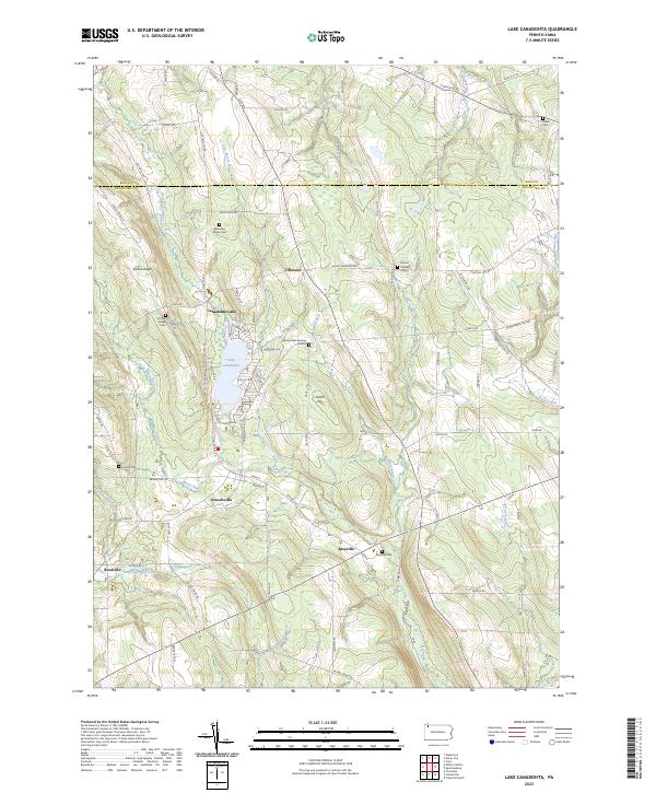 2023 Lake Canadohta2023 Print · USGSNorthwestern Pennsylvania's Crawford County lake country comes into focus in this recent survey, featuring the waters of Lake Canadohta. Genealogists and historians can trace numerous burial sites including Bloomfield Burying Ground and Riceville Cem, alongside the village of Lincolnville.
 - 2023 Map of Spartansburg, 2023 Print
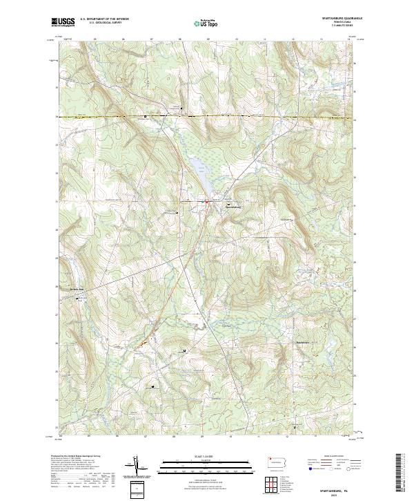 2023 Spartansburg2023 Print · USGSCrawford County's rural character remains prominent in the twenty-first century, centered on the historic borough of Spartansburg. Researchers can trace old family burial sites and rural outposts including McKuhn Farm Cem, Fish Flats, and Britton Run Cem.
 - 2023 Map of Union City, 2023 Print
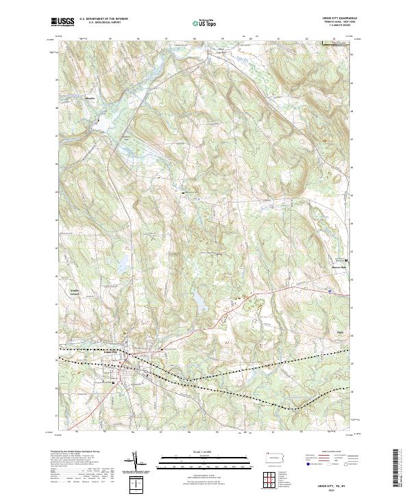 2023 Union City2023 Print · USGSThe Erie County countryside near Union City comes into focus in this contemporary survey of the Pennsylvania-New York borderlands. Researchers can locate several burial sites including Thompson Pioneer Cem and Lawn Cem of Beaverdam, alongside rural settlements like Elgin and Arbuckle.
End of results
Showing maps 1-6 of 6
Top cities near Concord Township
- Harborcreek Township historical maps
- Corry historical maps
- Union City historical maps
- North Harmony historical maps
- Harmony historical maps
- Columbus historical maps
See more
Top neighborhoods of Concord Township
Frequently asked questions
- What are the different types of historical maps available for Concord Township?
- What is the oldest map of Concord Township?
- Where can I purchase historical maps of Concord Township for my home or office?
- Where can I download high-res historical maps of Concord Township?
- Are there historical topographic maps available for Concord Township?
- Is there historical aerial imagery available for Concord Township?
- Where are historical maps of Concord Township sourced from?