1960s Maps of Greene Township, Pennsylvania
Explore 8 historic maps of Greene Township from the 1960s. These maps offer a rare glimpse into what life looked like during the 1960s — showing old roads, neighborhoods, homes, and landmarks that have changed or disappeared over time.
Whether you're researching your family's past, planning a metal detecting trip, or studying how Greene Township's landscape evolved across the 1960s, these high-resolution maps are a powerful tool for exploring the history of this region.
- Focus on a specific era: All maps on this page are from the 1960s, giving you a focused view of this time period.
- See what’s changed: Compare century-old streets, trails, and buildings to today's modern landscape using overlays and satellite layers.
- Research with precision: Use these maps for genealogy, historical research, land use analysis, or educational projects.
- View, download, or print: Maps are fully viewable online in high resolution, and can be downloaded or printed for your own records.
Start exploring Greene Township's history through authentic maps from the 1960s. This is your window into the past.
Greene Township, PA maps
(8)- 1960 Map of Buffalo
 1960 Buffalo1960 Print · USGSWestern New York and the Niagara Peninsula thrive during the mid-twentieth century industrial peak. Genealogists and historians can trace family-named points and early settlements from Dunkirk Light to the Allegany Indian Reservation.
 - 1960 Map of Hammett, 1962 Print
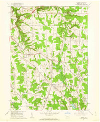 1960 Hammett1962 Print · USGSSoutheast of Erie in the early sixties, this region reveals a transition from college campus and gorge terrain to crossroads farming hamlets. Researchers can trace family sites near Kuhl Cem, St Boniface Sch & Ch, or the old Kuhl Road Speedway.3 unique versions available
 - 1962 Map of Cleveland
 1962 Cleveland1962 Print · USGSNortheast Ohio and the Pennsylvania borderlands appear here during the industrial peak of the early sixties. Genealogists and historians can trace the expansive rail lines of the Nickel Plate Road and the growth of suburbs from Parma to Lyndhurst.
 - 1962 Map of Buffalo, 1980 Print
 1962 Buffalo1980 Print · USGSThe Niagara Frontier and Western New York are captured here in the early sixties, showing the vital industrial and maritime nexus between the U.S. and Canada. Researchers can trace the path of the Welland Canal, locate the Allegany Indian Reservation, or find family sites near Chautauqua Lake.2 unique versions available
 - 1965 Map of Erie
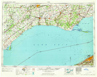 1965 Erie1965 Print · USGSSouthern Ontario and the Pennsylvania shore are captured in the late fifties, showcasing a robust rail-and-water economy. Trace family roots and old harbor towns like Port Stanley or explore the Six Nations Indian Reserve.
 - 1967 Map of Buffalo
 1967 Buffalo1967 Print · USGSWestern New York and the Lake Erie shoreline are shown here during the mid-1960s industrial peak. Researchers can trace the massive rail networks of the Erie Railroad, locate the Cattaraugus Indian Reservation, or find historic sites like Fort Erie.
 - 1967 Map of Cambridge Springs NE, 1972 Print
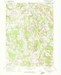 1967 Cambridge Springs NE1972 Print · USGSSouthern Erie County in the late sixties reveals a landscape of enduring rural crossroads and family homesteads. Genealogists can trace the locales of Sibleyville, Draketown, and Edinboro alongside landmarks like Washington Valley Church.3 unique versions available
 - 1967 Map of Waterford, 1973 Print
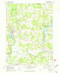 1967 Waterford1973 Print · USGSErie County's southern valleys come into focus in the 1960s, showing a landscape of rail corridors and small rural hamlets. Local historians can trace family-named roads and landmarks from the Covered Bridge near Waterford to the tracks of the Penn Central and Erie-Lackawanna railroads.3 unique versions available
End of results
Showing maps 1-8 of 8
Top cities near Greene Township
- Erie historical maps
- Harborcreek Township historical maps
- Fairview Township historical maps
- North East historical maps
- Edinboro historical maps
- Lawrence Park Township historical maps
See more
Top neighborhoods of Greene Township
- Belleview Heights historical maps
- Kuhl historical maps
- Sampson historical maps
- Weeds Corners historical maps
- West Greene historical maps
- Bogus Corners historical maps
See more
Frequently asked questions
- What are the different types of historical maps available for Greene Township?
- What is the oldest map of Greene Township?
- Where can I purchase historical maps of Greene Township for my home or office?
- Where can I download high-res historical maps of Greene Township?
- Are there historical topographic maps available for Greene Township?
- Is there historical aerial imagery available for Greene Township?
- Where are historical maps of Greene Township sourced from?