Old Maps of Greene Township, Pennsylvania for Hiking & Exploration
Hike through history with 54 historic maps of Greene Township. Explore old trails, ghost towns, and forgotten backroads — perfect for outdoor adventurers and local explorers.
- Rediscover forgotten places: Map out old mining camps, roads, and footpaths that no longer exist on modern maps.
- Layer with modern tools: Combine with LiDAR or satellite views to plan hikes through historical terrain.
- Made for exploration: Popular among hikers, overlanders, and local history lovers.
Use these maps to find adventure and explore the hidden past of Greene Township.
Greene Township, PA maps
(54)- 1899 Map of Erie, 1956 Print
 1899 Erie1956 Print · USGSThe industrial and maritime hub of Erie thrived at the turn of the century, anchored by its protected bay and extensive rail networks. Genealogists can trace family footprints through the street grids of ERIE and outlying hamlets like Wesleyville, Swanville, and Middleboro.
 - 1900 Map of Erie
 1900 Erie1900 Print · USGSLake Erie's shoreline and the growing industrial port of Erie are captured here at the end of the nineteenth century. Researchers can trace the early rail corridors and find local landmarks like West Library, Sterrettania, and the Presque Isle L.H..8 unique versions available
 - 1913 Map of North East, 1962 Print
 1913 North East1962 Print · USGSThe Lake Erie shoreline and the Pennsylvania-New York border come alive in this survey of the pre-war lakefront and interior. Genealogists can locate dozens of early district schools and family landmarks like Colts Station, Lowville, and the McCord School.
 - 1915 Map of North East
 1915 North East1915 Print · USGSCoastal Erie County at the height of its early twentieth-century rail and fruit-growing era shows a landscape transitioning from bustling lake ports to quiet hilltop farmsteads. Genealogists can trace family connections through numerous rural schoolhouses and small hubs like Philipsville, Colts Station, and Moorheadville.5 unique versions available
 - 1923 Map of Cambridge Springs, 1964 Print
 1923 Cambridge Springs1964 Print · USGSNorthwestern Pennsylvania in the 1920s reveals a landscape of rural schoolhouses and electric rail lines. Genealogists can trace family roots through numerous local landmarks like Saints Church, Carmel Cem, and the specialized Northwestern Electric railroad stops.
 - 1925 Map of Cambridge Springs
 1925 Cambridge Springs1925 Print · USGSNorthwestern Pennsylvania in the mid-1920s shows a landscape of busy crossroads and river towns connected by expanding rail lines. Genealogists can locate family-named sites like Mishler Corners and dozens of country schools such as Strong School and Sedgwick School.4 unique versions available
 - 1929 Map of Union City, 1961 Print
 1929 Union City1961 Print · USGSNorthwestern Pennsylvania in the late twenties remains a landscape of busy rail junctions and crossroads hamlets like Wattsburg and Union City. Genealogists can trace family footprints across dozens of local landmarks, including the Cottage Hill Ch, Barton Sch, and Tillotson Corners.
 - 1932 Map of Union City
 1932 Union City1932 Print · USGSNorthwestern Pennsylvania at the dawn of the 1930s reveals a landscape of thriving rail junctions and rural crossroads. Genealogists can trace family landmarks and forgotten hamlets such as Riceville, Mill Village, and the many one-room schools like Bonnell Sch.3 unique versions available
 - 1943 Map of North East
 1943 North East1943 Print · USGSThe Lake Erie shoreline in the early 1940s reveals a landscape of productive orchards and lakeside communities at the Pennsylvania-New York border. Family historians can locate dozens of neighborhood schoolhouses and rural crossroads like Colts Station, Gospel Hill Sch, and Orchard Beach.
 - 1943 Map of Cambridge Springs
 1943 Cambridge Springs1943 Print · USGSNorthwestern Pennsylvania in the early 1940s is shown as a thriving network of small schoolhouses and rail junctions. Genealogists can locate family landmarks like Mitchell Cem, the village of Edinboro, and rural hubs such as Drakes Mills.
 - 1950 Map of Cleveland
 1950 Cleveland1950 Print · USGSCovers Greene Township, including Cleveland, Akron, and other nearby areas
 - 1950 Map of Erie, 1953 Print
 1950 Erie1953 Print · USGSThe northern and southern shores of the Great Lakes meet in the mid-twentieth century, showcasing the vital shipping and rail corridors between Ontario and Pennsylvania. Trace the routes of the Michigan Central railroad or locate coastal landmarks like Presque Isle Light and the settlement of Iona Station.
 - 1956 Map of Cleveland, 1967 Print
 1956 Cleveland1967 Print · USGSNortheast Ohio and Western Pennsylvania are shown at their industrial height during the mid-fifties, from the steel mills to the lakeshore. Researchers can trace the massive Ravenna Arsenal, the Ohio Turnpike, and vanished rail sidings of the B & O RR.3 unique versions available
 - 1957 Map of Erie South, 1959 Print
 1957 Erie South1959 Print · USGSMid-century Erie shows its southern expansion toward the hills of Summit Township just as suburban growth began to accelerate. Genealogists and local researchers can locate numerous parish schools, the sprawling Erie Cemetery, and rural landmarks like St Matthews Ch and Five Points.4 unique versions available
 - 1957 Map of Warren, 1964 Print
 1957 Warren1964 Print · USGSThe northern Pennsylvania oil and timber country comes into focus in the mid-fifties, showing the region before modern highway expansions. Trace the industrial rail networks of the Pennsylvania RR and the early Allegheny River Reservoir near Warren and Oil City.4 unique versions available
 - 1958 Map of Warren
 1958 Warren1958 Print · USGSNorthern Pennsylvania’s timber and oil country is captured here during the late fifties, showing the interplay of industrial valleys and vast state forests. Genealogists can trace family connections across the Cornplanter Indian Reservation or through rail hubs like Oil City and Saint Marys.
 - 1959 Map of Warren
 1959 Warren1959 Print · USGSNorthern Pennsylvania's oil and timber country comes alive in this late-fifties study of the forest-clad plateaus. Trace the historic Cornplanter (Indian Reservation), the sprawling Oil Field, and the rail lines of the Pennsylvania RR.2 unique versions available
 - 1959 Map of Erie, 1974 Print
 1959 Erie1974 Print · USGSCoastal communities and busy international rail lines define the North Shore and Pennsylvania lakefront during the late fifties and early seventies. Researchers can trace historic docklands and depot sites in Erie, Port Burwell, and Simcoe alongside the extensive reaches of Long Point.2 unique versions available
 - 1960 Map of Buffalo
 1960 Buffalo1960 Print · USGSWestern New York and the Niagara Peninsula thrive during the mid-twentieth century industrial peak. Genealogists and historians can trace family-named points and early settlements from Dunkirk Light to the Allegany Indian Reservation.
 - 1960 Map of Hammett, 1962 Print
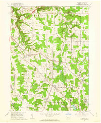 1960 Hammett1962 Print · USGSSoutheast of Erie in the early sixties, this region reveals a transition from college campus and gorge terrain to crossroads farming hamlets. Researchers can trace family sites near Kuhl Cem, St Boniface Sch & Ch, or the old Kuhl Road Speedway.3 unique versions available
 - 1962 Map of Cleveland
 1962 Cleveland1962 Print · USGSNortheast Ohio and the Pennsylvania borderlands appear here during the industrial peak of the early sixties. Genealogists and historians can trace the expansive rail lines of the Nickel Plate Road and the growth of suburbs from Parma to Lyndhurst.
 - 1962 Map of Buffalo, 1980 Print
 1962 Buffalo1980 Print · USGSThe Niagara Frontier and Western New York are captured here in the early sixties, showing the vital industrial and maritime nexus between the U.S. and Canada. Researchers can trace the path of the Welland Canal, locate the Allegany Indian Reservation, or find family sites near Chautauqua Lake.2 unique versions available
 - 1965 Map of Erie
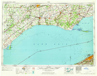 1965 Erie1965 Print · USGSSouthern Ontario and the Pennsylvania shore are captured in the late fifties, showcasing a robust rail-and-water economy. Trace family roots and old harbor towns like Port Stanley or explore the Six Nations Indian Reserve.
 - 1967 Map of Buffalo
 1967 Buffalo1967 Print · USGSWestern New York and the Lake Erie shoreline are shown here during the mid-1960s industrial peak. Researchers can trace the massive rail networks of the Erie Railroad, locate the Cattaraugus Indian Reservation, or find historic sites like Fort Erie.
 - 1967 Map of Cambridge Springs NE, 1972 Print
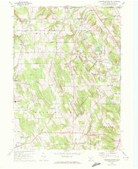 1967 Cambridge Springs NE1972 Print · USGSSouthern Erie County in the late sixties reveals a landscape of enduring rural crossroads and family homesteads. Genealogists can trace the locales of Sibleyville, Draketown, and Edinboro alongside landmarks like Washington Valley Church.3 unique versions available
Showing maps 1-25 of 54
Top cities near Greene Township
- Erie historical maps
- Harborcreek Township historical maps
- Fairview Township historical maps
- North East historical maps
- Edinboro historical maps
- Lawrence Park Township historical maps
See more
Top neighborhoods of Greene Township
- Belleview Heights historical maps
- Kuhl historical maps
- Sampson historical maps
- Weeds Corners historical maps
- West Greene historical maps
- Bogus Corners historical maps
See more
Frequently asked questions
- What are the different types of historical maps available for Greene Township?
- What is the oldest map of Greene Township?
- Where can I purchase historical maps of Greene Township for my home or office?
- Where can I download high-res historical maps of Greene Township?
- Are there historical topographic maps available for Greene Township?
- Is there historical aerial imagery available for Greene Township?
- Where are historical maps of Greene Township sourced from?