Old Maps of North East Township, Pennsylvania for Hiking & Exploration
Hike through history with 27 historic maps of North East Township. Explore old trails, ghost towns, and forgotten backroads — perfect for outdoor adventurers and local explorers.
- Rediscover forgotten places: Map out old mining camps, roads, and footpaths that no longer exist on modern maps.
- Layer with modern tools: Combine with LiDAR or satellite views to plan hikes through historical terrain.
- Made for exploration: Popular among hikers, overlanders, and local history lovers.
Use these maps to find adventure and explore the hidden past of North East Township.
North East Township, PA maps
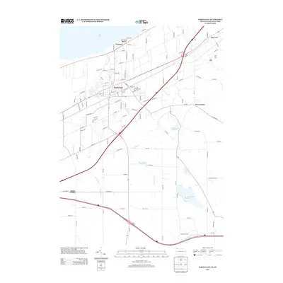
(27)- 1913 Map of North East, 1962 Print
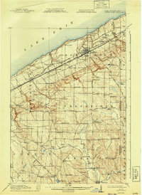
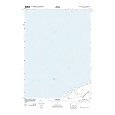
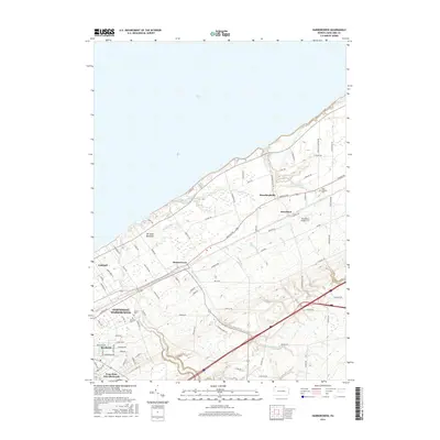
 1913 North East1962 Print · USGSThe Lake Erie shoreline and the Pennsylvania-New York border come alive in this survey of the pre-war lakefront and interior. Genealogists can locate dozens of early district schools and family landmarks like Colts Station, Lowville, and the McCord School.
 - 1915 Map of North East
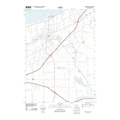
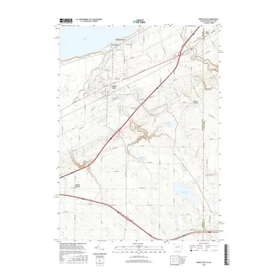
 1915 North East1915 Print · USGSCoastal Erie County at the height of its early twentieth-century rail and fruit-growing era shows a landscape transitioning from bustling lake ports to quiet hilltop farmsteads. Genealogists can trace family connections through numerous rural schoolhouses and small hubs like Philipsville, Colts Station, and Moorheadville.5 unique versions available
 - 1943 Map of North East
 1943 North East1943 Print · USGSThe Lake Erie shoreline in the early 1940s reveals a landscape of productive orchards and lakeside communities at the Pennsylvania-New York border. Family historians can locate dozens of neighborhood schoolhouses and rural crossroads like Colts Station, Gospel Hill Sch, and Orchard Beach.
 - 1960 Map of Buffalo
 1960 Buffalo1960 Print · USGSWestern New York and the Niagara Peninsula thrive during the mid-twentieth century industrial peak. Genealogists and historians can trace family-named points and early settlements from Dunkirk Light to the Allegany Indian Reservation.
 - 1960 Map of North East, 1962 Print
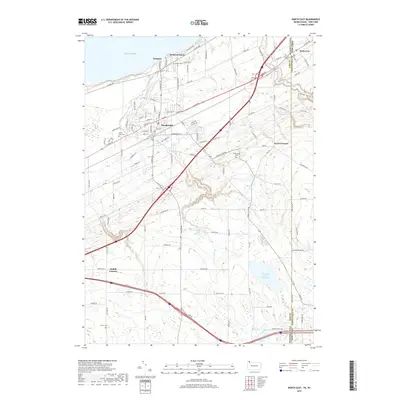
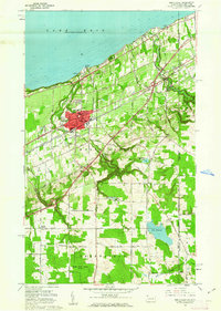 1960 North East1962 Print · USGSThe Lake Erie shoreline in the early 1960s highlights the vital rail and road corridors connecting Pennsylvania to New York. Researchers can trace the layout of North East, identify the campus of St Marys College, and locate rural family hubs like Delhill Corners.4 unique versions available
 - 1960 Map of Harborcreek, 1962 Print
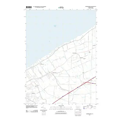
 1960 Harborcreek1962 Print · USGSCoastal Erie County in the early sixties shows a landscape defined by Great Lakes commerce and suburban growth. Researchers can trace the dual rail lines through Harborcreek and locate historical sites like the Moorhead Air Park and St Gregory Cem.3 unique versions available
 - 1962 Map of Buffalo, 1980 Print
 1962 Buffalo1980 Print · USGSThe Niagara Frontier and Western New York are captured here in the early sixties, showing the vital industrial and maritime nexus between the U.S. and Canada. Researchers can trace the path of the Welland Canal, locate the Allegany Indian Reservation, or find family sites near Chautauqua Lake.2 unique versions available
 - 1967 Map of Buffalo
 1967 Buffalo1967 Print · USGSWestern New York and the Lake Erie shoreline are shown here during the mid-1960s industrial peak. Researchers can trace the massive rail networks of the Erie Railroad, locate the Cattaraugus Indian Reservation, or find historic sites like Fort Erie.
 - 1973 Map of Buffalo
 1973 Buffalo1973 Print · USGSWestern New York and Ontario's Golden Horseshoe meet in the early seventies, spanning from the industrial waterfronts of Buffalo to the hills of Allegany State Park. Trace the paths of the Welland Canal and Erie Lackawanna railroad through the lakefront towns of Dunkirk and Port Colborne.
 - 1986 Map of Jamestown
 1986 Jamestown1986 Print · USGSChautauqua County and the Lake Erie shoreline are captured in the mid-eighties as the region balanced its industrial rail hubs with lakeside culture. Local historians can trace the grounds of the Chautauqua Institution, the expansion of Jamestown, and rural landmarks like Sunset Hill Cemetery.2 unique versions available
 - 1996 Map of Harborcreek
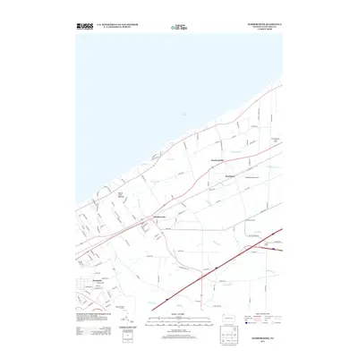
 1996 Harborcreek1996 Print · USGSCoastal Erie County in the mid-nineties shows a landscape of established lakeside communities and ripening transit corridors. Researchers can trace family sites at St Gregory Cem, locate the Drive-in Theater, or study the rail networks of Conrail.
 - 1996 Map of North East, 1997 Print
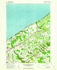
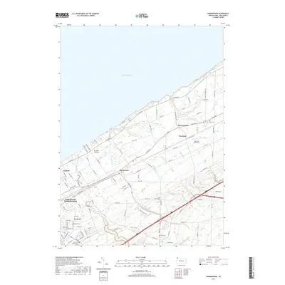
 1996 North East1997 Print · USGSThe Lake Erie shoreline in the mid-1990s reveals a landscape of lakeside recreation, agriculture, and transport at the New York border. Researchers can trace local lineage through sites like Northville Cemetery, Merryhurst College, and the family-named Delhill Corners.
 - 2010 Map of North East OE N, 2010 Print
 2010 North East OE N2010 Print · USGSCovers North East Township, including Ripley, Erie County, and other nearby areas
 - 2010 Map of North East, 2010 Print
 2010 North East2010 Print · USGSCovers North East Township, including North East, Ripley, and other nearby areas
 - 2010 Map of Harborcreek, 2010 Print
 2010 Harborcreek2010 Print · USGSCovers North East Township, including Harborcreek Township, Sheridan Corners, and other nearby areas
 - 2013 Map of Harborcreek, 2013 Print
 2013 Harborcreek2013 Print · USGSCovers North East Township, including Harborcreek Township, Sheridan Corners, and other nearby areas
 - 2013 Map of North East, 2013 Print
 2013 North East2013 Print · USGSCovers North East Township, including North East, Ripley, and other nearby areas
 - 2013 Map of North East OE N, 2013 Print
 2013 North East OE N2013 Print · USGSCovers North East Township, including Ripley, Erie County, and other nearby areas
 - 2016 Map of North East, 2016 Print
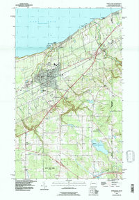
 2016 North East2016 Print · USGSCovers North East Township, including North East, Ripley, and other nearby areas
 - 2016 Map of North East OE N, 2016 Print
 2016 North East OE N2016 Print · USGSCovers North East Township, including Ripley, Erie County, and other nearby areas
 - 2016 Map of Harborcreek, 2016 Print
 2016 Harborcreek2016 Print · USGSCovers North East Township, including Harborcreek Township, Sheridan Corners, and other nearby areas
 - 2019 Map of North East, 2019 Print
 2019 North East2019 Print · USGSCovers North East Township, including North East, Ripley, and other nearby areas
 - 2019 Map of Harborcreek, 2019 Print
 2019 Harborcreek2019 Print · USGSCovers North East Township, including Harborcreek Township, Sheridan Corners, and other nearby areas
 - 2019 Map of North East OE N, 2019 Print
 2019 North East OE N2019 Print · USGSCovers North East Township, including Ripley, Erie County, and other nearby areas
 - 2023 Map of North East OE N, 2023 Print
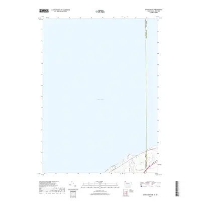
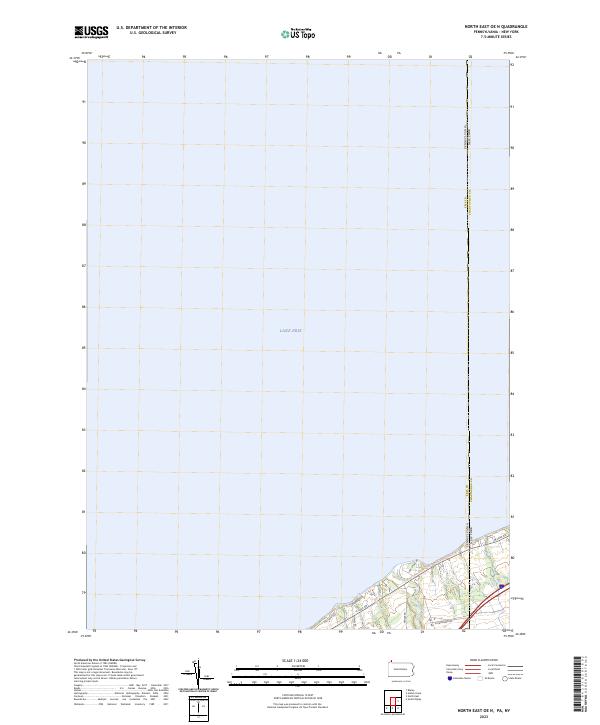 2023 North East OE N2023 Print · USGSThe Pennsylvania and New York border reaches the shoreline of Lake Erie in this recent survey of the coastal corridor. Researchers can trace the path of Twenty-mile Creek and the route of the Great Lakes Seaway Trail as they cross the state line.
Showing maps 1-25 of 27
Top cities near North East Township
- Erie historical maps
- Harborcreek Township historical maps
- North East historical maps
- Westfield historical maps
- Lawrence Park Township historical maps
- Wesleyville historical maps
See more
Top neighborhoods of North East Township
- Northville historical maps
- Kerrs Corners historical maps
- Delhill Corners historical maps
- Orchard Beach historical maps
- Sheridan Corners historical maps
- Freeport historical maps
See more
Frequently asked questions
- What are the different types of historical maps available for North East Township?
- What is the oldest map of North East Township?
- Where can I purchase historical maps of North East Township for my home or office?
- Where can I download high-res historical maps of North East Township?
- Are there historical topographic maps available for North East Township?
- Is there historical aerial imagery available for North East Township?
- Where are historical maps of North East Township sourced from?