2000s (21st Century) Maps of Georges Township, Pennsylvania
Explore 5 historic maps of Georges Township from the 2000s (21st Century). These maps offer a rare glimpse into what life looked like during the 2000s — showing old roads, neighborhoods, homes, and landmarks that have changed or disappeared over time.
Whether you're researching your family's past, planning a metal detecting trip, or studying how Georges Township's landscape evolved across the 2000s, these high-resolution maps are a powerful tool for exploring the history of this region.
- Focus on a specific era: All maps on this page are from the 2000s, giving you a focused view of this time period.
- See what’s changed: Compare century-old streets, trails, and buildings to today's modern landscape using overlays and satellite layers.
- Research with precision: Use these maps for genealogy, historical research, land use analysis, or educational projects.
- View, download, or print: Maps are fully viewable online in high resolution, and can be downloaded or printed for your own records.
Start exploring Georges Township's history through authentic maps from the 2000s. This is your window into the past.
Georges Township, PA maps
(5)- 2023 Map of Brownfield, 2023 Print
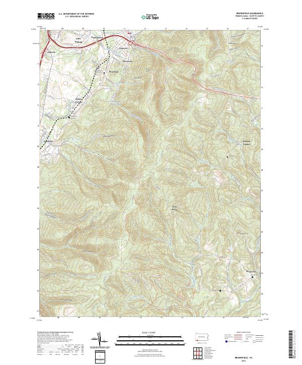 2023 Brownfield2023 Print · USGSModern Fayette County still bears the footprint of its industrial past, from the early ironworks at Wharton Furnace to the quiet hollows of the ridge. Trace family roots at Little White Rock Cem or explore the terrain around Hopwood and Elliottsville.
 - 2023 Map of Smithfield, 2023 Print
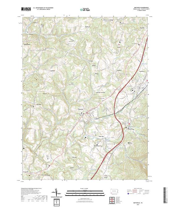 2023 Smithfield2023 Print · USGSSouthwestern Pennsylvania's rolling uplands are revealed in this detailed look at Fayette County's crossroads. Researchers can trace family lineage across dozens of burial grounds like the Mount Moriah Baptist Cem and Saint Joseph's Roman Catholic Cem.
 - 2023 Map of Lake Lynn, 2023 Print
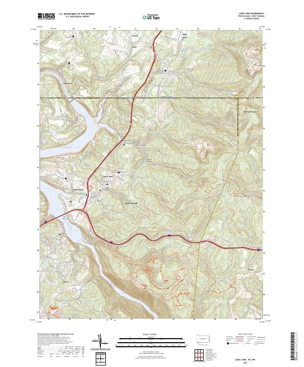 2023 Lake Lynn2023 Print · USGSThe Pennsylvania and West Virginia borderlands come alive on this map, showing the storied landscape surrounding Cheat Lake and the Cheat River. Genealogists and local historians can locate many family-named landmarks and burial sites, including the Baker Family Cem, Ices Ferry, and Gans.
 - 2023 Map of New Salem, 2023 Print
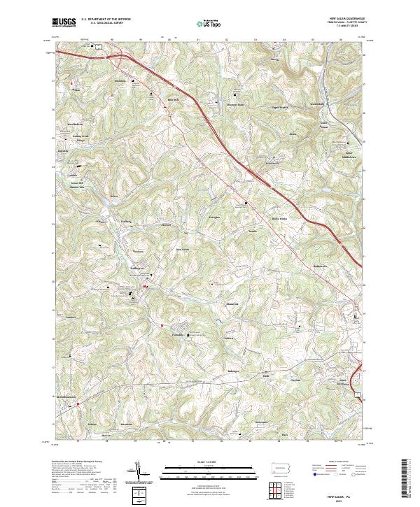 2023 New Salem2023 Print · USGSThe coal-country landscape near New Salem comes into focus in this recent survey. Genealogists can locate family burial sites at Saint Mary's Cem or Salem View Cem and trace the small residential clusters of Upper Peanut and Keisterville.
 - 2023 Map of Bruceton Mills, 2023 Print
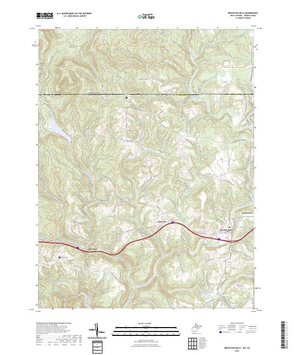 2023 Bruceton Mills2023 Print · USGSThe northern edge of Preston County is captured here at the West Virginia-Pennsylvania border. Local researchers can trace family landmarks and burial sites like Fair View Cem or explore the historic water power sites around Bruceton Mills Lake.
End of results
Showing maps 1-5 of 5
Top cities near Georges Township
- Morgantown historical maps
- Uniontown historical maps
- Connellsville historical maps
- Luzerne Township historical maps
- Westover historical maps
- Masontown historical maps
See more
Top neighborhoods of Georges Township
- Chadville historical maps
- Newcomer historical maps
- Ruble Mill historical maps
- Woodbridgetown historical maps
- York Run historical maps
- Amend historical maps
See more
Frequently asked questions
- What are the different types of historical maps available for Georges Township?
- What is the oldest map of Georges Township?
- Where can I purchase historical maps of Georges Township for my home or office?
- Where can I download high-res historical maps of Georges Township?
- Are there historical topographic maps available for Georges Township?
- Is there historical aerial imagery available for Georges Township?
- Where are historical maps of Georges Township sourced from?