Old Maps of Saltlick Township, Pennsylvania for Genealogy
Trace your family roots with 42 historic maps of Saltlick Township. These high-res maps reveal old neighborhoods, homesites, landmarks, and streets — helping you uncover where your ancestors lived and how the area evolved over time.
- Explore historic neighborhoods: Identify where your relatives may have lived in the 1800s or 1900s.
- Compare maps over time: Trace the changes in streets, buildings, and landmarks for multi-generational research.
- Perfect for genealogy & ancestry research: Used by family historians and researchers to map out lineage and migration.
These maps are an incredible resource for exploring your personal connection to Saltlick Township's past.
Saltlick Township, PA maps
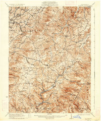
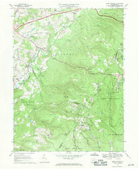
(42)- 1922 Map of Confluence
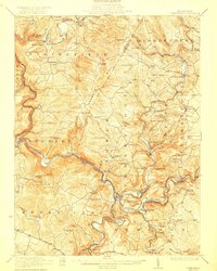 1922 Confluence1922 Print · USGSThe confluence of the Youghiogheny River and Casselman River was a major rail and river hub in the 1920s. Genealogists and local historians can trace the foundations of many small settlements and mountain schools, from Ohiopyle to the Baldwin Mine and Wesley Chapel.3 unique versions available
 - 1922 Map of Donegal
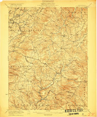 1922 Donegal1922 Print · USGSWestmoreland and Fayette counties are captured here in the early twenties, showing a landscape of mountain ridges and busy valley crossroads. Genealogists can trace family roots through dozens of rural landmarks like St Boniface Chapel, Hoods Mill, and the Snowball School.2 unique versions available
 - 1931 Map of Confluence, 1958 Print
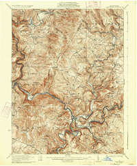
 1931 Confluence1958 Print · USGSThe Laurel Highlands at the start of the 1930s reveal a landscape of deep river valleys and high ridges defined by coal mining and heavy rail. Genealogists can trace family names through dozens of rural sites like Sands Church, Somerfield, and the Mary Ann Mine.2 unique versions available
 - 1933 Map of Confluence
 1933 Confluence1933 Print · USGSThe Laurel Highlands during the early 1930s come into focus through the river networks of Fayette and Somerset counties. Trace family roots at Paddytown or Somerfield, and locate long-gone schoolhouses such as Clay Run School and the Mary Ann Mine.2 unique versions available
 - 1935 Map of Donegal
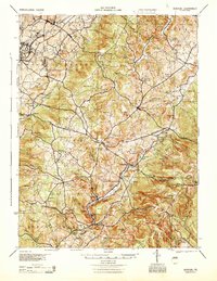
 1935 Donegal1935 Print · USGSWestmoreland County communities are shown here in the 1930s, as coal towns and rural hamlets relied on a network of mountain rail lines and country schools. Genealogists can trace family roots through numerous sites like Stahlstown, the Mansville Post Office, and St Boniface Chapel.2 unique versions available
 - 1944 Map of Donegal, 1945 Print
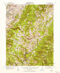
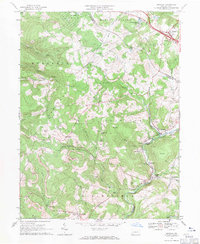
 1944 Donegal1945 Print · USGSWestmoreland and Fayette Counties are shown in the 1940s just as the Pennsylvania Turnpike was changing the landscape. Genealogists and historians can trace dozens of rural schools and churches, from Stauffer Sch to St Boniface Chapel.
 - 1948 Map of Cumberland
 1948 Cumberland1948 Print · USGSMid-century Appalachia and the Shenandoah Valley are shown in detail, documenting the industrial and transportation hubs of the tri-state area. Genealogists can trace family roots through settlements like Double Tollgate and Bunker Hill or along the Baltimore & Ohio RR.3 unique versions available
 - 1952 Map of Cumberland
 1952 Cumberland1952 Print · USGSThe Potomac Highlands and the Shenandoah Valley are revealed in this early 1950s survey of the Appalachian interior. Researchers can trace the river-and-rail corridors connecting Cumberland, Winchester, and the recreational waters of Deep Creek Lake.
 - 1953 Map of Pittsburgh
 1953 Pittsburgh1953 Print · USGSWestern Pennsylvania's industrial landscape at the start of the fifties shows the steel and rail corridors between Pittsburgh and Altoona. Trace family roots in river towns like Tarentum or follow the Pennsylvania Turnpike across Laurel Hill.
 - 1954 Map of Pittsburgh
 1954 Pittsburgh1954 Print · USGSWestern Pennsylvania in the early fifties remains a powerhouse of heavy industry and vital transit corridors. Genealogists and historians can trace the rail-and-river network connecting Pittsburgh, Johnstown, and Altoona via the Pennsylvania RR and the Lincoln Highway.2 unique versions available
 - 1956 Map of Cumberland, 1966 Print
 1956 Cumberland1966 Print · USGSThe tri-state Highlands in the mid-1950s show a landscape shaped by coal, timber, and the massive presence of the Baltimore & Ohio RR. Researchers can trace the industrial corridor from Cumberland through the Allegheny Mountains to mountain retreats like Deep Creek Lake.6 unique versions available
 - 1957 Map of Donegal
 1957 Donegal1957 Print · USGSWestmoreland and Fayette counties are captured here in the late fifties, showing the rural communities along the western slopes of the Laurel Highlands. Genealogists can trace family roots through numerous local landmarks like Norvelt, the Baltimore and Ohio rail line, and the many rural schools including Hurst High School.2 unique versions available
 - 1957 Map of Cumberland
 1957 Cumberland1957 Print · USGSThe Potomac River valley and the ridges of the Allegheny Front define this mid-century landscape at the intersection of Maryland, West Virginia, and Pennsylvania. Trace the steam-era rail lines of the Baltimore and Ohio RR or locate rural landmarks like St Stephens Church and Stony River Dam.
 - 1958 Map of Pittsburgh
 1958 Pittsburgh1958 Print · USGSWestern Pennsylvania in the late fifties shows an industrial heartland defined by the confluence of the Allegheny River and Monongahela River. Researchers can trace the sprawling rail networks of the Pennsylvania RR and find established towns like Butler, Latrobe, and Windber.5 unique versions available
 - 1959 Map of Pittsburgh
 1959 Pittsburgh1959 Print · USGSWestern Pennsylvania in the late fifties is captured here at the height of its industrial era. Genealogists and historians can trace the riverfront growth of Pittsburgh, the rail works at Altoona, and the mountain gaps of Laurel Hill.
 - 1961 Map of Cumberland
 1961 Cumberland1961 Print · USGSThe tri-state highlands of Maryland, West Virginia, and Pennsylvania are shown in the mid-twentieth century as a complex landscape of ridges and river valleys. Researchers can trace the winding Potomac River and find old rail-and-river towns like Cumberland, Keyser, and Morgantown.
 - 1962 Map of Cumberland
 1962 Cumberland1962 Print · USGSThe central Appalachians meet at the height of the mid-century industrial era, showing the rugged topography between Morgantown and Winchester. Genealogists can trace family lands near Fort Necessity or along the vital Baltimore & Ohio RR corridors.
 - 1964 Map of Pittsburgh
 1964 Pittsburgh1964 Print · USGSWestern Pennsylvania in the late fifties and early sixties shows a landscape of powerful river industries and expanding highways. Genealogists and historians can trace the rail corridors of the Pennsylvania RR through industrial hubs like Johnstown, Altoona, and Nanty Glo.
 - 1967 Map of Kingwood, 1970 Print
 1967 Kingwood1970 Print · USGSSomerset County's mountain ridges and river valleys are captured here in the late sixties, showcasing the intersection of traditional settlements and coal extraction. Genealogists can locate old family landmarks like the Kingwood Sch, Old Bethel Ch, and the Covered Bridge at Kings Bridge.3 unique versions available
 - 1967 Map of Seven Springs, 1971 Print
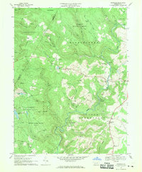
 1967 Seven Springs1971 Print · USGSThe Laurel Highlands during the late sixties show a fascinating transition from quiet mountain hamlets to a premier recreation destination. Genealogists and historians can trace family roots at St Raymonds Cem, explore the early footprint of Seven Springs, and locate the Old Railroad Grade near Kregar.4 unique versions available
 - 1967 Map of Donegal, 1971 Print
 1967 Donegal1971 Print · USGSThe Westmoreland and Fayette county line follows the crest of Chestnut Ridge in the late 1960s. Genealogists and historians can locate remote landmarks like Mt Salem Ch, Brown Cem, and the rail corridor serving Indian Head.4 unique versions available
 - 1977 Map of Kingwood, 1979 Print
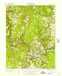
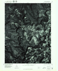 1977 Kingwood1979 Print · USGSSomerset County in the late seventies is revealed in this detailed orthophotograph, showing the rural character of the Pennsylvania highlands. Local historians can trace the exact field lines and homesteads near Kingwood, Barronvale, and Scullion.
 - 1977 Map of Seven Springs, 1979 Print
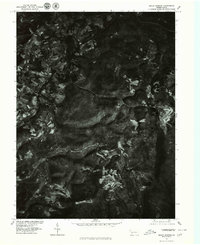 1977 Seven Springs1979 Print · USGSThe Seven Springs mountain region in the late seventies is captured in this detailed orthophotoquad, showing the intersection of dense forest and early resort development. Local historians can trace the clearings for Seven Springs and the small-scale settlement patterns near Champion and Maple Grove.
 - 1979 Map of Morgantown, 1983 Print
 1979 Morgantown1983 Print · USGSThe northern Appalachian borderlands are captured here in the late seventies, showing the tri-state area of West Virginia, Pennsylvania, and Maryland. Genealogists and historians can trace the Mason and Dixon Line through mountain settlements like Markleysburg and across the Youghiogheny River Lake.
 - 1986 Map of Pittsburgh East
 1986 Pittsburgh East1986 Print · USGSWestern Pennsylvania in the mid-eighties shows a landscape defined by industrial rivers and rising mountain ridges. Trace the dense rail networks of CONRAIL and the Pittsburgh and Lake Erie RR connecting historic centers like Monessen, Jeannette, and Connellsville.3 unique versions available
Showing maps 1-25 of 42
Top cities near Saltlick Township
- Connellsville historical maps
- Scottdale historical maps
- Mount Pleasant historical maps
- Youngwood historical maps
- South Connellsville historical maps
- New Stanton historical maps
See more
Top neighborhoods of Saltlick Township
- Coffman historical maps
- Sagamore historical maps
- Maple Grove historical maps
- Melcroft historical maps
- Nebo historical maps
- Clinton historical maps
See more
Frequently asked questions
- What are the different types of historical maps available for Saltlick Township?
- What is the oldest map of Saltlick Township?
- Where can I purchase historical maps of Saltlick Township for my home or office?
- Where can I download high-res historical maps of Saltlick Township?
- Are there historical topographic maps available for Saltlick Township?
- Is there historical aerial imagery available for Saltlick Township?
- Where are historical maps of Saltlick Township sourced from?