2020s Maps of Wharton Township, Pennsylvania
Explore 6 historic maps of Wharton Township from the 2020s. These maps offer a rare glimpse into what life looked like during the 2020s — showing old roads, neighborhoods, homes, and landmarks that have changed or disappeared over time.
Whether you're researching your family's past, planning a metal detecting trip, or studying how Wharton Township's landscape evolved across the 2020s, these high-resolution maps are a powerful tool for exploring the history of this region.
- Focus on a specific era: All maps on this page are from the 2020s, giving you a focused view of this time period.
- See what’s changed: Compare century-old streets, trails, and buildings to today's modern landscape using overlays and satellite layers.
- Research with precision: Use these maps for genealogy, historical research, land use analysis, or educational projects.
- View, download, or print: Maps are fully viewable online in high resolution, and can be downloaded or printed for your own records.
Start exploring Wharton Township's history through authentic maps from the 2020s. This is your window into the past.
Wharton Township, PA maps
(6)- 2023 Map of Brownfield, 2023 Print
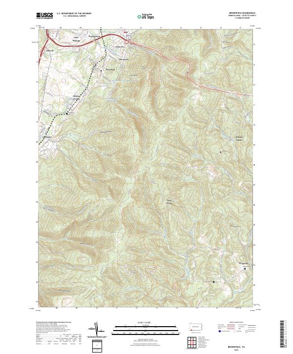 2023 Brownfield2023 Print · USGSModern Fayette County still bears the footprint of its industrial past, from the early ironworks at Wharton Furnace to the quiet hollows of the ridge. Trace family roots at Little White Rock Cem or explore the terrain around Hopwood and Elliottsville.
 - 2023 Map of South Connellsville, 2023 Print
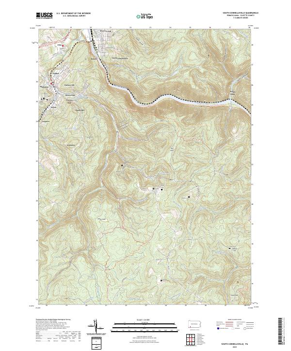 2023 South Connellsville2023 Print · USGSFayette County's river-carved landscape is shown in contemporary detail, tracing the path of the Youghiogheny River and its rail corridors. Genealogists can locate family landmarks like the Hay Family Cem and the Tharp Cem, or trace early settlements at Irishtown and Pechin.
 - 2023 Map of Fort Necessity, 2023 Print
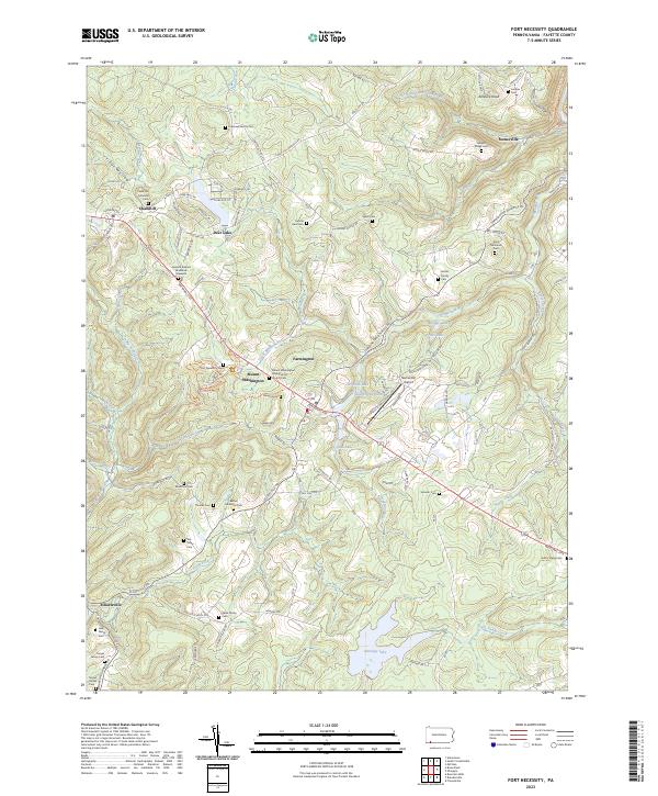 2023 Fort Necessity2023 Print · USGSFayette County’s colonial frontier is preserved here in modern detail, centered on the French and Indian War grounds of the 1750s. Genealogists can trace family lineage through numerous rural burial sites like the Cromwell Family Cem and the General Edward Braddock Gravesite.
 - 2023 Map of Ohiopyle, 2023 Print
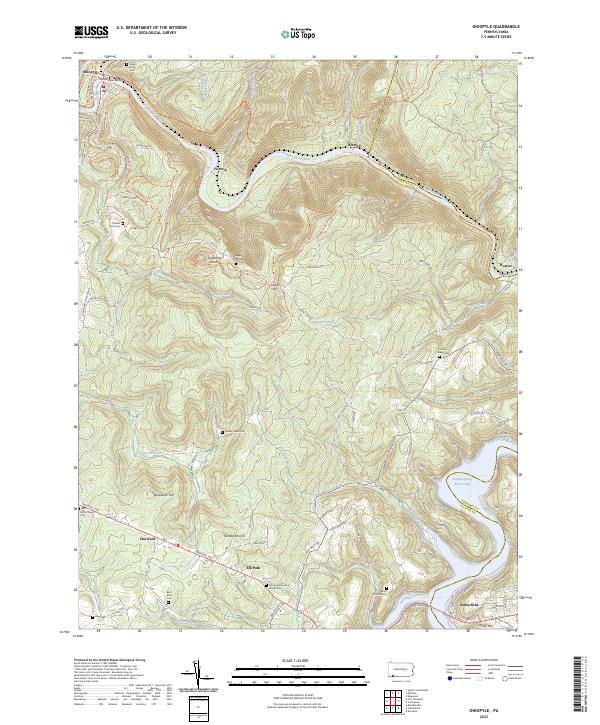 2023 Ohiopyle2023 Print · USGSThe Pennsylvania highlands between Fayette and Somerset counties are shown here in modern detail. Trace family history through numerous small burial sites like Tressler Farm Cemetery and Bird-Burd Cemetery or locate the historic National Pike.
 - 2023 Map of Brandonville, 2023 Print
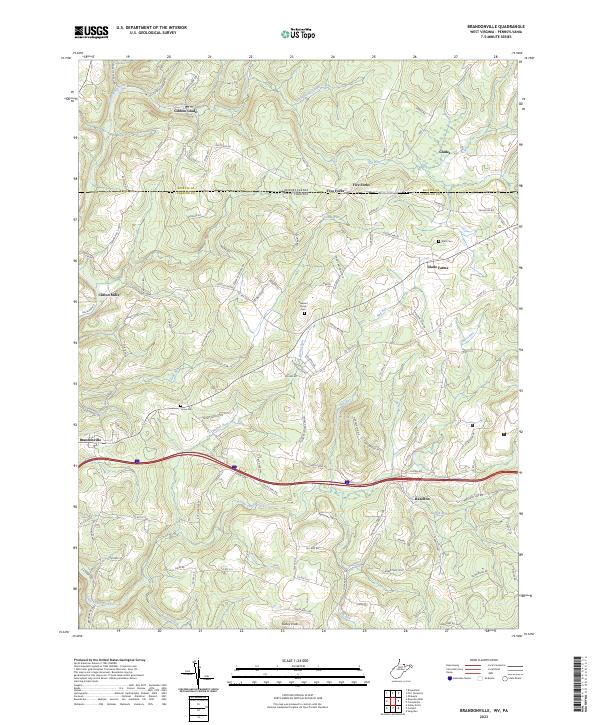 2023 Brandonville2023 Print · USGSThe West Virginia-Pennsylvania borderlands come into focus here, where the Mason-Dixon Rd divides the highland communities in the early twenty-first century. Researchers can trace family sites near Clifton Mills or locate local burials at Teets Cem and Union Cem.
 - 2023 Map of Bruceton Mills, 2023 Print
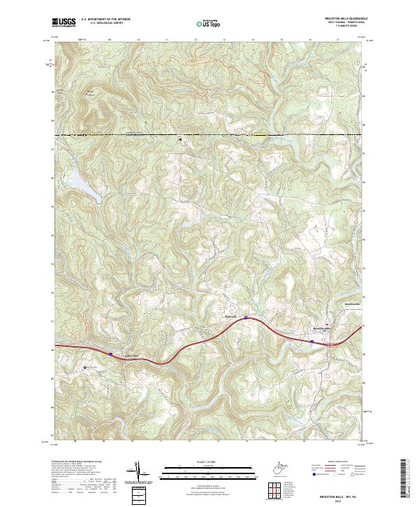 2023 Bruceton Mills2023 Print · USGSThe northern edge of Preston County is captured here at the West Virginia-Pennsylvania border. Local researchers can trace family landmarks and burial sites like Fair View Cem or explore the historic water power sites around Bruceton Mills Lake.
End of results
Showing maps 1-6 of 6
Top cities near Wharton Township
- Uniontown historical maps
- Connellsville historical maps
- Springhill Township historical maps
- South Connellsville historical maps
- Fairchance historical maps
- Dunbar historical maps
See more
Top neighborhoods of Wharton Township
- Point Breeze historical maps
- Spring Valley Bruderhof historical maps
- Deer Lake historical maps
- Fayette Springs historical maps
- Five Forks historical maps
- Gibbon Glade historical maps
See more
Frequently asked questions
- What are the different types of historical maps available for Wharton Township?
- What is the oldest map of Wharton Township?
- Where can I purchase historical maps of Wharton Township for my home or office?
- Where can I download high-res historical maps of Wharton Township?
- Are there historical topographic maps available for Wharton Township?
- Is there historical aerial imagery available for Wharton Township?
- Where are historical maps of Wharton Township sourced from?