2020s Maps of Jenks Township, Pennsylvania
Explore 6 historic maps of Jenks Township from the 2020s. These maps offer a rare glimpse into what life looked like during the 2020s — showing old roads, neighborhoods, homes, and landmarks that have changed or disappeared over time.
Whether you're researching your family's past, planning a metal detecting trip, or studying how Jenks Township's landscape evolved across the 2020s, these high-resolution maps are a powerful tool for exploring the history of this region.
- Focus on a specific era: All maps on this page are from the 2020s, giving you a focused view of this time period.
- See what’s changed: Compare century-old streets, trails, and buildings to today's modern landscape using overlays and satellite layers.
- Research with precision: Use these maps for genealogy, historical research, land use analysis, or educational projects.
- View, download, or print: Maps are fully viewable online in high resolution, and can be downloaded or printed for your own records.
Start exploring Jenks Township's history through authentic maps from the 2020s. This is your window into the past.
Jenks Township, PA maps
(6)- 2023 Map of Mayburg, 2023 Print
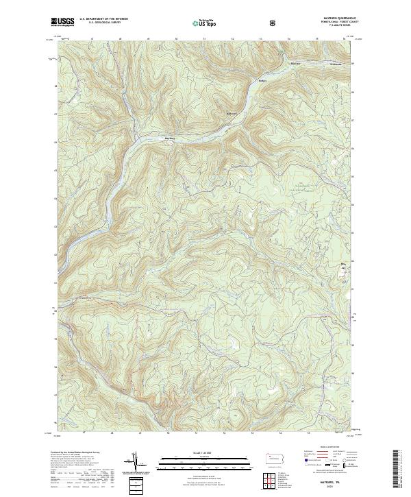 2023 Mayburg2023 Print · USGSForest County, Pennsylvania, is shown here as a dense landscape of timber and creeks within the Allegheny National Forest. You can trace the historic settlements along Tionesta Creek, including Mayburg, Truemans, and the evocative Dead Horse Hollow.
 - 2023 Map of Lynch, 2023 Print
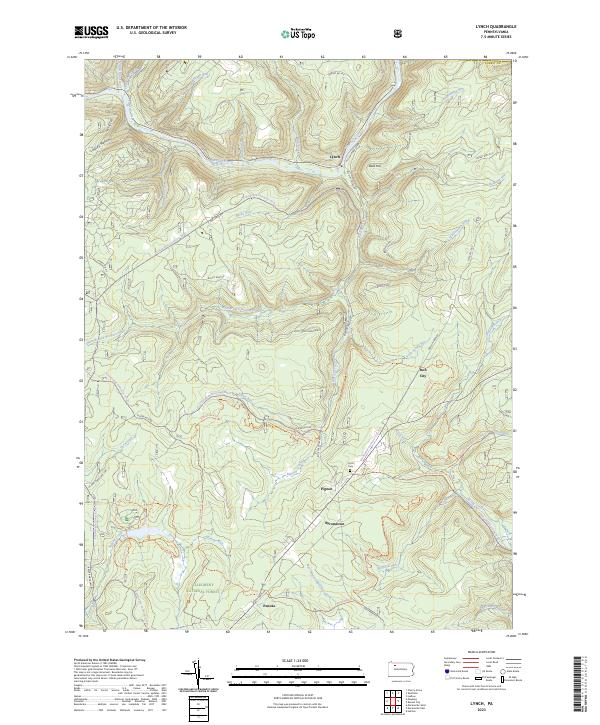 2023 Lynch2023 Print · USGSThe Pennsylvania woods of the Allegheny National Forest are shown here in 2023, featuring deep creek valleys and remote settlements. Local historians can trace old transit routes like the Old Railroad Grade and find family sites near Byromtown or the Frost Cem.
 - 2023 Map of Marienville West, 2023 Print
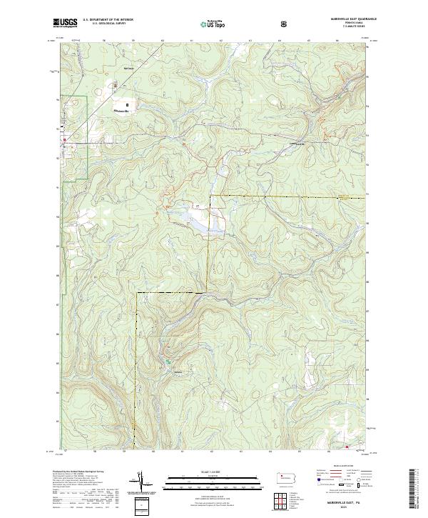
 2023 Marienville West2023 Print · USGSThe wooded plateaus of Forest and Clarion Counties are captured here in the early twenty-first century, showing a landscape defined by forestry and small settlements. Researchers can locate family sites at Roses Cem, Gilfoyle Methodist Church, and the rural crossroads of Vowinckel.
 - 2023 Map of Marienville East, 2023 Print
 2023 Marienville East2023 Print · USGSForest and Elk counties are shown here in the 2020s, dominated by the wooded reaches of the national forest and several established rural settlements. Genealogists and hikers can trace old landmarks like North Forest Cem or explore the network of trails around Loleta and Buzzard Swamp.
 - 2023 Map of Russell City, 2023 Print
 2023 Russell City2023 Print · USGSThe Allegheny National Forest is shown here at the intersection of four counties during the twenty-first century. Researchers can trace remote settlements and cemeteries such as Brookston, Pigs Ear, and the Brookston Cem amidst an extensive network of modern forest trails.
 - 2023 Map of Hallton, 2023 Print
 2023 Hallton2023 Print · USGSThe deep river valleys of Elk and Forest counties are documented in this recent survey. Local historians can trace riverside settlements like Hallton and Arroyo, or find old family sites near the Maxwell Run Cem.
End of results
Showing maps 1-6 of 6
Top cities near Jenks Township
- Sheffield Township historical maps
- Wetmore historical maps
- Warsaw Township historical maps
- Cherry Grove Township historical maps
- Millstone Township historical maps
Top neighborhoods of Jenks Township
- Roses historical maps
- Dunring historical maps
- Williams historical maps
- Lamonaville historical maps
- Gilfoyle historical maps
- Parrish historical maps
See more
Frequently asked questions
- What are the different types of historical maps available for Jenks Township?
- What is the oldest map of Jenks Township?
- Where can I purchase historical maps of Jenks Township for my home or office?
- Where can I download high-res historical maps of Jenks Township?
- Are there historical topographic maps available for Jenks Township?
- Is there historical aerial imagery available for Jenks Township?
- Where are historical maps of Jenks Township sourced from?