Old Maps of Forest County, Pennsylvania
Explore 137 old maps of Forest County, spanning from 1918 to today. These high-resolution historic maps reveal how streets, neighborhoods, landmarks, and natural features evolved over time — perfect for genealogy, metal detecting, research, and local history exploration.
What you can do with these maps:
- See how Forest County changed over time: Compare historical maps to modern-day views to trace roads, homesites, rail lines & more.
- View detailed metadata: Each map includes creators, publishers, year, scale, and archive source.
- Overlay maps with satellite & LiDAR: Visualize the past alongside modern tools to explore terrain & human change.
- Trusted historical sources: Maps sourced from the USGS, Library of Congress, and other archives.
- Access maps your way: View online, download high-res files, or order prints for personal or research use.
Start exploring old maps of Forest County to uncover forgotten places, hidden landmarks, and the deep history beneath your feet.
Forest County, PA maps
(137)- 1918 Map of Loleta
 1918 Loleta1918 Print · USGSThe Pennsylvania timber and rail country comes to life in this late-war tactical survey of the Clarion River valley. Genealogists and researchers can trace the early footprints of Marienville, Clarington, and the now-quiet settlement of Loleta.
 - 1922 Map of Oil City
 1922 Oil City1922 Print · USGSVenango County's river-driven economy and rural community structure are captured here in the early twenties, showing the intersection of heavy rail and upland farming. Researchers can trace family origins through numerous rural school sites like Rose School and old post offices at Cranberry PO or Davis Corners.2 unique versions available
 - 1922 Map of Tionesta, 1953 Print
 1922 Tionesta1953 Print · USGSNorthwestern Pennsylvania in the early twenties reveals a landscape defined by timber, the Allegheny River, and a dense network of country schools. Researchers can trace the legacy of small communities like Lucinda, Newmansville, and Fryburg alongside early railroad corridors.3 unique versions available
 - 1924 Map of Oil City
 1924 Oil City1924 Print · USGSVenango County's industrial river valleys and rural plateaus are captured here in the early twenties as the oil economy shaped the land. Genealogists can trace family roots through numerous country schools and post offices like Cranberry PO, Monarch Park, and St Marks Church.4 unique versions available
 - 1924 Map of Tionesta
 1924 Tionesta1924 Print · USGSThe northern Pennsylvania plateau comes alive in the early 1920s as the Allegheny National Forest was being established. Genealogists can trace hundreds of family-named landmarks and rural schoolhouses like Amsler School and Helen Furnace along the Baltimore and Ohio rail lines.4 unique versions available
 - 1927 Map of Tidioute
 1927 Tidioute1927 Print · USGSThe Allegheny River valley was a bustling corridor of rail and river industry in the late twenties. Genealogists can trace family footprints across dozens of local schoolhouses like Triumph Sch and rural hubs such as Endeavor or East Hickory.4 unique versions available
 - 1927 Map of Titusville, 1958 Print
 1927 Titusville1958 Print · USGSThe oil region of northwestern Pennsylvania is captured here in the late 1920s, centered on the industrial and rail hub of Titusville. Genealogists and researchers can locate the historic Drake Oil Well, dozens of country schools like Fink Ridge Sch, and the local Harrison Cem.3 unique versions available
 - 1930 Map of Tidioute
 1930 Tidioute1930 Print · USGSThe Allegheny River valley and the Pennsylvania Railroad corridor are shown in detail during the late 1920s. Genealogists and historians can trace defunct school sites like Triumph Sch and remote settlements such as Fagundus or Trunkeyville.4 unique versions available
 - 1933 Map of Titusville
 1933 Titusville1933 Print · USGSNorthwestern Pennsylvania in the early thirties reveals a landscape defined by the oil industry and rural township life. Genealogists and historians can trace family-named crossroads like Rendalls Corners or locate the historic Drake Oil Well and Asbury Chapel.3 unique versions available
 - 1934 Map of Kane
 1934 Kane1934 Print · USGSThe timber and oil lands of McKean and Elk counties are captured here in the mid-1930s as a network of railroads and pipelines. Researchers can trace family roots in settlements like De Young PO, locate CCC Camp No 7, or find the Greendale Sch.3 unique versions available
 - 1935 Map of Sheffield
 1935 Sheffield1935 Print · USGSThe Allegheny National Forest region in the mid-1930s reveals a landscape of deep timber runs, winding rail lines, and isolated New Deal work camps. Researchers can trace family roots at Cherry Grove Cem or locate forgotten crossroads like Deadmans Corners and Seldom Seen Corners.2 unique versions available
 - 1936 Map of Marienville
 1936 Marienville1936 Print · USGSThe Pennsylvania highlands between the Clarion River and Allegheny National Forest appear here in the mid-1930s. Researchers can trace the Baltimore and Ohio RR through Marienville or locate family landmarks like Donnely Cem and Greenwood Ch.3 unique versions available
 - 1939 Map of Kane
 1939 Kane1939 Print · USGSThe northern Pennsylvania plateau in the late 1930s is a landscape of timber-towns and industrial rail sidings. Genealogists and researchers can trace the old Baltimore and Ohio line through Kane, James City, and the rural Russell City De Young P O.3 unique versions available
 - 1940 Map of Hallton
 1940 Hallton1940 Print · USGSElk and Jefferson Counties appear here in the early 1940s, showing a landscape defined by the Clarion River valley and the growth of the Allegheny National Forest. Researchers can find old industrial sites and rural landmarks like the Empire Tunnel, St Tobias Cem, and the CCC Camp.3 unique versions available
 - 1941 Map of Sheffield
 1941 Sheffield1941 Print · USGSForest and Warren Counties are seen here during the early 1940s, a period when local logging and oil activities shaped the landscape. Researchers can trace the Tionesta Valley RR and find remote outposts like Pigeon PO or Seldom Seen Cors.2 unique versions available
 - 1941 Map of Marienville
 1941 Marienville1941 Print · USGSForest, Clarion, and Jefferson counties meet along the winding Clarion River in this pre-war survey of northern Pennsylvania's timberlands. Genealogists can locate numerous rural schoolhouses and social landmarks like Kahletown Hall, Greenwood Ch, and the Downey Cem.3 unique versions available
 - 1943 Map of Hallton
 1943 Hallton1943 Print · USGSThe Clarion River valley and surrounding plateau are captured here just before the mid-century, revealing a network of isolated settlements and forest industry. Researchers can find old sites like the CCC Camp near Croyland, the Empire Tunnel, and small rural schools including Lake City Sch.3 unique versions available
 - 1943 Map of Oil City, 1944 Print
 1943 Oil City1944 Print · USGSVenango County oil country is shown in detail during the early 1940s, centered on the industrial hub of Oil City. Genealogists can trace family names through dozens of rural schools like McCalmont Sch and churches such as St Marks Ch or Hoag Hill Ch.
 - 1946 Map of Tionesta
 1946 Tionesta1946 Print · USGSClarion and Forest Counties appear here in the 1940s, a period when rural schoolhouses and family-named hamlets still defined the interior ridges. Researchers can trace the Allegheny River and Clarion River or find specific landmarks like the Oil Field and Highland Township High Sch.
 - 1947 Map of Cherry Grove, 1972 Print
 1947 Cherry Grove1972 Print · USGSPotter County's high forest plateaus are captured here as they appeared in the late forties and early seventies. Researchers can trace the old Coudersport and Port Allegany Railroad and locate the Cherry Springs Fire Tower.
 - 1957 Map of Warren, 1964 Print
 1957 Warren1964 Print · USGSThe northern Pennsylvania oil and timber country comes into focus in the mid-fifties, showing the region before modern highway expansions. Trace the industrial rail networks of the Pennsylvania RR and the early Allegheny River Reservoir near Warren and Oil City.4 unique versions available
 - 1958 Map of Warren
 1958 Warren1958 Print · USGSNorthern Pennsylvania’s timber and oil country is captured here during the late fifties, showing the interplay of industrial valleys and vast state forests. Genealogists can trace family connections across the Cornplanter Indian Reservation or through rail hubs like Oil City and Saint Marys.
 - 1959 Map of Warren
 1959 Warren1959 Print · USGSNorthern Pennsylvania's oil and timber country comes alive in this late-fifties study of the forest-clad plateaus. Trace the historic Cornplanter (Indian Reservation), the sprawling Oil Field, and the rail lines of the Pennsylvania RR.2 unique versions available
 - 1963 Map of President
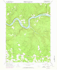 1963 President1963 Print · USGSVenango County's oil heritage and river geography are on full display in the 1960s, showing the intersection of heavy industry and rural life. Researchers can trace family names and old landmarks from the Cornplanter Oil Field to Hampton Station and the McCrea Cem.5 unique versions available
 - 1966 Map of Russell City, 1967 Print
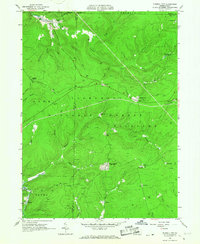 1966 Russell City1967 Print · USGSElk and Forest Counties in the mid-1960s were centers of active timber and energy production within the Allegheny National Forest. Genealogists and researchers can trace the rail-and-resource economy through sites like Russell City, Sheffield Junction, and the numerous gas wells dotting the hills.4 unique versions available
Showing maps 1-25 of 137
Top cities of Forest County
Frequently asked questions
- What are the different types of historical maps available for Forest County?
- What is the oldest map of Forest County?
- Where can I purchase historical maps of Forest County for my home or office?
- Where can I download high-res historical maps of Forest County?
- Are there historical topographic maps available for Forest County?
- Is there historical aerial imagery available for Forest County?
- Where are historical maps of Forest County sourced from?