2020s Maps of Antrim Township, Pennsylvania
Explore 4 historic maps of Antrim Township from the 2020s. These maps offer a rare glimpse into what life looked like during the 2020s — showing old roads, neighborhoods, homes, and landmarks that have changed or disappeared over time.
Whether you're researching your family's past, planning a metal detecting trip, or studying how Antrim Township's landscape evolved across the 2020s, these high-resolution maps are a powerful tool for exploring the history of this region.
- Focus on a specific era: All maps on this page are from the 2020s, giving you a focused view of this time period.
- See what’s changed: Compare century-old streets, trails, and buildings to today's modern landscape using overlays and satellite layers.
- Research with precision: Use these maps for genealogy, historical research, land use analysis, or educational projects.
- View, download, or print: Maps are fully viewable online in high resolution, and can be downloaded or printed for your own records.
Start exploring Antrim Township's history through authentic maps from the 2020s. This is your window into the past.
Antrim Township, PA maps
(4)- 2023 Map of Mason and Dixon, 2023 Print
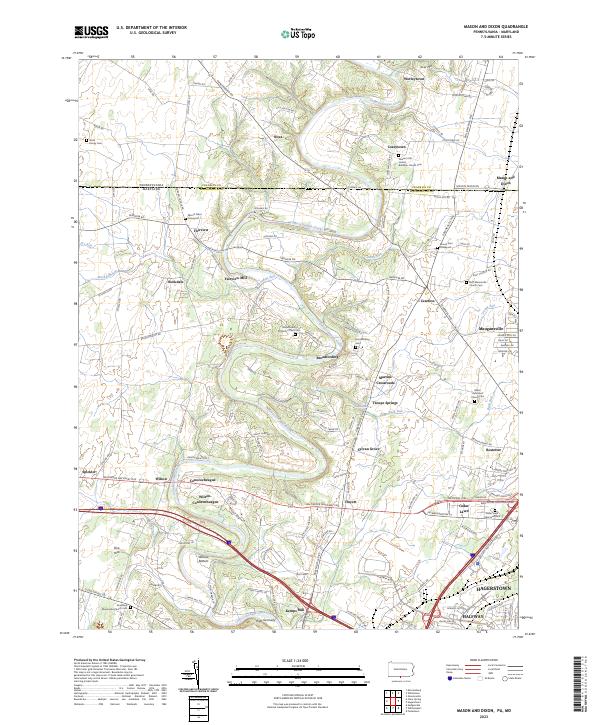 2023 Mason and Dixon2023 Print · USGSThe Mason-Dixon line divides this landscape of historic farmsteads and creek-side settlements along the Pennsylvania and Maryland border. Genealogists can trace family roots at Pleasant Hill United Brethren Church Cem or find old mill sites like Fairview Mill.
 - 2023 Map of Williamson, 2023 Print
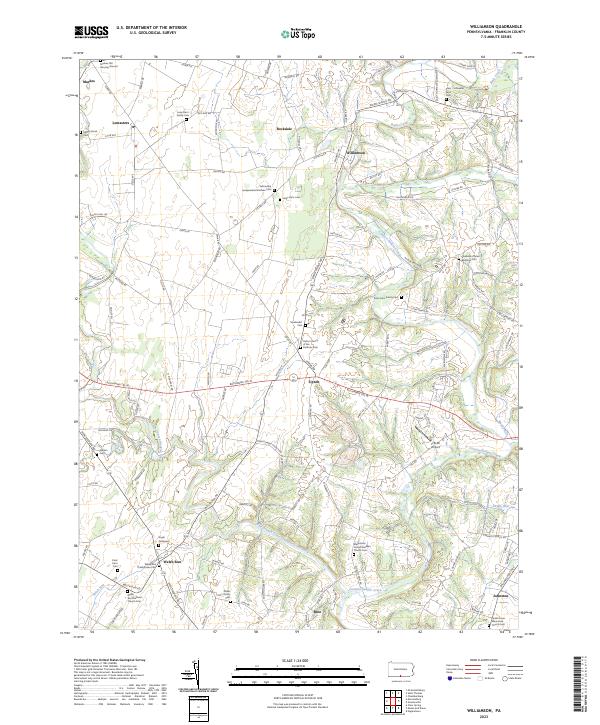 2023 Williamson2023 Print · USGSFranklin County's rural heartland is meticulously documented in this recent survey of its historic family farms and churchyards. Researchers can locate numerous ancestral sites including the Markes Old Burying Ground, Upton Church of the Brethren Cem, and Angle Graveyard.
 - 2023 Map of Greencastle, 2023 Print
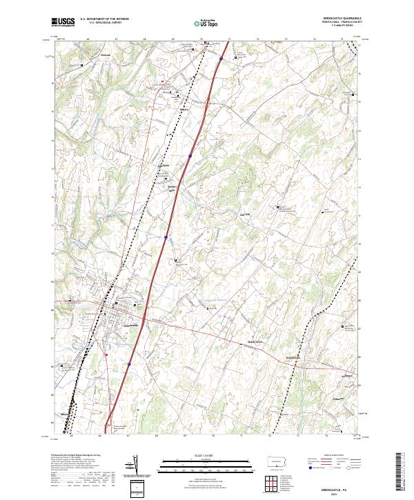 2023 Greencastle2023 Print · USGSGreencastle and its surrounding Franklin County townships are shown here in the early twenty-first century. Genealogists can trace family heritage through sites like Moss Spring Cem, Hades Church, and the Paradise Dunkard Meetinghouse.
 - 2023 Map of Hagerstown, 2023 Print
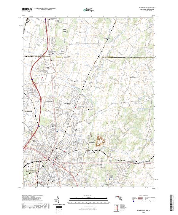 2023 Hagerstown2023 Print · USGSMaryland's northern borderland comes into focus in this recent survey of the Cumberland Valley. Genealogists and historians can trace family roots through numerous burial sites like Shank Family Cem and the State Line Methodist Church Cem.
End of results
Showing maps 1-4 of 4
Top cities near Antrim Township
- Hagerstown historical maps
- Chambersburg historical maps
- Halfway historical maps
- Waynesboro historical maps
- Robinwood historical maps
- Fountainhad-Orchard Hills historical maps
See more
Top neighborhoods of Antrim Township
- Wingerton historical maps
- Brown Mills historical maps
- Milnor historical maps
- Waynecastle historical maps
- Coseytown historical maps
- Clay Hill historical maps
See more
Frequently asked questions
- What are the different types of historical maps available for Antrim Township?
- What is the oldest map of Antrim Township?
- Where can I purchase historical maps of Antrim Township for my home or office?
- Where can I download high-res historical maps of Antrim Township?
- Are there historical topographic maps available for Antrim Township?
- Is there historical aerial imagery available for Antrim Township?
- Where are historical maps of Antrim Township sourced from?