Old Maps of Chambersburg, Pennsylvania for Academic Research
Study the evolution of Chambersburg with 25 high-resolution historic maps. Whether you're teaching, researching, or modeling changes in land use, these maps provide essential visual documentation of urban, environmental, and geographic change.
- Analyze long-term change: Track patterns in development, transportation, and natural features.
- Ideal for environmental or urban studies: Support academic projects with primary historical map data.
- Use in the classroom or lab: Educators and researchers rely on these maps to bring historical context to life.
These maps are a powerful tool for teaching, research, and visualizing how Chambersburg has changed over the decades.
Chambersburg, PA maps
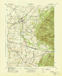
(25)- 1902 Map of Chambersburg
 1902 Chambersburg1902 Print · USGSFranklin County at the dawn of the new century shows a thriving valley dominated by the rail lines connecting Chambersburg, Greencastle, and Waynesboro. Genealogists and historians can trace long-gone stops and industrial sites like Guilford Siding, Browns Mills, and the Pond Bank iron area.7 unique versions available
 - 1942 Map of Hagerstown
 1942 Hagerstown1942 Print · USGSThe Cumberland Valley and Potomac corridor are captured here at the height of the Second World War rail-and-river era. Genealogists and historians can trace the industrial landscape of Richmond Furnace, the route of the Chesapeake and Ohio Canal, and the grounds of Camp Ritchie.
 - 1943 Map of Hagerstown
 1943 Hagerstown1943 Print · USGSThe Cumberland Valley was a critical wartime logistics hub in the 1940s, teeming with rail traffic and new military installations. Genealogists and historians can trace the Chesapeake and Ohio Canal or locate local landmarks like Richmond Furnace and Camp Ritchie.
 - 1943 Map of Chambersburg, 1955 Print
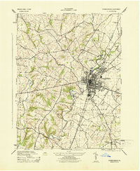
 1943 Chambersburg1955 Print · USGSChambersburg and the Cumberland Valley are seen here during the war years, dominated by the massive Letterkenny Ordnance Depot and active rail lines. Genealogists can trace family names through dozens of rural landmarks like Salem Ch and the Pennsylvania Soldiers Orphan Sch.3 unique versions available
 - 1944 Map of Scotland
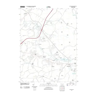
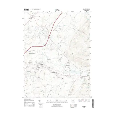
 1944 Scotland1944 Print · USGSFranklin County at the height of the war years reveals a landscape of tight-knit rail towns and mountain forest reserves. Genealogists can locate specific homesteads and institutions like the Soldiers Orphan School, the Stone Quarry, and schools like Mt Vernon School.7 unique versions available
 - 1944 Map of Chambersburg
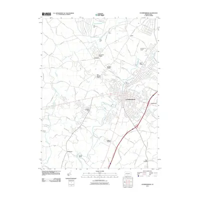
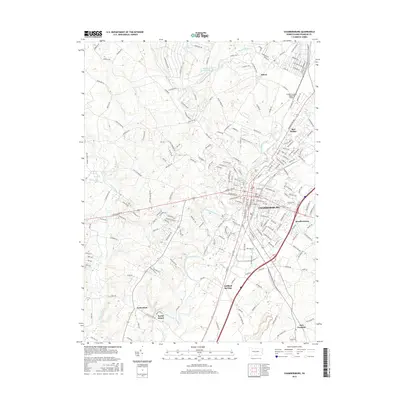
 1944 Chambersburg1944 Print · USGSFranklin County at the height of the Second World War shows a landscape defined by industrial centers and burgeoning military infrastructure. Researchers can trace the dual rail lines serving Chambersburg or locate rural landmarks like U S Paper Mill and Social Island.6 unique versions available
 - 1948 Map of Baltimore
 1948 Baltimore1948 Print · USGSMaryland and Pennsylvania crossroads are captured in the late 1940s, showing a landscape defined by historic rail lines and major military installations. Genealogists can trace family connections in Gettysburg, Westminster, and near the U.S. Naval Academy in Annapolis.2 unique versions available
 - 1954 Map of Baltimore
 1954 Baltimore1954 Print · USGSThe Mid-Atlantic region in the early fifties shows a landscape of growing suburban centers and heavy rail corridors. Trace mid-century transit networks and military landmarks from the Aberdeen Proving Ground to the Gettysburg National Military Park.
 - 1956 Map of Baltimore
 1956 Baltimore1956 Print · USGSMid-century Maryland and Pennsylvania are captured here during a period of massive suburban and military growth across the Chesapeake region. Genealogists and historians can trace the rail corridors of the Baltimore & Ohio RR and locate landmarks like Fort McHenry or the Aberdeen Proving Ground.
 - 1957 Map of Baltimore, 1964 Print
 1957 Baltimore1964 Print · USGSMaryland and Southern Pennsylvania are shown during the mid-century expansion of the Baltimore-Washington corridor. Researchers can trace the extensive rail lines of the Baltimore & Ohio RR and locate sites like Fort Detrick and Gettysburg National Military Park.5 unique versions available
 - 1961 Map of Baltimore
 1961 Baltimore1961 Print · USGSMaryland and Pennsylvania are captured at a mid-century peak of industrial and military expansion. Genealogists and historians can trace rail corridors like the Western Maryland Ry or locate regional landmarks such as Camp Detrick and Kent Island.
 - 1983 Map of Hagerstown, 1984 Print
 1983 Hagerstown1984 Print · USGSThe tri-state borderlands of Maryland, Pennsylvania, and West Virginia are shown in the early eighties as a hub of military installations and valley towns. Genealogists and historians can trace the landscape from Gettysburg National Military Park to the banks of the Potomac River.2 unique versions available
 - 1989 Map of Baltimore
 1989 Baltimore1989 Print · USGSThe Mid-Atlantic corridor in the late eighties is captured here, from the Baltimore harbor to the Blue Ridge foothills. Researchers can trace the sprawling footprints of Aberdeen Proving Ground, the historic grounds of Gettysburg National Military Park, and the winding Susquehanna River.
 - 1990 Map of Chambersburg, 1995 Print
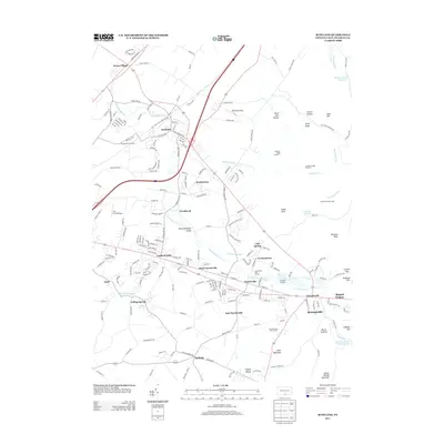
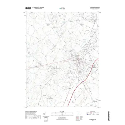
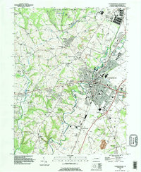 1990 Chambersburg1995 Print · USGSChambersburg and the surrounding Franklin County townships are captured in the early nineties as suburban expansion meets traditional valley life. Genealogists and local researchers can locate numerous burial grounds such as Old Crider Cem and Lincoln Cem, or trace landmarks like Wilson College and the Siloam Dam.
 - 1990 Map of Scotland, 1995 Print
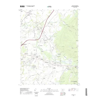
 1990 Scotland1995 Print · USGSFranklin County in the early nineties shows a landscape of growing towns and deep forest roots. Genealogists can trace family sites at Mentzers Cem and Park Lawns Cem or locate the historic Scotland School for Veterans Children.
 - 2010 Map of Scotland, 2010 Print
 2010 Scotland2010 Print · USGSCovers Chambersburg, including Fayetteville, Guilford Township, and other nearby areas
 - 2010 Map of Chambersburg, 2010 Print
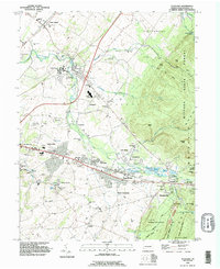
 2010 Chambersburg2010 Print · USGSCovers Chambersburg, including Guilford Township, Letterkenny Township, and other nearby areas
 - 2013 Map of Scotland, 2013 Print
 2013 Scotland2013 Print · USGSCovers Chambersburg, including Fayetteville, Guilford Township, and other nearby areas
 - 2013 Map of Chambersburg, 2013 Print
 2013 Chambersburg2013 Print · USGSCovers Chambersburg, including Guilford Township, Letterkenny Township, and other nearby areas
 - 2016 Map of Scotland, 2016 Print
 2016 Scotland2016 Print · USGSCovers Chambersburg, including Fayetteville, Guilford Township, and other nearby areas
 - 2016 Map of Chambersburg, 2016 Print
 2016 Chambersburg2016 Print · USGSCovers Chambersburg, including Guilford Township, Letterkenny Township, and other nearby areas
 - 2019 Map of Scotland, 2019 Print
 2019 Scotland2019 Print · USGSCovers Chambersburg, including Fayetteville, Guilford Township, and other nearby areas
 - 2019 Map of Chambersburg, 2019 Print
 2019 Chambersburg2019 Print · USGSCovers Chambersburg, including Guilford Township, Letterkenny Township, and other nearby areas
 - 2023 Map of Scotland, 2023 Print
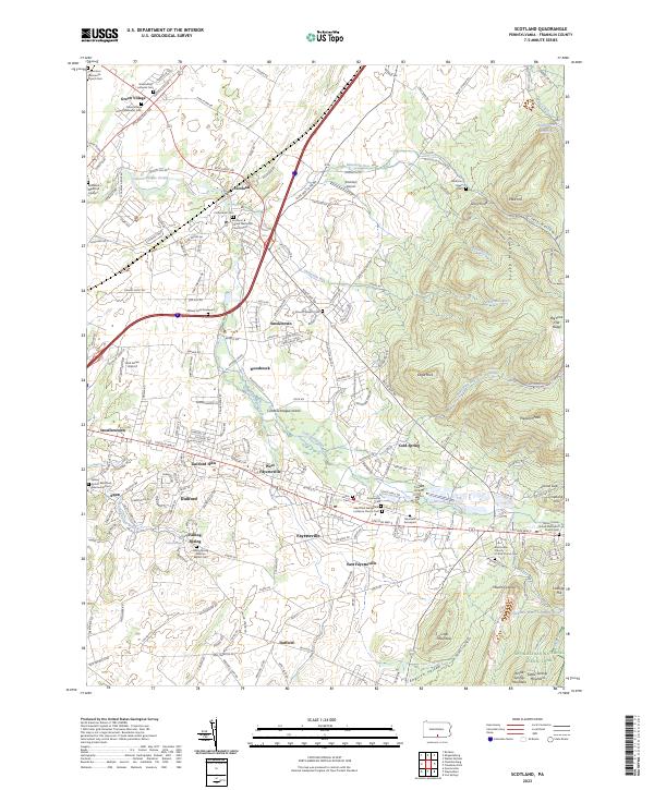 2023 Scotland2023 Print · USGSFranklin County's central valley and the slopes of South Mountain are shown in detail as they appeared in the early 2020s. Genealogists can trace family history through sites like the Witwer Farm Graveyard and Mentzers Graveyard near Fayetteville.
 - 2023 Map of Chambersburg, 2023 Print
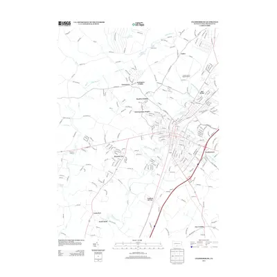
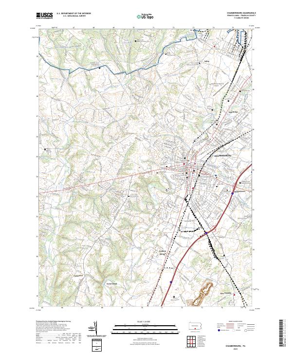 2023 Chambersburg2023 Print · USGSChambersburg and its surrounding hamlets are captured in this recent survey of Franklin County. Genealogists can trace family heritage through numerous burial sites like the Samuel Miller Farm Cem and Stoufferstown Cem, while mapping the footprint of Wilson College.
End of results
Showing maps 1-25 of 25
Top cities near Chambersburg
- Waynesboro historical maps
- Quincy Township historical maps
- Shippensburg historical maps
- Greencastle historical maps
- Fayetteville historical maps
- State Line historical maps
See more
Frequently asked questions
- What are the different types of historical maps available for Chambersburg?
- What is the oldest map of Chambersburg?
- Where can I purchase historical maps of Chambersburg for my home or office?
- Where can I download high-res historical maps of Chambersburg?
- Are there historical topographic maps available for Chambersburg?
- Is there historical aerial imagery available for Chambersburg?
- Where are historical maps of Chambersburg sourced from?