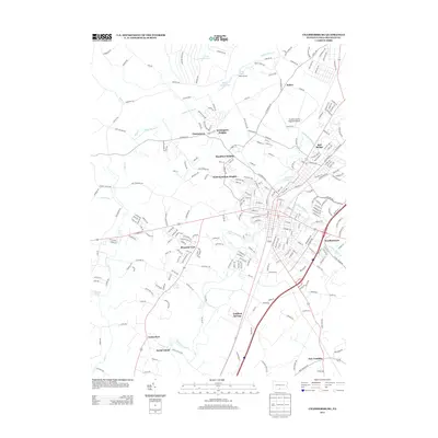
2013 Map of Chambersburg
USGS Topo · Published 2013About this map
Conococheague Cr and the winding Falling Spring Br define the landscape of this Franklin County region, anchoring the historic urban center and its surrounding residential developments. The area's twentieth-century growth is evident in the cluster of neighborhoods including West Hamilton Heights, Kensington Heights, and Pleasant View. To the north, the terrain reflects its proximity to the Letterkenny Army Depot, with military-related roads such as Bazooka Rd, Dud Rd, and Sandbag Rd skirting Lake Letterkenny. Small outlying communities like Stoufferstown and New Franklin maintain their distinct identities along the primary transport corridors, while the Franklin County Regional Airport serves as a modern regional hub. The map captures a transition from dense street grids to the more pastoral reaches of Turkeyfoot and Social Island, documenting the complex mix of residential expansion, agricultural heritage, and industrial utility.
Find a feature on this map
256 named features on this map. Tap any name to fly to it.
Don’t see what you’re looking for? This feature index may not catch every label — zoom into the map to look around manually.
Map Details
Editions of this 2013 Chambersburg Map
This is the sole edition of this map. No revisions or reprints were ever made.
Other maps of this area

1900 · Mercersburg
USGS Topo · 1:62,500

1902 · Chambersburg
USGS Topo · 1:62,500

1902 · Mercersburg
USGS Topo · 1:62,500

1923 · Shippensburg
USGS Topo · 1:62,500

1939 · Orbisonia
USGS Topo · 1:62,500

1940 · Orbisonia
USGS Topo · 1:62,500

1942 · Hagerstown
USGS Topo · 1:125,000

1943 · Hagerstown
USGS Topo · 1:125,000

1943 · Chambersburg
USGS Topo · 1:62,500

1943 · Mercersburg
USGS Topo · 1:62,500
Featured Places
- Chambersburg, PA
- Guilford Township, PA
- Letterkenny Township, PA
- Hamilton Township, PA
- Social Island, Guilford Township