Old Maps of Dublin Township, Pennsylvania for Metal Detecting
Plan your next treasure hunt with 35 historic maps of Dublin Township. Find old homesites, ghost towns, trails, and gathering spots that may be lost to time — perfect for identifying promising metal detecting locations.
- Locate forgotten sites: Uncover places like long-lost settlements, abandoned rail lines, or gathering spots.
- Plan better hunts: Use map overlays combined with LiDAR or satellite views to narrow in on historically rich areas.
- Made for detectorists: Thousands of hobbyists use these maps to discover relics, coins, and hidden history.
Use these historic maps to boost your research and find new opportunities beneath the surface of Dublin Township.
Dublin Township, PA maps
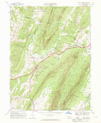
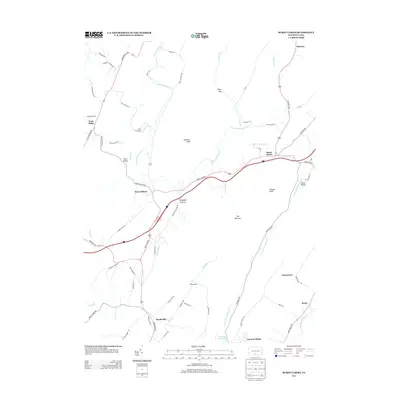
(35)- 1930 Map of Broad Top, 1958 Print
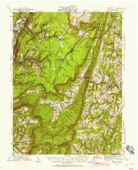 1930 Broad Top1958 Print · USGSThe Broad Top coalfields of the 1930s come alive through this survey of the region's mining towns and mountain ridges. Genealogists can trace family footprints at Bills Place, Miller Sch, and the Garlick Mine along the Huntingdon and Broad Top Mountain RR.2 unique versions available
 - 1933 Map of Broad Top
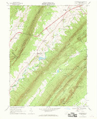
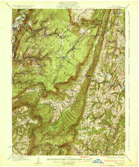 1933 Broad Top1933 Print · USGSBroad Top Mountain and its surrounding coalfields were at a peak of rail-driven activity in the early thirties. Local historians can trace the precise routes of the Huntingdon and Broad Top Mountain RR and locate community landmarks like Wells Tannery and Eagle Foundry Ch.3 unique versions available
 - 1939 Map of Orbisonia, 1954 Print
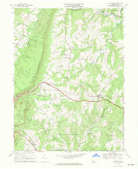
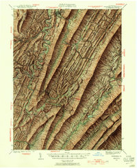 1939 Orbisonia1954 Print · USGSOrbisonia and the surrounding mountain gaps are captured in the late thirties just as the modern turnpike was transforming the valley. Researchers can trace the narrow-gauge East Broad Top RR or find rural landmarks like Burnt Cabins and Jordan Cem.7 unique versions available
 - 1940 Map of Orbisonia
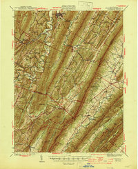
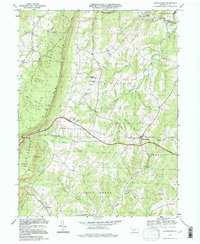
 1940 Orbisonia1940 Print · USGSCentral Pennsylvania's Ridge and Valley province is captured here just as the Pennsylvania Turnpike reached Burnt Cabins. Researchers can trace the narrow-gauge EAST BROAD TOP RR and locate family landmarks like Jordan Cem, Kuhns Mill, or St Marys Ch.2 unique versions available
 - 1944 Map of Orbisonia
 1944 Orbisonia1944 Print · USGSCentral Pennsylvania's ridge-and-valley landscape is shown here at the height of the narrow-gauge era just as modern highways arrived. Researchers can trace the East Broad Top RR through Rockhill, find legacy family sites like Kuhns Mill, and locate the Pennsylvania Turnpike near Burnt Cabins.3 unique versions available
 - 1950 Map of Harrisburg, 1952 Print
 1950 Harrisburg1952 Print · USGSMid-century Central Pennsylvania comes alive through its dense rail networks and river valley settlements during the post-war industrial era. Genealogists and historians can trace family roots through hubs like Harrisburg, locate Carlisle Barracks, or follow the Pennsylvania RR through the Lebanon Valley.
 - 1953 Map of Pittsburgh
 1953 Pittsburgh1953 Print · USGSWestern Pennsylvania's industrial landscape at the start of the fifties shows the steel and rail corridors between Pittsburgh and Altoona. Trace family roots in river towns like Tarentum or follow the Pennsylvania Turnpike across Laurel Hill.
 - 1954 Map of Pittsburgh
 1954 Pittsburgh1954 Print · USGSWestern Pennsylvania in the early fifties remains a powerhouse of heavy industry and vital transit corridors. Genealogists and historians can trace the rail-and-river network connecting Pittsburgh, Johnstown, and Altoona via the Pennsylvania RR and the Lincoln Highway.2 unique versions available
 - 1957 Map of Harrisburg
 1957 Harrisburg1957 Print · USGSMid-century Central Pennsylvania comes into focus as a bustling network of rail, river, and mountain ridges. Genealogists and historians can trace the development of the State Capitol and surrounding hubs like Middletown, Columbia, and Pottsville.7 unique versions available
 - 1958 Map of Pittsburgh
 1958 Pittsburgh1958 Print · USGSWestern Pennsylvania in the late fifties shows an industrial heartland defined by the confluence of the Allegheny River and Monongahela River. Researchers can trace the sprawling rail networks of the Pennsylvania RR and find established towns like Butler, Latrobe, and Windber.5 unique versions available
 - 1959 Map of Pittsburgh
 1959 Pittsburgh1959 Print · USGSWestern Pennsylvania in the late fifties is captured here at the height of its industrial era. Genealogists and historians can trace the riverfront growth of Pittsburgh, the rail works at Altoona, and the mountain gaps of Laurel Hill.
 - 1961 Map of Harrisburg
 1961 Harrisburg1961 Print · USGSCentral Pennsylvania is shown at a mid-century peak of industrial and military activity, from the Susquehanna water gaps to the fertile Dutch Country. Genealogists and historians can trace the rail corridors of the Pennsylvania RR and find landmarks like Carlisle Barracks or the Anthracite Coal Fields.2 unique versions available
 - 1964 Map of Pittsburgh
 1964 Pittsburgh1964 Print · USGSWestern Pennsylvania in the late fifties and early sixties shows a landscape of powerful river industries and expanding highways. Genealogists and historians can trace the rail corridors of the Pennsylvania RR through industrial hubs like Johnstown, Altoona, and Nanty Glo.
 - 1964 Map of Harrisburg
 1964 Harrisburg1964 Print · USGSCentral Pennsylvania in the mid-fifties reveals a landscape shaped by ridge-and-valley geology and critical Cold War infrastructure. Researchers can trace the massive Indiantown Gap Military Reservation or the rail corridors of the Pennsylvania RR and Reading RR.
 - 1966 Map of Burnt Cabins, 1969 Print
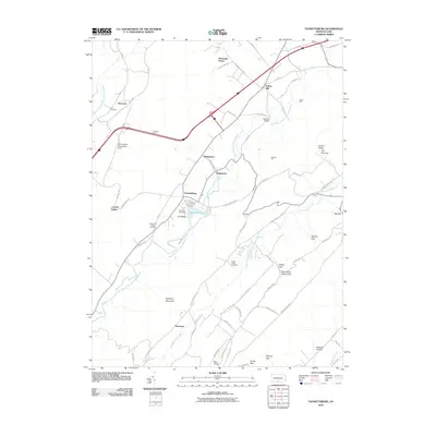
 1966 Burnt Cabins1969 Print · USGSFulton County and the surrounding ridges are captured in the mid-sixties, showing the high-speed transit of the early turnpike era cutting through quiet valley settlements. Genealogists can locate family landmarks such as Cromwell Ch, Fort Littleton, and the small community of Sweetwater.3 unique versions available
 - 1966 Map of Fannettsburg, 1969 Print
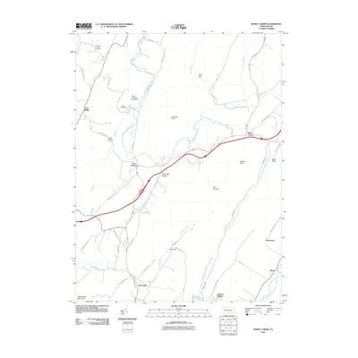
 1966 Fannettsburg1969 Print · USGSPath Valley and its surrounding ridges in the 1960s reveal a landscape of secluded mountain gaps and established crossroads. Researchers can trace family sites at Lower Path Valley Cem, locate the Tollgate on the turnpike, or find the Burnt Cabins Landing Strip on the valley floor.3 unique versions available
 - 1968 Map of Hustontown, 1970 Print
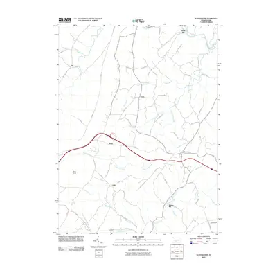
 1968 Hustontown1970 Print · USGSFulton County and the rugged ridge of Sideling Hill are captured here in the late sixties, showing the intersection of mountain wilderness and rural industry. Genealogists and local historians can trace family locations near Hustontown, Mellotts Mill, and several country churches like Wells Valley Ch.3 unique versions available
 - 1981 Map of Johnstown, 1983 Print
 1981 Johnstown1983 Print · USGSSouth Central Pennsylvania is captured here in the early eighties, from the industrial heart of the Conemaugh Valley to the ridges of the Allegheny Front. Local historians can trace the rail corridors of Conrail and the growth of mountain communities like Ebensburg, Nanty Glo, and Windber.
 - 1984 Map of Carlisle, 1985 Print
 1984 Carlisle1985 Print · USGSSouth-central Pennsylvania is shown during the mid-eighties as a hub of military activity and mountain transit. Genealogists and historians can trace the development of Carlisle Barracks and Letterkenny Army Depot, alongside rail routes like Conrail.2 unique versions available
 - 1994 Map of Hustontown, 1997 Print
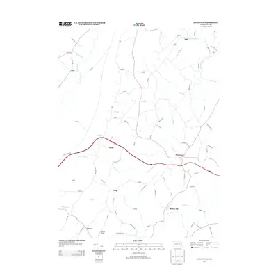
 1994 Hustontown1997 Print · USGSCentral Pennsylvania's ridge-and-valley country is captured here in the mid-1990s, centered on the intersection of the turnpike and local rural life. Genealogists can locate family landmarks like Mellotts Mill, Dublin Mills, and several country churches including Fairview Ch.
 - 2010 Map of Fannettsburg, 2010 Print
 2010 Fannettsburg2010 Print · USGSCovers Dublin Township, including Metal Township, Letterkenny Township, and other nearby areas
 - 2010 Map of Burnt Cabins, 2010 Print
 2010 Burnt Cabins2010 Print · USGSCovers Dublin Township, including Metal Township, Burnt Cabins, and other nearby areas
 - 2010 Map of Hustontown, 2010 Print
 2010 Hustontown2010 Print · USGSCovers Dublin Township, including Laidig, Hustontown, and other nearby areas
 - 2013 Map of Hustontown, 2013 Print
 2013 Hustontown2013 Print · USGSCovers Dublin Township, including Laidig, Hustontown, and other nearby areas
 - 2013 Map of Burnt Cabins, 2013 Print
 2013 Burnt Cabins2013 Print · USGSCovers Dublin Township, including Metal Township, Burnt Cabins, and other nearby areas
Showing maps 1-25 of 35
Top cities near Dublin Township
- Guilford Township historical maps
- Metal Township historical maps
- McConnellsburg historical maps
- Todd Township historical maps
- Three Springs historical maps
- Orbisonia historical maps
See more
Top neighborhoods of Dublin Township
- Burnt Cabins historical maps
- Clear Ridge historical maps
- Fort Littleton historical maps
- Hustontown historical maps
Frequently asked questions
- What are the different types of historical maps available for Dublin Township?
- What is the oldest map of Dublin Township?
- Where can I purchase historical maps of Dublin Township for my home or office?
- Where can I download high-res historical maps of Dublin Township?
- Are there historical topographic maps available for Dublin Township?
- Is there historical aerial imagery available for Dublin Township?
- Where are historical maps of Dublin Township sourced from?