Old Maps of Rees Mill, Franklin Township for Genealogy
Trace your family roots with 13 historic maps of Rees Mill. These high-res maps reveal old neighborhoods, homesites, landmarks, and streets — helping you uncover where your ancestors lived and how the area evolved over time.
- Explore historic neighborhoods: Identify where your relatives may have lived in the 1800s or 1900s.
- Compare maps over time: Trace the changes in streets, buildings, and landmarks for multi-generational research.
- Perfect for genealogy & ancestry research: Used by family historians and researchers to map out lineage and migration.
These maps are an incredible resource for exploring your personal connection to Rees Mill's past.
Rees Mill, Franklin Township maps
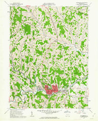
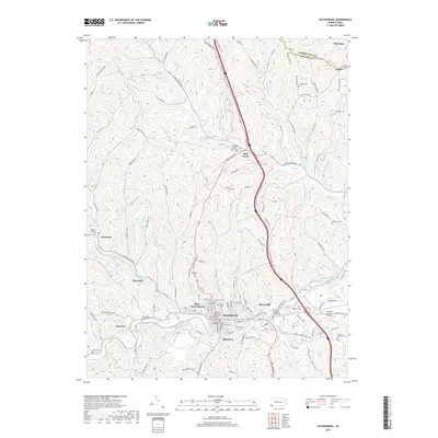
(13)- 1901 Map of Waynesburg, 1958 Print
 1901 Waynesburg1958 Print · USGSGreene County at the start of the twentieth century shows a landscape of deep valleys and rising townships connected by the South Fork of Tenmile Creek. Genealogists can trace family names through landmarks like Rees Mill, Gump, and the dual settlement of Kirby Newtown.
 - 1904 Map of Waynesburg
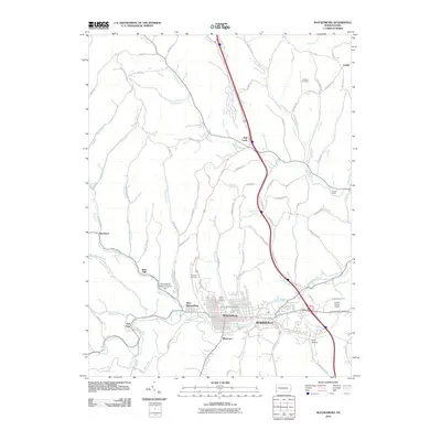
 1904 Waynesburg1904 Print · USGSGreene County was a landscape of deeply carved creek valleys and rural crossroads at the start of the twentieth century. Genealogists and local historians can trace early property settings near Waynesburg, Rees Mill, and the riverside borough of Rices Landing.5 unique versions available
 - 1949 Map of Clarksburg
 1949 Clarksburg1949 Print · USGSThe upper Ohio River valley and the industrial heart of West Virginia come into focus during this post-war period. Genealogists and researchers can trace the rail corridors of the Baltimore and Ohio and locate centers like Fairmont, Grafton, and Waynesburg.
 - 1956 Map of Clarksburg, 1966 Print
 1956 Clarksburg1966 Print · USGSThe Ohio River valley and the industrial heart of West Virginia are seen here in the mid-1950s as rail and river commerce thrived. Researchers can trace historic transport lines like the Baltimore and Ohio RR and locate ancestral homes in Clarksburg, Moundsville, or Parkersburg.2 unique versions available
 - 1961 Map of Clarksburg
 1961 Clarksburg1961 Print · USGSThe mid-century industrial and river landscapes of West Virginia and Ohio are detailed here, centered on the Ohio River. Researchers can trace the Baltimore and Ohio rail lines connecting towns like Parkersburg, Clarksburg, and Monongah.
 - 1961 Map of Waynesburg, 1963 Print
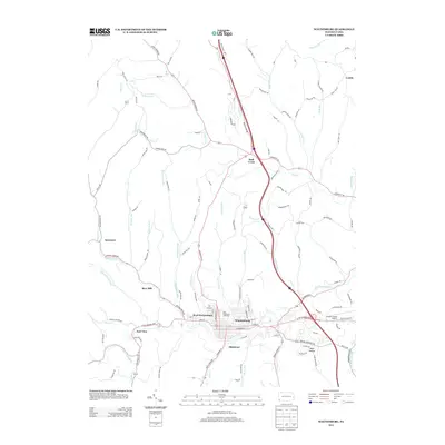
 1961 Waynesburg1963 Print · USGSMid-century Greene County comes to life in this detailed survey centered on the collegiate town of Waynesburg. Researchers can locate family sites at Green Mount Cem, trace the local coal landscape at Grimes Portal, or find the old Drive-in Theater.4 unique versions available
 - 1984 Map of Moundsville
 1984 Moundsville1984 Print · USGSThe Ohio River valley and the Appalachian interior meet in the mid-eighties as a hub of rail and river commerce. Genealogists and historians can trace the development of river towns like New Martinsville, inland hubs like Waynesburg, and the path of the B & O RR.
 - 1988 Map of Clarksburg, 1989 Print
 1988 Clarksburg1989 Print · USGSThe central Appalachians are documented in detail during the late eighties, showing the industrial and river-based economies of West Virginia, Ohio, and Pennsylvania. Researchers can trace historic rail routes like the B & O RR and locate river towns from St Marys to Parkersburg.
 - 2010 Map of Waynesburg, 2010 Print
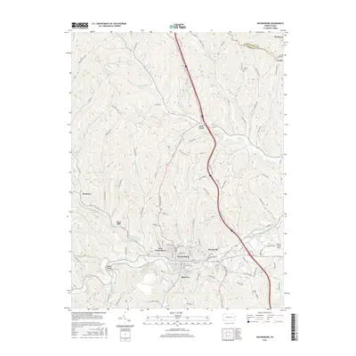
 2010 Waynesburg2010 Print · USGSCovers Rees Mill, including Waynesburg, Morgan Township, and other nearby areas
 - 2013 Map of Waynesburg, 2013 Print
 2013 Waynesburg2013 Print · USGSCovers Rees Mill, including Waynesburg, Morgan Township, and other nearby areas
 - 2016 Map of Waynesburg, 2016 Print
 2016 Waynesburg2016 Print · USGSCovers Rees Mill, including Waynesburg, Morgan Township, and other nearby areas
 - 2019 Map of Waynesburg, 2019 Print
 2019 Waynesburg2019 Print · USGSCovers Rees Mill, including Waynesburg, Morgan Township, and other nearby areas
 - 2023 Map of Waynesburg, 2023 Print
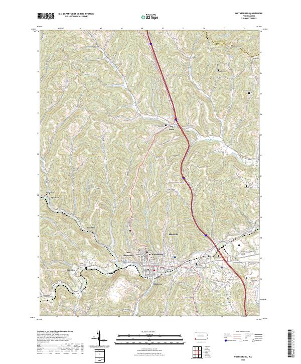 2023 Waynesburg2023 Print · USGSWaynesburg and its satellite settlements are documented in this contemporary study of the Greene County seat and its upland valleys. Researchers can trace local genealogy at Saint Ann Cem or explore institutional landmarks like Waynesburg University and the Greene County Courthouse.
End of results
Showing maps 1-13 of 13
Top cities near Rees Mill
- South Strabane Township historical maps
- Luzerne Township historical maps
- Waynesburg historical maps
- Bentleyville historical maps
- Dunkard Township historical maps
- East Finley Township historical maps
See more
Frequently asked questions
- What are the different types of historical maps available for Rees Mill?
- What is the oldest map of Rees Mill?
- Where can I purchase historical maps of Rees Mill for my home or office?
- Where can I download high-res historical maps of Rees Mill?
- Are there historical topographic maps available for Rees Mill?
- Is there historical aerial imagery available for Rees Mill?
- Where are historical maps of Rees Mill sourced from?