1900-1909 Maps of Springhill Township, Pennsylvania
Explore 5 historic maps of Springhill Township from 1900-1909. These maps offer a rare glimpse into what life looked like during the 1900s — showing old roads, neighborhoods, homes, and landmarks that have changed or disappeared over time.
Whether you're researching your family's past, planning a metal detecting trip, or studying how Springhill Township's landscape evolved across the 1900s, these high-resolution maps are a powerful tool for exploring the history of this region.
- Focus on a specific era: All maps on this page are from the 1900s, giving you a focused view of this time period.
- See what’s changed: Compare century-old streets, trails, and buildings to today's modern landscape using overlays and satellite layers.
- Research with precision: Use these maps for genealogy, historical research, land use analysis, or educational projects.
- View, download, or print: Maps are fully viewable online in high resolution, and can be downloaded or printed for your own records.
Start exploring Springhill Township's history through authentic maps from the 1900s. This is your window into the past.
Springhill Township, PA maps
(5)- 1903 Map of Littleton
 1903 Littleton1903 Print · USGSThe West Virginia and Pennsylvania borderlands appear here at the turn of the century, marked by deep ridges and creek-side settlements. Trace the path of the B. and O. R. R. as it connects Littleton to outlying hamlets like Wileyville and Burchfield.
 - 1904 Map of Cameron
 1904 Cameron1904 Print · USGSMarshall County's river-and-rail economy is frozen in time at the dawn of the century, showing the dense settlement patterns of the West Virginia panhandle. Researchers can trace the Baltimore and Ohio R R through Rosbys Rock or locate rural landmarks like Beelers Station and the Waynesburg Turnpike.4 unique versions available
 - 1905 Map of Mannington
 1905 Mannington1905 Print · USGSThe West Virginia-Pennsylvania borderlands are captured here at the start of the twentieth century, showing a landscape defined by deep ridges and rail-side commerce. Genealogists can trace family roots through locations like Hundred Church, Wadestown, and Brave P.O. along the state line.2 unique versions available
 - 1905 Map of Rogersville
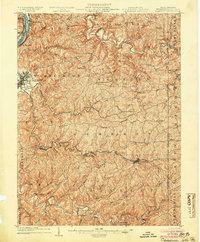
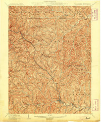
 1905 Rogersville1905 Print · USGSGreene and Washington counties are documented here at the turn of the century as a maze of ridge-and-valley settlements. Genealogists can trace early homesteads and commerce hubs like Harveys P.O. Graysville, Simpson Store, and Ryerson Station.4 unique versions available
 - 1905 Map of Littleton
 1905 Littleton1905 Print · USGSWetzel County and the surrounding borderlands appear here in the early twentieth century, showing a landscape defined by steep ridges and rail corridors. Researchers can trace the B and O RR through Littleton or find small settlements like Saint Joseph and Silver Hill.2 unique versions available
End of results
Showing maps 1-5 of 5
Top cities near Springhill Township
- Mannington historical maps
- East Finley Township historical maps
- Cameron historical maps
- West Finley Township historical maps
- Aleppo Township historical maps
- Pine Grove historical maps
See more
Top neighborhoods of Springhill Township
Frequently asked questions
- What are the different types of historical maps available for Springhill Township?
- What is the oldest map of Springhill Township?
- Where can I purchase historical maps of Springhill Township for my home or office?
- Where can I download high-res historical maps of Springhill Township?
- Are there historical topographic maps available for Springhill Township?
- Is there historical aerial imagery available for Springhill Township?
- Where are historical maps of Springhill Township sourced from?