1960s Maps of Huntingdon County, Pennsylvania
Explore 26 historic maps of Huntingdon County from the 1960s. These maps offer a rare glimpse into what life looked like during the 1960s — showing old roads, neighborhoods, homes, and landmarks that have changed or disappeared over time.
Whether you're researching your family's past, planning a metal detecting trip, or studying how Huntingdon County's landscape evolved across the 1960s, these high-resolution maps are a powerful tool for exploring the history of this region.
- Focus on a specific era: All maps on this page are from the 1960s, giving you a focused view of this time period.
- See what’s changed: Compare century-old streets, trails, and buildings to today's modern landscape using overlays and satellite layers.
- Research with precision: Use these maps for genealogy, historical research, land use analysis, or educational projects.
- View, download, or print: Maps are fully viewable online in high resolution, and can be downloaded or printed for your own records.
Start exploring Huntingdon County's history through authentic maps from the 1960s. This is your window into the past.
Huntingdon County, PA maps
(26)- 1960 Map of Blairs Mills, 1963 Print
 1960 Blairs Mills1963 Print · USGSJuniata and Franklin Counties are documented here in the early 1960s, showing a landscape shaped by parallel ridges and the winding Tuscarora Creek. Researchers can trace rural lineages through Blairs Mills, McCabe Chapel, and the isolated McWilliams Cem.2 unique versions available
 - 1961 Map of Harrisburg
 1961 Harrisburg1961 Print · USGSCentral Pennsylvania is shown at a mid-century peak of industrial and military activity, from the Susquehanna water gaps to the fertile Dutch Country. Genealogists and historians can trace the rail corridors of the Pennsylvania RR and find landmarks like Carlisle Barracks or the Anthracite Coal Fields.2 unique versions available
 - 1963 Map of Martinsburg, 1964 Print
 1963 Martinsburg1964 Print · USGSThe valleys and ridges of Blair County are captured here in the early sixties, showing a landscape of small farms and crossroads settlements. Genealogists can trace family names at the Detwiler Cem or Nicodemus Cem and locate landmarks like Central High Sch.3 unique versions available
 - 1963 Map of Entriken, 1964 Print
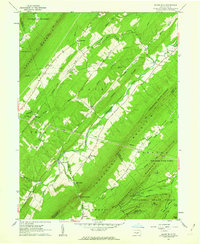
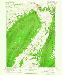
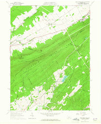
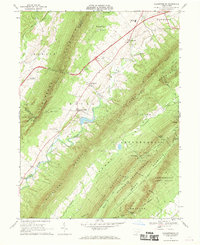
 1963 Entriken1964 Print · USGSHuntsville's river valleys and ridgelines are captured here in the early sixties, showing the Raystown Branch Juniata River before major reservoir changes. Genealogists can locate family names at Brumbaugh Cem and community hubs like Salems Ch and Lincoln Grange Hall.5 unique versions available
 - 1963 Map of Donation, 1964 Print
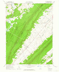
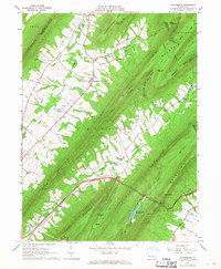
 1963 Donation1964 Print · USGSThe valleys of Huntingdon County appear in the early 1960s as a patchwork of university research forests, game lands, and traditional farmsteads. Genealogists and local historians can trace family locations near Cottage, Manor Hill, and the Steel Cem.3 unique versions available
 - 1963 Map of Huntingdon, 1965 Print
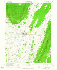
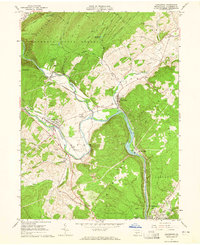
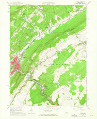
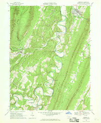
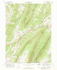
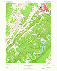 1963 Huntingdon1965 Print · USGSMid-Pennsylvania ridge-and-valley life is on full display here in the early sixties, centered on the historic river town of Huntingdon. Family historians can trace rural roots at St Jacobs Ch Cem or locate the old Hawns Bridge before the landscape was reshaped by modern water projects.4 unique versions available
 - 1963 Map of Cassville, 1965 Print
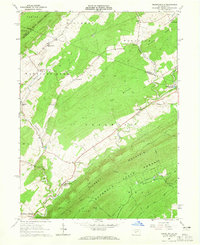
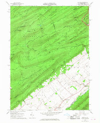
 1963 Cassville1965 Print · USGSHuntingdon County ridge-and-valley country in the early 1960s shows a landscape of deep forests and small hill towns. Trace family roots at Sheridan Cem, find the Old Grade Railroad, or locate old landmarks like the Trough Creek Valley Sch and Todd Tabernacle.4 unique versions available
 - 1963 Map of Mc Alevys Fort, 1965 Print
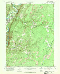
 1963 Mc Alevys Fort1965 Print · USGSNorth of Huntingdon in the mid-1960s, this area shows a landscape defined by prominent ridges and early industrial sites. Researchers can trace local genealogy at McAlevys Fort or find historic locations like the Jackson-Miller Sch and Greenwood Furnace.4 unique versions available
 - 1963 Map of Alexandria, 1965 Print
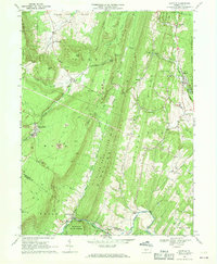
 1963 Alexandria1965 Print · USGSHuntingdon County's river valleys and ridgelines are shown here in the early sixties, as the historic rail-and-water corridors continued to shape local industry. Researchers can trace family sites at Neff Cem, explore the network of the Pennsylvania Railroad, or locate landmarks like Camp Barree and Lincoln Caverns.4 unique versions available
 - 1963 Map of Spruce Creek, 1965 Print
 1963 Spruce Creek1965 Print · USGSBlair and Huntingdon counties in the early sixties show a landscape shaped by narrow valleys and the legacy of the iron industry. Genealogists and historians can trace the foundations of Etna Furnace, locate the St John Cem, and follow the old rail lines through Union Furnace.4 unique versions available
 - 1963 Map of Allensville, 1965 Print
 1963 Allensville1965 Print · USGSBig Valley in the early 1960s remains a corridor of traditional farmsteads and rural institutions between the ridges of central Pennsylvania. Genealogists and historians can trace family roots through the Mennonite Cem, Wesley Chapel, and the vanished schoolrooms of Waynesburg Sch.3 unique versions available
 - 1963 Map of Tyrone, 1965 Print
 1963 Tyrone1965 Print · USGSIn the early 1960s, the industrial corridor along the Little Juniata River was a hub of transit and production. Trace the rail lines and old roads through Tyrone, Warriors Mark, and Birmingham, or locate family landmarks like Baughman Cem and Grier Sch.4 unique versions available
 - 1963 Map of Franklinville, 1965 Print
 1963 Franklinville1965 Print · USGSCentral Pennsylvania’s industrial and agricultural valleys are captured here in the early sixties. Researchers can trace the heritage of Pennsylvania Furnace and locate landmark sites like Indian Caverns and Warriors Mark Airport.3 unique versions available
 - 1963 Map of Williamsburg, 1965 Print
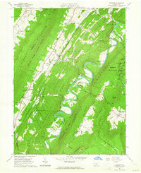
 1963 Williamsburg1965 Print · USGSThe valleys of Blair and Huntingdon Counties are captured here in the early sixties, showing a landscape of deep-rooted settlements and railroad corridors. Genealogists can trace family names at Snively Cem, Biddle Cem, and the crossing at Brumhaugh Crossing.5 unique versions available
 - 1963 Map of Pine Grove Mills, 1965 Print
 1963 Pine Grove Mills1965 Print · USGSThe ridges of central Pennsylvania define this early 1960s landscape, where university experimental forests meet historic furnace settlements. Genealogists and researchers can trace the valley communities of Pine Grove Mills and Neffs Mills or locate local landmarks like the Pennsylvania Furnace Cem and Monroe Furnace.4 unique versions available
 - 1964 Map of Pittsburgh
 1964 Pittsburgh1964 Print · USGSWestern Pennsylvania in the late fifties and early sixties shows a landscape of powerful river industries and expanding highways. Genealogists and historians can trace the rail corridors of the Pennsylvania RR through industrial hubs like Johnstown, Altoona, and Nanty Glo.
 - 1964 Map of Harrisburg
 1964 Harrisburg1964 Print · USGSCentral Pennsylvania in the mid-fifties reveals a landscape shaped by ridge-and-valley geology and critical Cold War infrastructure. Researchers can trace the massive Indiantown Gap Military Reservation or the rail corridors of the Pennsylvania RR and Reading RR.
 - 1966 Map of Doylesburg, 1968 Print
 1966 Doylesburg1968 Print · USGSFranklin County's ridge-and-valley landscape is captured here in the mid-1960s, showing a region defined by high timber and narrow farming gaps. Researchers can locate family sites at St Marys Ch Cem, the rural crossroads of Doylesburg, and the path of the Pennsylvania Turnpike.4 unique versions available
 - 1966 Map of Barrville, 1968 Print
 1966 Barrville1968 Print · USGSThe high ridges and deep gaps of Mifflin County appear in detail during the mid-sixties, from the forested slopes of Broad Mountain to the farms of the valley floor. Genealogists and hikers can trace old schoolhouse locations like Mountain View Sch and quiet rural burials at Long Lane Cem.3 unique versions available
 - 1966 Map of Orbisonia, 1969 Print
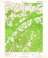
 1966 Orbisonia1969 Print · USGSIn the mid-sixties, the ridges of Huntingdon County remained a land of small settlements and rugged mountain gaps. Local historians can trace family roots through the IOOF Cem, the McKendree Ch, and the rural crossroads of Meadow Gap and Maddensville.3 unique versions available
 - 1966 Map of Burnt Cabins, 1969 Print
 1966 Burnt Cabins1969 Print · USGSFulton County and the surrounding ridges are captured in the mid-sixties, showing the high-speed transit of the early turnpike era cutting through quiet valley settlements. Genealogists can locate family landmarks such as Cromwell Ch, Fort Littleton, and the small community of Sweetwater.3 unique versions available
 - 1966 Map of Shade Gap, 1969 Print
 1966 Shade Gap1969 Print · USGSRidge-and-valley terrain in the mid-1960s defines this part of Huntingdon and Franklin counties, where rural life followed the mountain gaps. Genealogists can locate family sites at Gilliland Cem, Path Valley Cem, and the village of Neelyton.4 unique versions available
 - 1966 Map of Fannettsburg, 1969 Print
 1966 Fannettsburg1969 Print · USGSPath Valley and its surrounding ridges in the 1960s reveal a landscape of secluded mountain gaps and established crossroads. Researchers can trace family sites at Lower Path Valley Cem, locate the Tollgate on the turnpike, or find the Burnt Cabins Landing Strip on the valley floor.3 unique versions available
 - 1968 Map of Saxton, 1970 Print
 1968 Saxton1970 Print · USGSThe mining country of central Pennsylvania is documented here in the late sixties, where the Raystown Branch Juniata River meets a landscape of industry. Genealogists can trace family roots through settlements like Dudley and Broad Top City or find local burials at Grandview Cem.5 unique versions available
 - 1968 Map of Saltillo, 1970 Print
 1968 Saltillo1970 Print · USGSThe coal and timber country of Huntingdon County is frozen in time here just before the close of the 1960s. Researchers can trace the legacy of industry and faith through locations like the Robertsdale mines, Eagle Foundry, and Calvary Ch.3 unique versions available
Showing maps 1-25 of 26
Top cities of Huntingdon County
- Huntingdon historical maps
- Mount Union historical maps
- Warriors Mark Township historical maps
- Todd Township historical maps
- Mapleton historical maps
- Petersburg historical maps
See more
Frequently asked questions
- What are the different types of historical maps available for Huntingdon County?
- What is the oldest map of Huntingdon County?
- Where can I purchase historical maps of Huntingdon County for my home or office?
- Where can I download high-res historical maps of Huntingdon County?
- Are there historical topographic maps available for Huntingdon County?
- Is there historical aerial imagery available for Huntingdon County?
- Where are historical maps of Huntingdon County sourced from?