2000s (21st Century) Maps of Huntingdon County, Pennsylvania
Explore 27 historic maps of Huntingdon County from the 2000s (21st Century). These maps offer a rare glimpse into what life looked like during the 2000s — showing old roads, neighborhoods, homes, and landmarks that have changed or disappeared over time.
Whether you're researching your family's past, planning a metal detecting trip, or studying how Huntingdon County's landscape evolved across the 2000s, these high-resolution maps are a powerful tool for exploring the history of this region.
- Focus on a specific era: All maps on this page are from the 2000s, giving you a focused view of this time period.
- See what’s changed: Compare century-old streets, trails, and buildings to today's modern landscape using overlays and satellite layers.
- Research with precision: Use these maps for genealogy, historical research, land use analysis, or educational projects.
- View, download, or print: Maps are fully viewable online in high resolution, and can be downloaded or printed for your own records.
Start exploring Huntingdon County's history through authentic maps from the 2000s. This is your window into the past.
Huntingdon County, PA maps
(27)- 2023 Map of Saltillo, 2023 Print
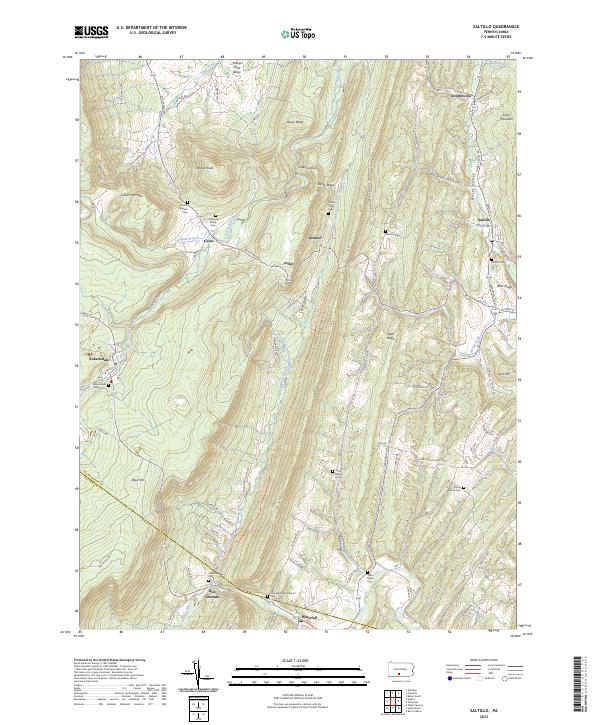 2023 Saltillo2023 Print · USGSThe Huntingdon and Fulton county line comes alive in this survey of the coal and mountain settlements during the early 2020s. Genealogists can trace family legacies at the Robertsdale Italian Cem, Mount Pleasant Cem, and Zion Methodist Church.
 - 2023 Map of Hustontown, 2023 Print
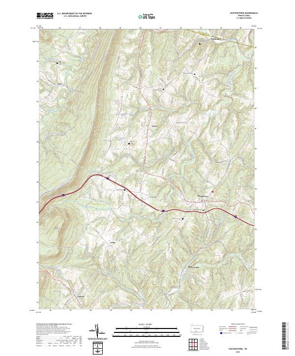 2023 Hustontown2023 Print · USGSFulton County and the eastern slopes of Sideling Hill are documented here in recent detail. Researchers can trace rural legacy through many family-named landmarks like Mellotts Mill and local burial sites such as Winegardner Cem and Fairview Cem.
 - 2023 Map of Doylesburg, 2023 Print
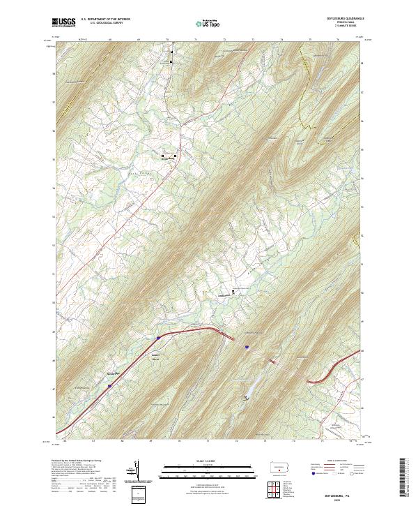 2023 Doylesburg2023 Print · USGSThe mountain gaps of northern Franklin County are surveyed here in recent detail, showing the rural communities of Path Valley and Amberson Valley. Local historians can trace family roots at the Concord Union Cem or locate the quiet grounds of Laurel Grove and Newbridge.
 - 2023 Map of Alexandria, 2023 Print
 2023 Alexandria2023 Print · USGSThe river forks and ridge gaps of Huntingdon County are shown here in modern detail. Genealogists can trace family names across numerous sites like Old Hartslog Cem and Huyett Cem, while hikers can follow the Mid State Trail.
 - 2023 Map of Williamsburg, 2023 Print
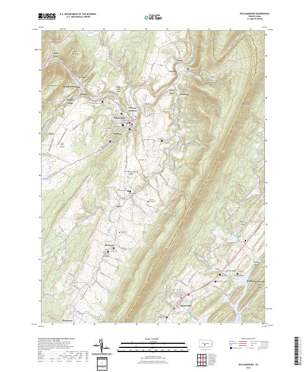 2023 Williamsburg2023 Print · USGSModern-day Blair and Huntingdon Counties are captured here, showing the enduring settlement patterns along the Frankstown Branch Juniata River. Genealogists can trace numerous family sites like the Biddle Farm Cem and Shellytown Fairview Cem.
 - 2023 Map of Mount Union, 2023 Print
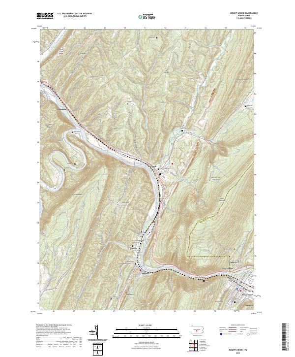 2023 Mount Union2023 Print · USGSThe Juniata River gap at Jacks Narrows defines this central Pennsylvania landscape during the early twenty-first century. Genealogists can trace family footprints at the Old White Church Cem, Hampson Family Cem, and the industrial site at Lucy Furnace.
 - 2023 Map of Franklinville, 2023 Print
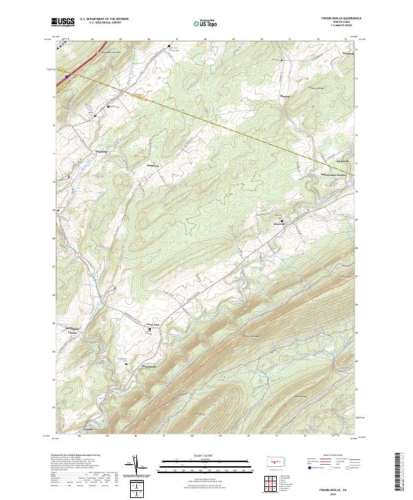 2023 Franklinville2023 Print · USGSHuntingdon County's iron-working past and ridge-and-valley settlement patterns are preserved in this recent survey. Local historians can trace the foundations of Pennsylvania Furnace, locate family plots at Seven Stars Cem, and follow the historical Warriors Mark Path.
 - 2023 Map of Donation, 2023 Print
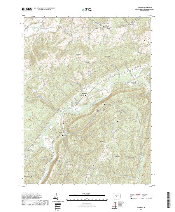 2023 Donation2023 Print · USGSHuntingdon County high country is documented here in the early twenty-first century, showing the rural crossroads and ridge-and-valley landscape. Researchers can trace family sites at Donation Cem, Coy Cem, and the Agudath Achim Memorial Park.
 - 2023 Map of Pine Grove Mills, 2023 Print
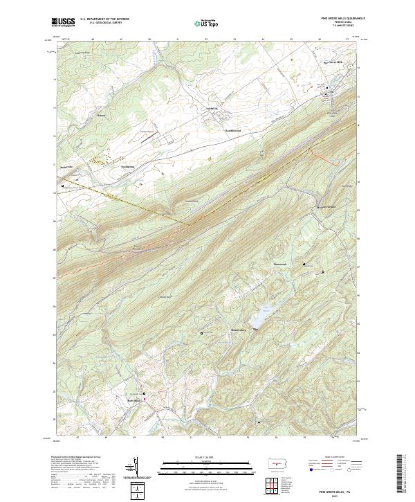 2023 Pine Grove Mills2023 Print · USGSPine Grove Mills and the surrounding ridges of Central Pennsylvania are captured here at the start of the 2020s. Researchers can locate several family burial grounds, such as the Pennsylvania Furnace Cem and Bennett Cem, or trace the rural routes connecting Neffs Mills and Monroe Furnace.
 - 2023 Map of Allensville, 2023 Print
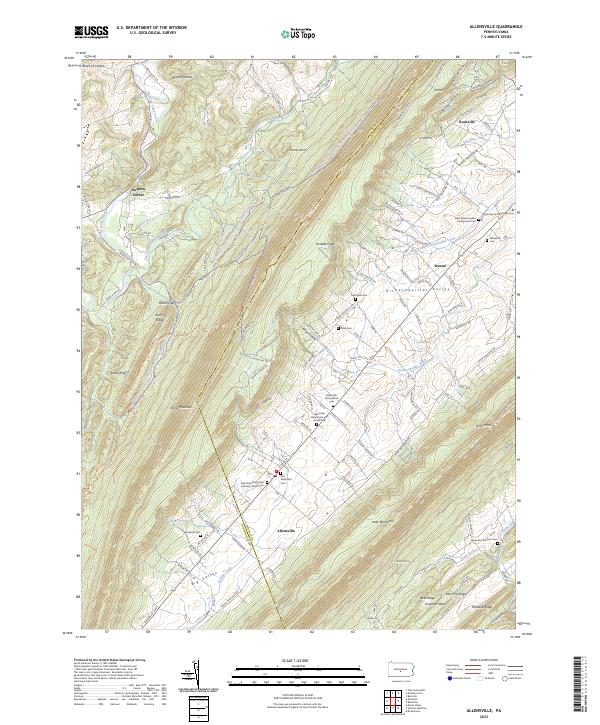 2023 Allensville2023 Print · USGSThe Big Valley region of Mifflin County reveals its deep Amish and Mennonite roots in the twenty-first century. Genealogists and historians can trace family locations through numerous sites like the Allensville Presbyterian Cem, McDowell Cem, and the settlement of Menno.
 - 2023 Map of Aughwick, 2023 Print
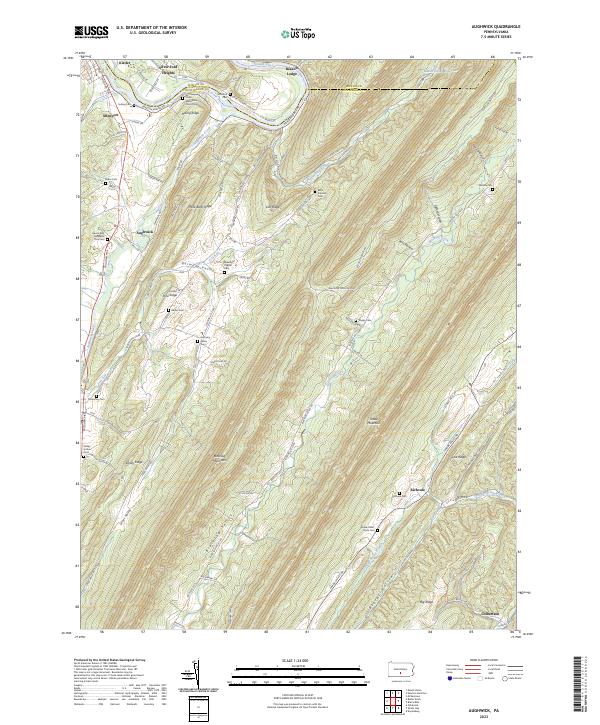 2023 Aughwick2023 Print · USGSHuntingdon County's ridge-and-valley landscape is mapped here in detail, showing the rural communities along the Juniata River and Aughwick Creek. Researchers can locate numerous family burial grounds including McGarvey Cem, Shope Cem, and the Otelia Mennonite Church Cem.
 - 2023 Map of Orbisonia, 2023 Print
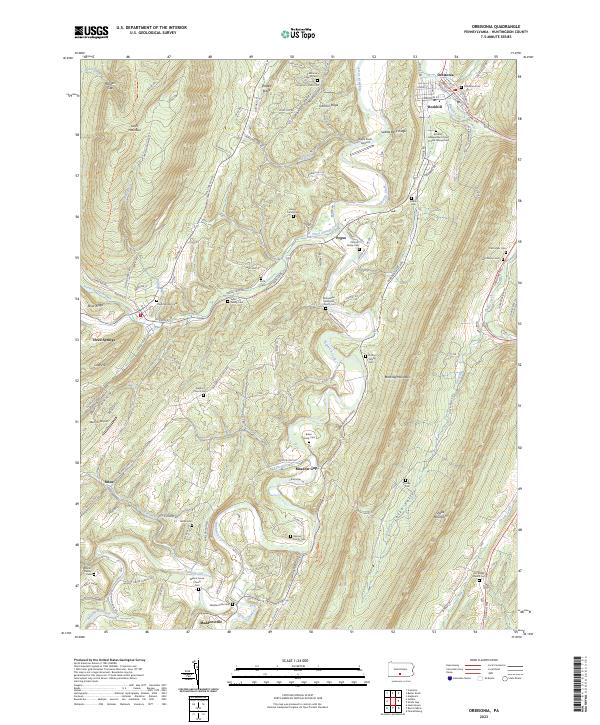 2023 Orbisonia2023 Print · USGSIn the valley between Jacks Mountain and Blacklog Mountain, this Huntingdon County landscape shows a network of ridge-top roads and creek-side settlements. Genealogists can trace family lines through the Orbisonia Cem, Ramsey Family Cem, and Booth Family Cem.
 - 2023 Map of Shade Gap, 2023 Print
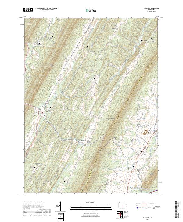 2023 Shade Gap2023 Print · USGSThe Huntingdon and Franklin county line runs through this landscape of steep ridges and narrow valleys in the twenty-first century. Genealogists can trace local history through numerous sites including the Bolinger Family Cem, Possumtown Cem, and Shade Gap Presbyterian Church.
 - 2023 Map of Fannettsburg, 2023 Print
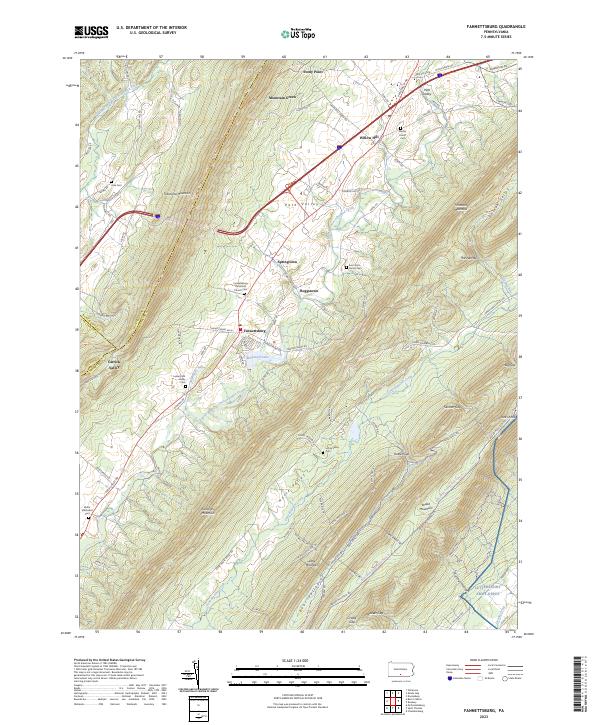 2023 Fannettsburg2023 Print · USGSFranklin County settlement patterns remain defined by the steep ridges of the Appalachians in this recent survey. Genealogists can locate several family and church burial grounds, such as Lower Path Valley Cem and Cree Cem, alongside the small communities of Willow Hill and Springtown.
 - 2023 Map of McAlevys Fort, 2023 Print
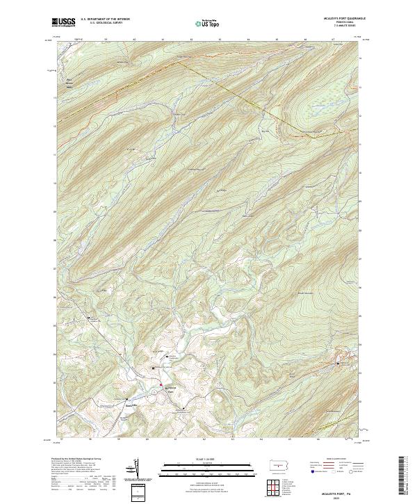 2023 McAlevys Fort2023 Print · USGSThe valleys and ridges of Huntingdon and Centre counties are captured in this modern survey of the Stone Creek headwaters. Genealogists and hikers can trace connections between Mcalevys Fort and historic burial sites like Ennisville Cem and Greenlee Presbyterian Cem.
 - 2023 Map of Burnt Cabins, 2023 Print
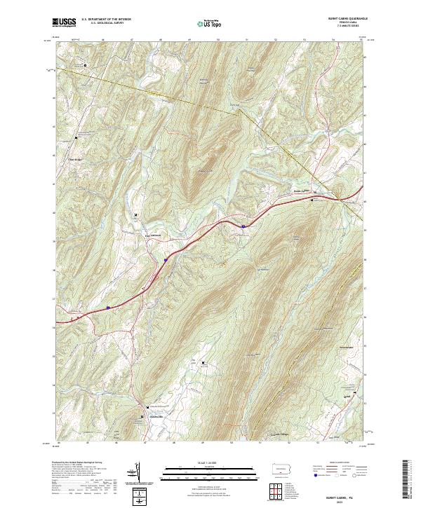 2023 Burnt Cabins2023 Print · USGSThe ridge-and-valley landscape of Fulton County is captured here in detail, showcasing a region defined by its narrow gaps and historic mountain passes. Genealogists can trace family sites at Englert Farm Cem, Knobsville, and the historic Fort Littleton Cem.
 - 2023 Map of Blairs Mills, 2023 Print
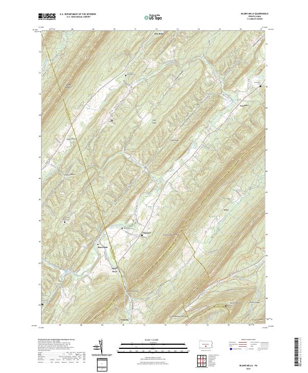 2023 Blairs Mills2023 Print · USGSThe Ridge-and-Valley province of central Pennsylvania appears in high detail, showing the rural communities between Tuscarora Mountain and Shade Mountain. Genealogists can trace early homesteads through burial sites like Upper Tuscarora Presbyterian Cem and Polk Cem near Blairs Mills.
 - 2023 Map of Butler Knob, 2023 Print
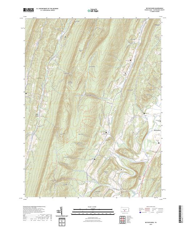 2023 Butler Knob2023 Print · USGSThe ridges and valleys of Huntingdon County are captured here in the early twenty-first century, showing a landscape defined by gaps and agricultural hollows. Genealogists can trace numerous local burial grounds including Dell Family Cem, Ricketts Cem, and Gilboa Cem.
 - 2023 Map of Newton Hamilton, 2023 Print
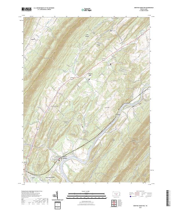 2023 Newton Hamilton2023 Print · USGSThe Juniata River valley in Mifflin County remains a landscape defined by its deep ridges and river-bend settlements in this recent survey. Genealogists can locate family names at the Newton Hamilton Memorial Cem, trace the grounds of Heister's Mill, or explore the rural layout of Atkinson Mills.
 - 2023 Map of Barrville, 2023 Print
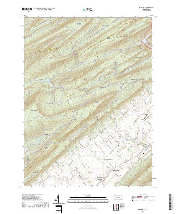 2023 Barrville2023 Print · USGSMifflin County's ridge-and-valley landscape is showcased in this contemporary survey of the Barrville area. Genealogists and local historians can locate family burial sites at Long Lane Cem and Hooleys Cem or trace the drainage of Tea Creek.
 - 2023 Map of Spruce Creek, 2023 Print
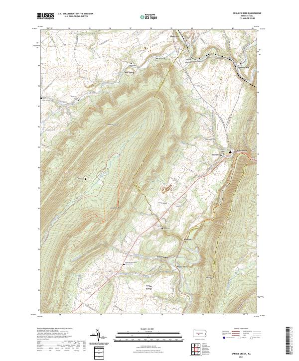 2023 Spruce Creek2023 Print · USGSThe industrial and agricultural valleys of Blair and Huntingdon Counties are captured here in the contemporary era. Researchers can locate numerous family and denominational burial sites like Amish Cem and Keller Church Cem near the historic Etna Furnace.
 - 2023 Map of Huntingdon, 2023 Print
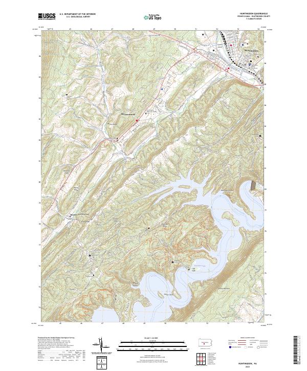 2023 Huntingdon2023 Print · USGSHuntingdon and the surrounding ridges of central Pennsylvania are shown here in the early twenty-first century. Genealogists and local historians can trace family plots from Riverview Cem to the Speck Family Cem and explore the sprawling shores of Raystown Lake.
 - 2023 Map of Tyrone, 2023 Print
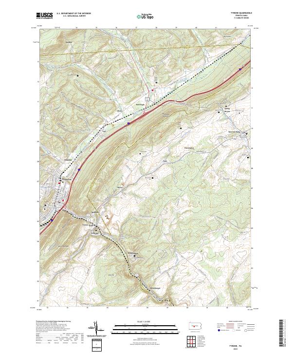 2023 Tyrone2023 Print · USGSSettled along the river and rail corridors of Central Pennsylvania, this area reveals a landscape shaped by gaps and ridges. Genealogists can trace family roots at Birmingham Cem and Grazier Cem or locate the village of Tyrone Forge.
 - 2023 Map of Entriken, 2023 Print
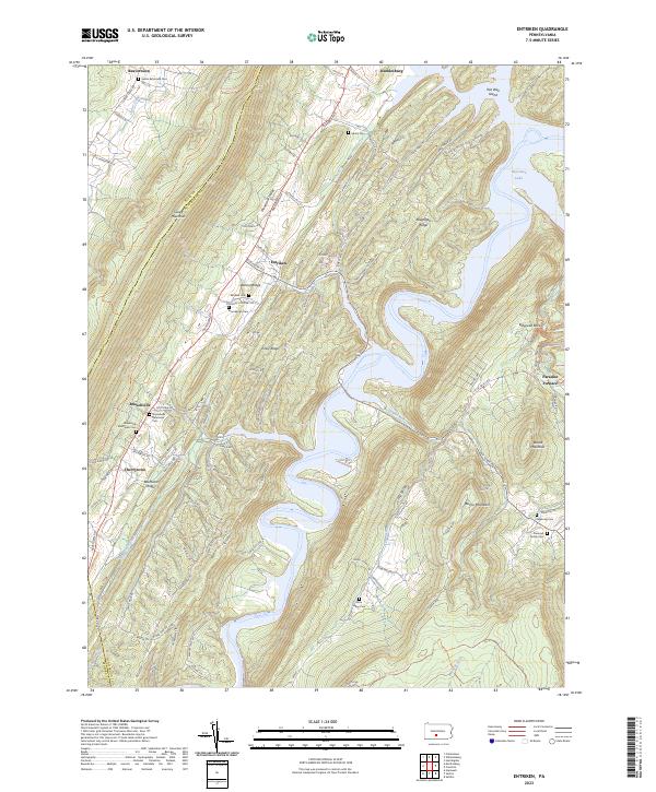 2023 Entriken2023 Print · USGSThe ridges and valleys of Huntingdon County are preserved here in the early twenty-first century, centered on the expansive waters of Raystown Lake. Genealogists and researchers can locate historic burial grounds like Brumbaugh Cem and Plummer Family Cem or trace the early industrial footprint of Paradise Furnace.
 - 2023 Map of Cassville, 2023 Print
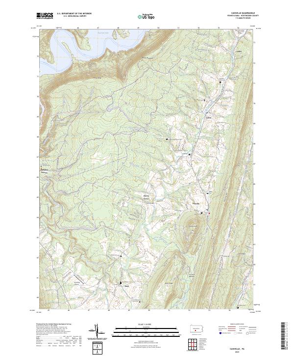 2023 Cassville2023 Print · USGSCentral Pennsylvania's ridge-and-valley landscape comes into focus in this recent survey of Huntingdon County. Genealogists and local researchers can trace the modern layout of rural settlements like Colfax and Calvin as they exist today.
Showing maps 1-25 of 27
Top cities of Huntingdon County
- Huntingdon historical maps
- Mount Union historical maps
- Warriors Mark Township historical maps
- Todd Township historical maps
- Mapleton historical maps
- Petersburg historical maps
See more
Frequently asked questions
- What are the different types of historical maps available for Huntingdon County?
- What is the oldest map of Huntingdon County?
- Where can I purchase historical maps of Huntingdon County for my home or office?
- Where can I download high-res historical maps of Huntingdon County?
- Are there historical topographic maps available for Huntingdon County?
- Is there historical aerial imagery available for Huntingdon County?
- Where are historical maps of Huntingdon County sourced from?